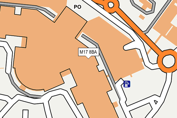
M17 8BA is located in the Lostock & Barton electoral ward, within the metropolitan district of Trafford and the English Parliamentary constituency of Stretford and Urmston. The Sub Integrated Care Board (ICB) Location is NHS Greater Manchester ICB - 02A and the police force is Greater Manchester. This postcode has been in use since June 1998.


GetTheData
Source: OS OpenMap – Local (Ordnance Survey)
Source: OS VectorMap District (Ordnance Survey)
Licence: Open Government Licence (requires attribution)
| Easting | 377113 |
| Northing | 396583 |
| Latitude | 53.465486 |
| Longitude | -2.346212 |
GetTheData
Source: Open Postcode Geo
Licence: Open Government Licence
| Country | England |
| Postcode District | M17 |
➜ See where M17 is on a map ➜ Where is Trafford Park? | |
GetTheData
Source: Land Registry Price Paid Data
Licence: Open Government Licence
Elevation or altitude of M17 8BA as distance above sea level:
| Metres | Feet | |
|---|---|---|
| Elevation | 20m | 66ft |
Elevation is measured from the approximate centre of the postcode, to the nearest point on an OS contour line from OS Terrain 50, which has contour spacing of ten vertical metres.
➜ How high above sea level am I? Find the elevation of your current position using your device's GPS.
GetTheData
Source: Open Postcode Elevation
Licence: Open Government Licence
| Ward | Lostock & Barton |
| Constituency | Stretford And Urmston |
GetTheData
Source: ONS Postcode Database
Licence: Open Government Licence
| Barton Dock Rd/Phoenix Way (Barton Dock Rd) | Dumplington | 205m |
| Barton Dock Road/Phoenix Way (Barton Dock Rd) | Dumplington | 227m |
| Barton Dock Rd/The Trafford Centre (Barton Dock Rd) | Dumplington | 233m |
| Barton Dock Rd/The Trafford Centre (Barton Dock Rd) | Dumplington | 234m |
| Barton Dock Road/Mercury Way (Barton Dock Rd) | Trafford Park | 383m |
| Humphrey Park Station | 1.9km |
| Urmston Station | 2km |
| Patricroft Station | 2.3km |
GetTheData
Source: NaPTAN
Licence: Open Government Licence
GetTheData
Source: ONS Postcode Database
Licence: Open Government Licence


➜ Get more ratings from the Food Standards Agency
GetTheData
Source: Food Standards Agency
Licence: FSA terms & conditions
| Last Collection | |||
|---|---|---|---|
| Location | Mon-Fri | Sat | Distance |
| 67 Shetland Way | 17:30 | 11:30 | 570m |
| Queensway | 17:30 | 12:00 | 617m |
| 104 Kingsway Park | 17:30 | 11:30 | 794m |
GetTheData
Source: Dracos
Licence: Creative Commons Attribution-ShareAlike
The below table lists the International Territorial Level (ITL) codes (formerly Nomenclature of Territorial Units for Statistics (NUTS) codes) and Local Administrative Units (LAU) codes for M17 8BA:
| ITL 1 Code | Name |
|---|---|
| TLD | North West (England) |
| ITL 2 Code | Name |
| TLD3 | Greater Manchester |
| ITL 3 Code | Name |
| TLD34 | Greater Manchester South West |
| LAU 1 Code | Name |
| E08000009 | Trafford |
GetTheData
Source: ONS Postcode Directory
Licence: Open Government Licence
The below table lists the Census Output Area (OA), Lower Layer Super Output Area (LSOA), and Middle Layer Super Output Area (MSOA) for M17 8BA:
| Code | Name | |
|---|---|---|
| OA | E00030982 | |
| LSOA | E01006121 | Trafford 002E |
| MSOA | E02001260 | Trafford 002 |
GetTheData
Source: ONS Postcode Directory
Licence: Open Government Licence
| M17 8BN | Peel Avenue | 69m |
| M17 8AR | Regent Crescent | 240m |
| M41 7EY | Iona Way | 476m |
| M41 7FT | Harris Avenue | 479m |
| M41 7FU | Shetland Way | 491m |
| M41 7EZ | Jura Drive | 492m |
| M41 7EW | Lismore Way | 501m |
| M41 7FY | Iona Way | 507m |
| M41 7FW | Benbecula Way | 511m |
| M41 7FX | Coll Drive | 515m |
GetTheData
Source: Open Postcode Geo; Land Registry Price Paid Data
Licence: Open Government Licence