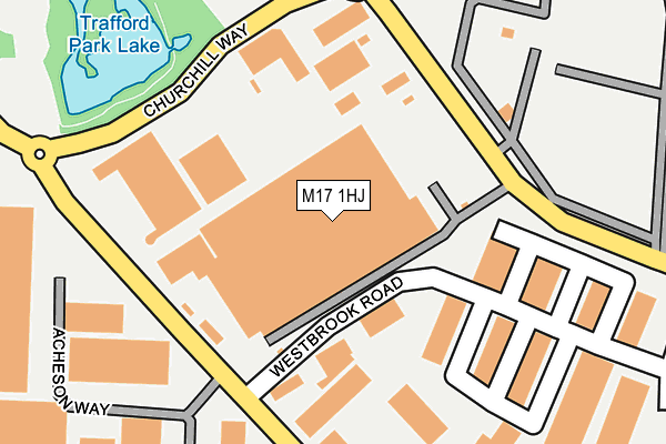
M17 1HJ is located in the Gorse Hill & Cornbrook electoral ward, within the metropolitan district of Trafford and the English Parliamentary constituency of Stretford and Urmston. The Sub Integrated Care Board (ICB) Location is NHS Greater Manchester ICB - 02A and the police force is Greater Manchester. This postcode has been in use since August 1992.


GetTheData
Source: OS OpenMap – Local (Ordnance Survey)
Source: OS VectorMap District (Ordnance Survey)
Licence: Open Government Licence (requires attribution)
| Easting | 379449 |
| Northing | 397214 |
| Latitude | 53.471254 |
| Longitude | -2.311068 |
GetTheData
Source: Open Postcode Geo
Licence: Open Government Licence
| Country | England |
| Postcode District | M17 |
➜ See where M17 is on a map ➜ Where is Trafford Park? | |
GetTheData
Source: Land Registry Price Paid Data
Licence: Open Government Licence
Elevation or altitude of M17 1HJ as distance above sea level:
| Metres | Feet | |
|---|---|---|
| Elevation | 20m | 66ft |
Elevation is measured from the approximate centre of the postcode, to the nearest point on an OS contour line from OS Terrain 50, which has contour spacing of ten vertical metres.
➜ How high above sea level am I? Find the elevation of your current position using your device's GPS.
GetTheData
Source: Open Postcode Elevation
Licence: Open Government Licence
| Ward | Gorse Hill & Cornbrook |
| Constituency | Stretford And Urmston |
GetTheData
Source: ONS Postcode Database
Licence: Open Government Licence
| Trafford Park Road/Carborundum (Trafford Pk Rd) | Trafford Park | 190m |
| Trafford Park Road/Carborundum (Trafford Pk Rd) | Trafford Park | 225m |
| Trafford Park Road/Westbrook Road (Trafford Pk Rd) | Trafford Park | 247m |
| Trafford Park Road/Third Avenue (Trafford Pk Rd) | Trafford Park | 268m |
| Trafford Park Road/Lake Road (Trafford Pk Rd) | Trafford Park | 400m |
| Mediacityuk (Manchester Metrolink) | Mediacityuk | 919m |
| Broadway (Manchester Metrolink) (Off Broadway) | Broadway | 1,154m |
| Weaste (Manchester Metrolink) (Eccles New Road) | Weaste | 1,268m |
| Harbour City (Manchester Metrolink) (The Quays) | The Lowry | 1,297m |
| Langworthy (Manchester Metrolink) (Eccles New Road) | Langworthy | 1,434m |
| Manchester United FC Station | 1.7km |
| Trafford Park Station | 1.8km |
| Eccles Station | 2.2km |
GetTheData
Source: NaPTAN
Licence: Open Government Licence
GetTheData
Source: ONS Postcode Database
Licence: Open Government Licence


➜ Get more ratings from the Food Standards Agency
GetTheData
Source: Food Standards Agency
Licence: FSA terms & conditions
| Last Collection | |||
|---|---|---|---|
| Location | Mon-Fri | Sat | Distance |
| Westbrook Road | 18:30 | 145m | |
| Westbrook Road / Trafford P Road | 17:30 | 11:45 | 153m |
| Opp Unit 6 Mosley Road | 17:30 | 11:45 | 403m |
GetTheData
Source: Dracos
Licence: Creative Commons Attribution-ShareAlike
| Risk of M17 1HJ flooding from rivers and sea | Low |
| ➜ M17 1HJ flood map | |
GetTheData
Source: Open Flood Risk by Postcode
Licence: Open Government Licence
The below table lists the International Territorial Level (ITL) codes (formerly Nomenclature of Territorial Units for Statistics (NUTS) codes) and Local Administrative Units (LAU) codes for M17 1HJ:
| ITL 1 Code | Name |
|---|---|
| TLD | North West (England) |
| ITL 2 Code | Name |
| TLD3 | Greater Manchester |
| ITL 3 Code | Name |
| TLD34 | Greater Manchester South West |
| LAU 1 Code | Name |
| E08000009 | Trafford |
GetTheData
Source: ONS Postcode Directory
Licence: Open Government Licence
The below table lists the Census Output Area (OA), Lower Layer Super Output Area (LSOA), and Middle Layer Super Output Area (MSOA) for M17 1HJ:
| Code | Name | |
|---|---|---|
| OA | E00030982 | |
| LSOA | E01006121 | Trafford 002E |
| MSOA | E02001260 | Trafford 002 |
GetTheData
Source: ONS Postcode Directory
Licence: Open Government Licence
| M17 1GA | Acheson Way | 248m |
| M17 1AN | Trafford Park Way | 367m |
| M17 1JY | Village Way | 532m |
| M50 1UU | Columbus Way | 591m |
| M50 2TH | Blue | 704m |
| M50 2TJ | Blue | 704m |
| M17 1DB | Fourth Avenue | 706m |
| M17 1GB | Ordinal Street | 721m |
| M50 1DS | Waybridge Industrial Estate | 747m |
| M17 1PQ | Praed Road | 784m |
GetTheData
Source: Open Postcode Geo; Land Registry Price Paid Data
Licence: Open Government Licence