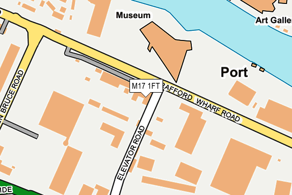
M17 1FT is located in the Gorse Hill & Cornbrook electoral ward, within the metropolitan district of Trafford and the English Parliamentary constituency of Stretford and Urmston. The Sub Integrated Care Board (ICB) Location is NHS Greater Manchester ICB - 02A and the police force is Greater Manchester. This postcode has been in use since January 1980.


GetTheData
Source: OS OpenMap – Local (Ordnance Survey)
Source: OS VectorMap District (Ordnance Survey)
Licence: Open Government Licence (requires attribution)
| Easting | 380222 |
| Northing | 396936 |
| Latitude | 53.468785 |
| Longitude | -2.299405 |
GetTheData
Source: Open Postcode Geo
Licence: Open Government Licence
| Country | England |
| Postcode District | M17 |
➜ See where M17 is on a map ➜ Where is Trafford Park? | |
GetTheData
Source: Land Registry Price Paid Data
Licence: Open Government Licence
Elevation or altitude of M17 1FT as distance above sea level:
| Metres | Feet | |
|---|---|---|
| Elevation | 30m | 98ft |
Elevation is measured from the approximate centre of the postcode, to the nearest point on an OS contour line from OS Terrain 50, which has contour spacing of ten vertical metres.
➜ How high above sea level am I? Find the elevation of your current position using your device's GPS.
GetTheData
Source: Open Postcode Elevation
Licence: Open Government Licence
| Ward | Gorse Hill & Cornbrook |
| Constituency | Stretford And Urmston |
GetTheData
Source: ONS Postcode Database
Licence: Open Government Licence
| Trafford Wharf Road/War Museum (Traff Wharf Rd) | Trafford Park | 58m |
| Trafford Wharf Road/War Museum (Traff Wharf Rd) | Trafford Park | 85m |
| Trafford Wharf Road/Quay West (Traff Wharf Rd) | Trafford Park | 181m |
| Trafford Wharf Road/Quay West (Traff Wharf Rd) | Trafford Park | 236m |
| Wharfside Way/Village Circle (Wharfside Way) | Trafford Park | 299m |
| Mediacityuk (Manchester Metrolink) | Mediacityuk | 396m |
| Broadway (Manchester Metrolink) (Off Broadway) | Broadway | 727m |
| Harbour City (Manchester Metrolink) (The Quays) | The Lowry | 760m |
| Salford Quays (Manchester Metrolink) (St Peters Quay) | Salford Quays | 1,036m |
| Anchorage (Manchester Metrolink) (Anchorage Quay) | Salford Quays | 1,091m |
| Manchester United FC Station | 0.9km |
| Trafford Park Station | 1.7km |
| Salford Crescent Station | 2.5km |
GetTheData
Source: NaPTAN
Licence: Open Government Licence
GetTheData
Source: ONS Postcode Database
Licence: Open Government Licence


➜ Get more ratings from the Food Standards Agency
GetTheData
Source: Food Standards Agency
Licence: FSA terms & conditions
| Last Collection | |||
|---|---|---|---|
| Location | Mon-Fri | Sat | Distance |
| Trafford Development | 17:30 | 11:45 | 597m |
| Dallas Court | 17:30 | 11:45 | 708m |
| Winnipeg Quay Salford Quays | 17:30 | 12:00 | 710m |
GetTheData
Source: Dracos
Licence: Creative Commons Attribution-ShareAlike
| Risk of M17 1FT flooding from rivers and sea | Low |
| ➜ M17 1FT flood map | |
GetTheData
Source: Open Flood Risk by Postcode
Licence: Open Government Licence
The below table lists the International Territorial Level (ITL) codes (formerly Nomenclature of Territorial Units for Statistics (NUTS) codes) and Local Administrative Units (LAU) codes for M17 1FT:
| ITL 1 Code | Name |
|---|---|
| TLD | North West (England) |
| ITL 2 Code | Name |
| TLD3 | Greater Manchester |
| ITL 3 Code | Name |
| TLD34 | Greater Manchester South West |
| LAU 1 Code | Name |
| E08000009 | Trafford |
GetTheData
Source: ONS Postcode Directory
Licence: Open Government Licence
The below table lists the Census Output Area (OA), Lower Layer Super Output Area (LSOA), and Middle Layer Super Output Area (MSOA) for M17 1FT:
| Code | Name | |
|---|---|---|
| OA | E00031187 | |
| LSOA | E01006157 | Trafford 006B |
| MSOA | E02001264 | Trafford 006 |
GetTheData
Source: ONS Postcode Directory
Licence: Open Government Licence
| M50 3RA | The Quays | 355m |
| M50 3RB | The Quays | 355m |
| M50 2TH | Blue | 379m |
| M50 2TJ | Blue | 379m |
| M50 2BA | Pink | 492m |
| M50 2BB | Pink | 492m |
| M50 3TS | The Quays | 522m |
| M50 3TW | The Quays | 522m |
| M50 3TZ | The Quays | 522m |
| M17 1EX | Wharfside Business Centre | 541m |
GetTheData
Source: Open Postcode Geo; Land Registry Price Paid Data
Licence: Open Government Licence