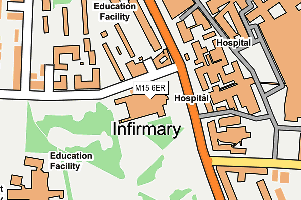
M15 6ER is located in the Ardwick electoral ward, within the metropolitan district of Manchester and the English Parliamentary constituency of Manchester Central. The Sub Integrated Care Board (ICB) Location is NHS Greater Manchester ICB - 14L and the police force is Greater Manchester. This postcode has been in use since January 1980.


GetTheData
Source: OS OpenMap – Local (Ordnance Survey)
Source: OS VectorMap District (Ordnance Survey)
Licence: Open Government Licence (requires attribution)
| Easting | 384871 |
| Northing | 395975 |
| Latitude | 53.460303 |
| Longitude | -2.229326 |
GetTheData
Source: Open Postcode Geo
Licence: Open Government Licence
| Country | England |
| Postcode District | M15 |
➜ See where M15 is on a map ➜ Where is Manchester? | |
GetTheData
Source: Land Registry Price Paid Data
Licence: Open Government Licence
Elevation or altitude of M15 6ER as distance above sea level:
| Metres | Feet | |
|---|---|---|
| Elevation | 40m | 131ft |
Elevation is measured from the approximate centre of the postcode, to the nearest point on an OS contour line from OS Terrain 50, which has contour spacing of ten vertical metres.
➜ How high above sea level am I? Find the elevation of your current position using your device's GPS.
GetTheData
Source: Open Postcode Elevation
Licence: Open Government Licence
| Ward | Ardwick |
| Constituency | Manchester Central |
GetTheData
Source: ONS Postcode Database
Licence: Open Government Licence
| Oxford Rd/Royal Infirmary (Oxford Rd) | Chorlton Upon Medlock | 142m |
| Oxford Rd/Royal Infirmary (Oxford Rd) | Chorlton Upon Medlock | 149m |
| Oxford Rd/Royal Infirmary (Oxford Rd) | Chorlton Upon Medlock | 183m |
| The Boulevard | Chorlton Upon Medlock | 195m |
| Oxford Rd/St Mary's (Oxford Rd) | Rusholme | 211m |
| Ardwick Station | 1.6km |
| Manchester Oxford Road Station | 1.7km |
| Manchester Piccadilly Station | 1.9km |
GetTheData
Source: NaPTAN
Licence: Open Government Licence
GetTheData
Source: ONS Postcode Database
Licence: Open Government Licence


➜ Get more ratings from the Food Standards Agency
GetTheData
Source: Food Standards Agency
Licence: FSA terms & conditions
| Last Collection | |||
|---|---|---|---|
| Location | Mon-Fri | Sat | Distance |
| Manchester Royal | 17:30 | 12:00 | 100m |
| Wilmslow Park Post Office | 17:30 | 12:00 | 214m |
| Thorncliffe Place | 17:30 | 12:00 | 219m |
GetTheData
Source: Dracos
Licence: Creative Commons Attribution-ShareAlike
The below table lists the International Territorial Level (ITL) codes (formerly Nomenclature of Territorial Units for Statistics (NUTS) codes) and Local Administrative Units (LAU) codes for M15 6ER:
| ITL 1 Code | Name |
|---|---|
| TLD | North West (England) |
| ITL 2 Code | Name |
| TLD3 | Greater Manchester |
| ITL 3 Code | Name |
| TLD33 | Manchester |
| LAU 1 Code | Name |
| E08000003 | Manchester |
GetTheData
Source: ONS Postcode Directory
Licence: Open Government Licence
The below table lists the Census Output Area (OA), Lower Layer Super Output Area (LSOA), and Middle Layer Super Output Area (MSOA) for M15 6ER:
| Code | Name | |
|---|---|---|
| OA | E00175808 | |
| LSOA | E01005209 | Manchester 019B |
| MSOA | E02001063 | Manchester 019 |
GetTheData
Source: ONS Postcode Directory
Licence: Open Government Licence
| M15 6ET | Burleigh Street | 221m |
| M15 6FG | Denmark Road | 235m |
| M15 6FQ | Acomb Street | 281m |
| M15 6GD | Cecil Street | 312m |
| M14 4PW | Moss Lane East | 322m |
| M13 9NT | Grafton Street | 323m |
| M14 5TE | Rusholme Place | 351m |
| M14 4PN | Parkfield Street | 355m |
| M14 4EA | Heald Place | 368m |
| M15 6GF | Hawsworth Close | 374m |
GetTheData
Source: Open Postcode Geo; Land Registry Price Paid Data
Licence: Open Government Licence