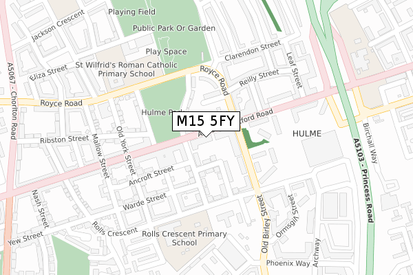
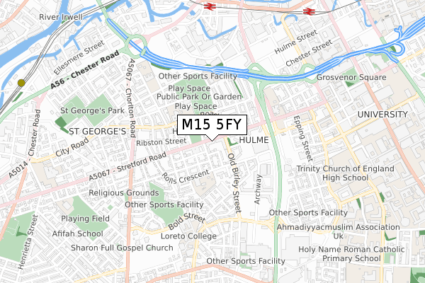
M15 5FY is located in the Hulme electoral ward, within the metropolitan district of Manchester and the English Parliamentary constituency of Manchester Central. The Sub Integrated Care Board (ICB) Location is NHS Greater Manchester ICB - 14L and the police force is Greater Manchester. This postcode has been in use since September 2019.


GetTheData
Source: OS Open Zoomstack (Ordnance Survey)
Licence: Open Government Licence (requires attribution)
Attribution: Contains OS data © Crown copyright and database right 2024
Source: Open Postcode Geo
Licence: Open Government Licence (requires attribution)
Attribution: Contains OS data © Crown copyright and database right 2024; Contains Royal Mail data © Royal Mail copyright and database right 2024; Source: Office for National Statistics licensed under the Open Government Licence v.3.0
| Easting | 383457 |
| Northing | 396718 |
| Latitude | 53.466955 |
| Longitude | -2.250660 |
GetTheData
Source: Open Postcode Geo
Licence: Open Government Licence
| Country | England |
| Postcode District | M15 |
➜ See where M15 is on a map ➜ Where is Manchester? | |
GetTheData
Source: Land Registry Price Paid Data
Licence: Open Government Licence
| Ward | Hulme |
| Constituency | Manchester Central |
GetTheData
Source: ONS Postcode Database
Licence: Open Government Licence
| Stretford Rd/Hulme Park (Stretford Rd) | Hulme | 9m |
| Stretford Rd/Hulme Park (Stretford Rd) | Hulme | 45m |
| Royce Rd/Clayburn St (Royce Rd) | Hulme | 99m |
| Stretford Rd/Royce Road (Stretford Rd) | Hulme | 178m |
| Stretford Rd/Royce Rd (Stretford Rd) | Hulme | 201m |
| Deansgate-castlefield (Manchester Metrolink) (Whitworth Street West) | Manchester City Centre | 870m |
| Cornbrook (Manchester Metrolink) | Cornbrook | 1,174m |
| St Peters Square (Manchester Metrolink) (Peter Street) | Manchester City Centre | 1,349m |
| Piccadilly (Manchester Metrolink) (London Road) | Manchester City Centre | 1,710m |
| Piccadilly Gardens (Manchester Metrolink) (Portland Street) | Piccadilly Gardens | 1,734m |
| Deansgate Station | 0.8km |
| Manchester Oxford Road Station | 1km |
| Manchester Piccadilly Station | 1.8km |
GetTheData
Source: NaPTAN
Licence: Open Government Licence
GetTheData
Source: ONS Postcode Database
Licence: Open Government Licence


➜ Get more ratings from the Food Standards Agency
GetTheData
Source: Food Standards Agency
Licence: FSA terms & conditions
| Last Collection | |||
|---|---|---|---|
| Location | Mon-Fri | Sat | Distance |
| Hulme P.o. | 17:30 | 12:00 | 128m |
| Chichester Road | 17:30 | 11:45 | 454m |
| Woodcock Square | 17:30 | 12:00 | 497m |
GetTheData
Source: Dracos
Licence: Creative Commons Attribution-ShareAlike
The below table lists the International Territorial Level (ITL) codes (formerly Nomenclature of Territorial Units for Statistics (NUTS) codes) and Local Administrative Units (LAU) codes for M15 5FY:
| ITL 1 Code | Name |
|---|---|
| TLD | North West (England) |
| ITL 2 Code | Name |
| TLD3 | Greater Manchester |
| ITL 3 Code | Name |
| TLD33 | Manchester |
| LAU 1 Code | Name |
| E08000003 | Manchester |
GetTheData
Source: ONS Postcode Directory
Licence: Open Government Licence
The below table lists the Census Output Area (OA), Lower Layer Super Output Area (LSOA), and Middle Layer Super Output Area (MSOA) for M15 5FY:
| Code | Name | |
|---|---|---|
| OA | E00176075 | |
| LSOA | E01005208 | Manchester 019A |
| MSOA | E02001063 | Manchester 019 |
GetTheData
Source: ONS Postcode Directory
Licence: Open Government Licence
| M15 5TQ | Stretford Road | 36m |
| M15 5TS | Ellis Street | 54m |
| M15 4UW | Stretford Road | 59m |
| M15 5FX | Dunham Street | 83m |
| M15 5TA | Ellis Street | 87m |
| M15 5TR | The Sanctuary | 97m |
| M15 5FW | Tomlinson Street | 97m |
| M15 5EA | Clayburn Street | 106m |
| M15 5RG | Old Birley Street | 120m |
| M15 5LA | Royce Road | 131m |
GetTheData
Source: Open Postcode Geo; Land Registry Price Paid Data
Licence: Open Government Licence