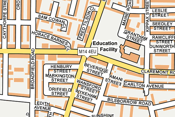
M14 4EU is located in the Moss Side electoral ward, within the metropolitan district of Manchester and the English Parliamentary constituency of Manchester Central. The Sub Integrated Care Board (ICB) Location is NHS Greater Manchester ICB - 14L and the police force is Greater Manchester. This postcode has been in use since May 2017.


GetTheData
Source: OS OpenMap – Local (Ordnance Survey)
Source: OS VectorMap District (Ordnance Survey)
Licence: Open Government Licence (requires attribution)
| Easting | 384352 |
| Northing | 395177 |
| Latitude | 53.453131 |
| Longitude | -2.237102 |
GetTheData
Source: Open Postcode Geo
Licence: Open Government Licence
| Country | England |
| Postcode District | M14 |
➜ See where M14 is on a map ➜ Where is Manchester? | |
GetTheData
Source: Land Registry Price Paid Data
Licence: Open Government Licence
| Ward | Moss Side |
| Constituency | Manchester Central |
GetTheData
Source: ONS Postcode Database
Licence: Open Government Licence
| Lloyd St South/Claremont Rd (Lloyd St South) | Moss Side | 22m |
| Lloyd St South/Claremont Rd (Lloyd St South) | Moss Side | 50m |
| Claremont Rd/Maine Rd (Claremont Rd) | Moss Side | 60m |
| Upper Lloyd St/Claremont Rd (Upper Lloyd St) | Moss Side | 87m |
| Claremont Rd/Maine Rd (Claremont Rd) | Moss Side | 111m |
| Manchester Oxford Road Station | 2.3km |
| Deansgate Station | 2.5km |
| Ardwick Station | 2.5km |
GetTheData
Source: NaPTAN
Licence: Open Government Licence
GetTheData
Source: ONS Postcode Database
Licence: Open Government Licence


➜ Get more ratings from the Food Standards Agency
GetTheData
Source: Food Standards Agency
Licence: FSA terms & conditions
| Last Collection | |||
|---|---|---|---|
| Location | Mon-Fri | Sat | Distance |
| 251 Claremont Road | 17:30 | 12:00 | 17m |
| Opp 47 Lloyd Street South | 17:30 | 12:00 | 311m |
| 46 Broadfield Road | 17:30 | 12:00 | 314m |
GetTheData
Source: Dracos
Licence: Creative Commons Attribution-ShareAlike
The below table lists the International Territorial Level (ITL) codes (formerly Nomenclature of Territorial Units for Statistics (NUTS) codes) and Local Administrative Units (LAU) codes for M14 4EU:
| ITL 1 Code | Name |
|---|---|
| TLD | North West (England) |
| ITL 2 Code | Name |
| TLD3 | Greater Manchester |
| ITL 3 Code | Name |
| TLD33 | Manchester |
| LAU 1 Code | Name |
| E08000003 | Manchester |
GetTheData
Source: ONS Postcode Directory
Licence: Open Government Licence
The below table lists the Census Output Area (OA), Lower Layer Super Output Area (LSOA), and Middle Layer Super Output Area (MSOA) for M14 4EU:
| Code | Name | |
|---|---|---|
| OA | E00026552 | |
| LSOA | E01005242 | Manchester 025B |
| MSOA | E02001069 | Manchester 025 |
GetTheData
Source: ONS Postcode Directory
Licence: Open Government Licence
| M14 4EP | Claremont Road | 27m |
| M14 7NN | Beveridge Street | 41m |
| M14 7JD | Lloyd Street South | 75m |
| M14 7JE | Henbury Street | 87m |
| M14 4TS | Claremont Road | 92m |
| M14 7WW | Wansford Street | 102m |
| M14 4JE | Upper Lloyd Street | 102m |
| M14 7JB | Markington Street | 108m |
| M14 7TL | Amani Street | 121m |
| M14 7TR | Maine Road | 126m |
GetTheData
Source: Open Postcode Geo; Land Registry Price Paid Data
Licence: Open Government Licence