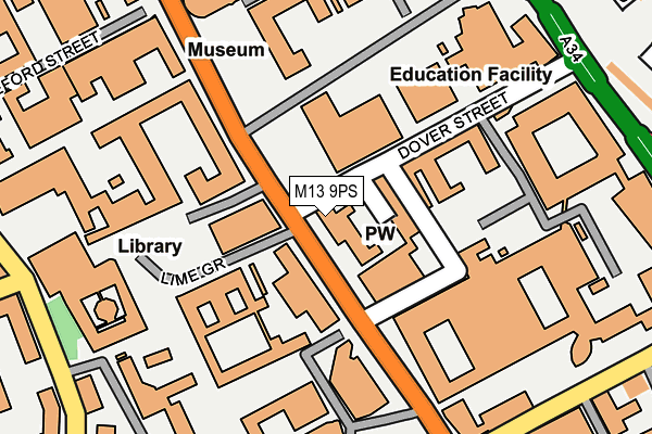
M13 9PS is located in the Hulme electoral ward, within the metropolitan district of Manchester and the English Parliamentary constituency of Manchester Central. The Sub Integrated Care Board (ICB) Location is NHS Greater Manchester ICB - 14L and the police force is Greater Manchester. This postcode has been in use since January 1980.


GetTheData
Source: OS OpenMap – Local (Ordnance Survey)
Source: OS VectorMap District (Ordnance Survey)
Licence: Open Government Licence (requires attribution)
| Easting | 384697 |
| Northing | 396491 |
| Latitude | 53.464936 |
| Longitude | -2.231972 |
GetTheData
Source: Open Postcode Geo
Licence: Open Government Licence
| Country | England |
| Postcode District | M13 |
➜ See where M13 is on a map ➜ Where is Manchester? | |
GetTheData
Source: Land Registry Price Paid Data
Licence: Open Government Licence
Elevation or altitude of M13 9PS as distance above sea level:
| Metres | Feet | |
|---|---|---|
| Elevation | 40m | 131ft |
Elevation is measured from the approximate centre of the postcode, to the nearest point on an OS contour line from OS Terrain 50, which has contour spacing of ten vertical metres.
➜ How high above sea level am I? Find the elevation of your current position using your device's GPS.
GetTheData
Source: Open Postcode Elevation
Licence: Open Government Licence
| Ward | Hulme |
| Constituency | Manchester Central |
GetTheData
Source: ONS Postcode Database
Licence: Open Government Licence
| Oxford Rd/University (Oxford Rd) | Chorlton Upon Medlock | 37m |
| Oxford Rd/University (Oxford Rd) | Chorlton Upon Medlock | 44m |
| Oxford Rd/University (Oxford Rd) | Chorlton Upon Medlock | 119m |
| Upper Brook St/Brunswick St (Upper Brook St) | Brunswick | 265m |
| Grafton St/Royal Infirmary (Grafton Street) | Chorlton Upon Medlock | 283m |
| Piccadilly (Manchester Metrolink) (London Road) | Manchester City Centre | 1,375m |
| St Peters Square (Manchester Metrolink) (Peter Street) | Manchester City Centre | 1,651m |
| Deansgate-castlefield (Manchester Metrolink) (Whitworth Street West) | Manchester City Centre | 1,685m |
| Manchester Oxford Road Station | 1.2km |
| Manchester Piccadilly Station | 1.4km |
| Ardwick Station | 1.4km |
GetTheData
Source: NaPTAN
Licence: Open Government Licence
GetTheData
Source: ONS Postcode Database
Licence: Open Government Licence


➜ Get more ratings from the Food Standards Agency
GetTheData
Source: Food Standards Agency
Licence: FSA terms & conditions
| Last Collection | |||
|---|---|---|---|
| Location | Mon-Fri | Sat | Distance |
| Albert Club | 17:30 | 12:00 | 40m |
| Owens Collage | 17:30 | 12:00 | 276m |
| York Place | 17:30 | 12:00 | 401m |
GetTheData
Source: Dracos
Licence: Creative Commons Attribution-ShareAlike
The below table lists the International Territorial Level (ITL) codes (formerly Nomenclature of Territorial Units for Statistics (NUTS) codes) and Local Administrative Units (LAU) codes for M13 9PS:
| ITL 1 Code | Name |
|---|---|
| TLD | North West (England) |
| ITL 2 Code | Name |
| TLD3 | Greater Manchester |
| ITL 3 Code | Name |
| TLD33 | Manchester |
| LAU 1 Code | Name |
| E08000003 | Manchester |
GetTheData
Source: ONS Postcode Directory
Licence: Open Government Licence
The below table lists the Census Output Area (OA), Lower Layer Super Output Area (LSOA), and Middle Layer Super Output Area (MSOA) for M13 9PS:
| Code | Name | |
|---|---|---|
| OA | E00175812 | |
| LSOA | E01005062 | Manchester 018B |
| MSOA | E02001062 | Manchester 018 |
GetTheData
Source: ONS Postcode Directory
Licence: Open Government Licence
| M13 9PG | Oxford Road | 22m |
| M13 9GB | Portsmouth Street | 72m |
| M13 9NT | Grafton Street | 237m |
| M13 9JS | Upper Brook Street | 298m |
| M13 9RQ | Condor Walk | 352m |
| M15 6HQ | Burlington Street | 363m |
| M13 9SR | Brunswick Street | 364m |
| M13 9SL | Hutton Walk | 376m |
| M13 9LY | Upper Brook Street | 397m |
| M13 9JJ | Plymouth View | 424m |
GetTheData
Source: Open Postcode Geo; Land Registry Price Paid Data
Licence: Open Government Licence