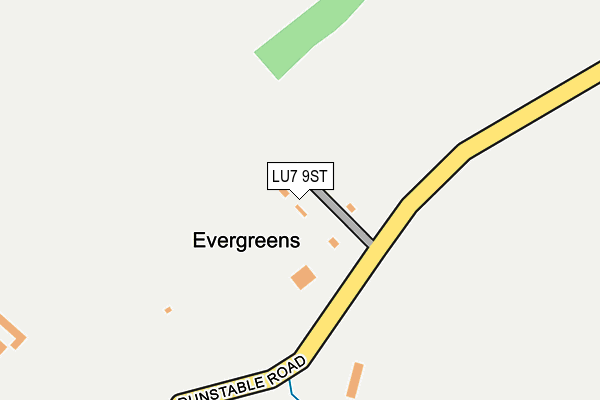
LU7 9ST is located in the Heath & Reach electoral ward, within the unitary authority of Central Bedfordshire and the English Parliamentary constituency of South West Bedfordshire. The Sub Integrated Care Board (ICB) Location is NHS Bedfordshire, Luton and Milton Keynes ICB - M1J4Y and the police force is Bedfordshire. This postcode has been in use since June 2017.


GetTheData
Source: OS OpenMap – Local (Ordnance Survey)
Source: OS VectorMap District (Ordnance Survey)
Licence: Open Government Licence (requires attribution)
| Easting | 498303 |
| Northing | 224627 |
| Latitude | 51.911520 |
| Longitude | -0.572272 |
GetTheData
Source: Open Postcode Geo
Licence: Open Government Licence
| Country | England |
| Postcode District | LU7 |
➜ See where LU7 is on a map | |
GetTheData
Source: Land Registry Price Paid Data
Licence: Open Government Licence
| Ward | Heath & Reach |
| Constituency | South West Bedfordshire |
GetTheData
Source: ONS Postcode Database
Licence: Open Government Licence
| Dickens Lane (Dunstable Road) | Tilsworth | 370m |
| Dickens Lane (Dunstable Road) | Tilsworth | 382m |
| Tilsworth Golf Centre (Dunstable Road) | Tilsworth | 391m |
| Tilsworth Golf Centre (Dunstable Road) | Tilsworth | 392m |
| Blackhill (Dunstable Road) | Tilsworth | 443m |
GetTheData
Source: NaPTAN
Licence: Open Government Licence
| Percentage of properties with Next Generation Access | 100.0% |
| Percentage of properties with Superfast Broadband | 0.0% |
| Percentage of properties with Ultrafast Broadband | 0.0% |
| Percentage of properties with Full Fibre Broadband | 0.0% |
Superfast Broadband is between 30Mbps and 300Mbps
Ultrafast Broadband is > 300Mbps
| Percentage of properties unable to receive 2Mbps | 0.0% |
| Percentage of properties unable to receive 5Mbps | 0.0% |
| Percentage of properties unable to receive 10Mbps | 0.0% |
| Percentage of properties unable to receive 30Mbps | 100.0% |
GetTheData
Source: Ofcom
Licence: Ofcom Terms of Use (requires attribution)
GetTheData
Source: ONS Postcode Database
Licence: Open Government Licence


➜ Get more ratings from the Food Standards Agency
GetTheData
Source: Food Standards Agency
Licence: FSA terms & conditions
| Last Collection | |||
|---|---|---|---|
| Location | Mon-Fri | Sat | Distance |
| Anchor Public House | 17:00 | 09:30 | 442m |
| Peddars Lane | 17:00 | 10:30 | 1,338m |
| Post Office Stanbridge | 17:00 | 10:00 | 1,707m |
GetTheData
Source: Dracos
Licence: Creative Commons Attribution-ShareAlike
The below table lists the International Territorial Level (ITL) codes (formerly Nomenclature of Territorial Units for Statistics (NUTS) codes) and Local Administrative Units (LAU) codes for LU7 9ST:
| ITL 1 Code | Name |
|---|---|
| TLH | East |
| ITL 2 Code | Name |
| TLH2 | Bedfordshire and Hertfordshire |
| ITL 3 Code | Name |
| TLH25 | Central Bedfordshire |
| LAU 1 Code | Name |
| E06000056 | Central Bedfordshire |
GetTheData
Source: ONS Postcode Directory
Licence: Open Government Licence
The below table lists the Census Output Area (OA), Lower Layer Super Output Area (LSOA), and Middle Layer Super Output Area (MSOA) for LU7 9ST:
| Code | Name | |
|---|---|---|
| OA | E00088914 | |
| LSOA | E01017615 | Central Bedfordshire 019B |
| MSOA | E02003637 | Central Bedfordshire 019 |
GetTheData
Source: ONS Postcode Directory
Licence: Open Government Licence
| LU7 9FQ | Greenhill View | 369m |
| LU7 9PU | Dunstable Road | 375m |
| LU7 9PX | Dickens Lane | 466m |
| LU7 9PP | Blackhill | 472m |
| LU7 9PW | Stanbridge Road | 542m |
| LU7 9PR | Bury Rise | 558m |
| LU7 9PT | Stanbridge Road | 667m |
| LU7 9PN | Stanbridge Road | 892m |
| LU7 9PL | Stanbridge Road | 1102m |
| LU7 9HZ | Kingsway | 1307m |
GetTheData
Source: Open Postcode Geo; Land Registry Price Paid Data
Licence: Open Government Licence