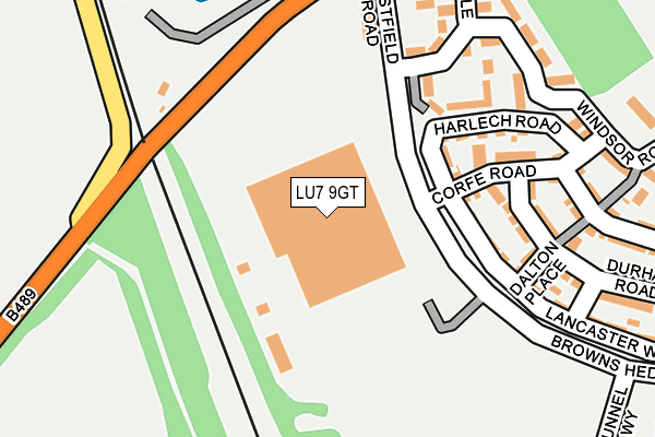
LU7 9GT is located in the Ivinghoe electoral ward, within the unitary authority of Buckinghamshire and the English Parliamentary constituency of Buckingham. The Sub Integrated Care Board (ICB) Location is NHS Buckinghamshire, Oxfordshire and Berkshire West ICB - 14Y and the police force is Thames Valley. This postcode has been in use since June 2002.


GetTheData
Source: OS OpenMap – Local (Ordnance Survey)
Source: OS VectorMap District (Ordnance Survey)
Licence: Open Government Licence (requires attribution)
| Easting | 493217 |
| Northing | 215224 |
| Latitude | 51.827867 |
| Longitude | -0.648748 |
GetTheData
Source: Open Postcode Geo
Licence: Open Government Licence
| Country | England |
| Postcode District | LU7 |
➜ See where LU7 is on a map ➜ Where is Pitstone? | |
GetTheData
Source: Land Registry Price Paid Data
Licence: Open Government Licence
Elevation or altitude of LU7 9GT as distance above sea level:
| Metres | Feet | |
|---|---|---|
| Elevation | 120m | 394ft |
Elevation is measured from the approximate centre of the postcode, to the nearest point on an OS contour line from OS Terrain 50, which has contour spacing of ten vertical metres.
➜ How high above sea level am I? Find the elevation of your current position using your device's GPS.
GetTheData
Source: Open Postcode Elevation
Licence: Open Government Licence
| Ward | Ivinghoe |
| Constituency | Buckingham |
GetTheData
Source: ONS Postcode Database
Licence: Open Government Licence
| Harlech Road (Westfield Road) | Pitstone | 82m |
| Harlech Road (Westfield Road) | Pitstone | 90m |
| Castlemead Estate (Windsor Road) | Pitstone | 407m |
| Playing Fields (Marsworth Road) | Pitstone | 522m |
| Warwick Road (Browns Hedge) | Pitstone | 528m |
| Cheddington Station | 3.5km |
| Tring Station | 3.5km |
GetTheData
Source: NaPTAN
Licence: Open Government Licence
GetTheData
Source: ONS Postcode Database
Licence: Open Government Licence


➜ Get more ratings from the Food Standards Agency
GetTheData
Source: Food Standards Agency
Licence: FSA terms & conditions
| Last Collection | |||
|---|---|---|---|
| Location | Mon-Fri | Sat | Distance |
| The Crescent | 16:45 | 10:30 | 612m |
| Wellington Place | 17:00 | 10:30 | 887m |
| Vicarage Road | 16:45 | 10:30 | 933m |
GetTheData
Source: Dracos
Licence: Creative Commons Attribution-ShareAlike
The below table lists the International Territorial Level (ITL) codes (formerly Nomenclature of Territorial Units for Statistics (NUTS) codes) and Local Administrative Units (LAU) codes for LU7 9GT:
| ITL 1 Code | Name |
|---|---|
| TLJ | South East (England) |
| ITL 2 Code | Name |
| TLJ1 | Berkshire, Buckinghamshire and Oxfordshire |
| ITL 3 Code | Name |
| TLJ13 | Buckinghamshire |
| LAU 1 Code | Name |
| E06000060 | Buckinghamshire |
GetTheData
Source: ONS Postcode Directory
Licence: Open Government Licence
The below table lists the Census Output Area (OA), Lower Layer Super Output Area (LSOA), and Middle Layer Super Output Area (MSOA) for LU7 9GT:
| Code | Name | |
|---|---|---|
| OA | E00169107 | |
| LSOA | E01017701 | Aylesbury Vale 009E |
| MSOA | E02003660 | Aylesbury Vale 009 |
GetTheData
Source: ONS Postcode Directory
Licence: Open Government Licence
| LU7 9GH | Browns Hedge | 143m |
| LU7 9FX | Harlech Road | 161m |
| LU7 9QZ | Dalton Place | 186m |
| LU7 9GD | Windsor Road | 192m |
| LU7 9AP | Marsworth Road | 193m |
| LU7 9FY | Corfe Road | 195m |
| LU7 9RH | Lancaster Way | 224m |
| LU7 9JZ | Durham Road | 239m |
| LU7 9GB | Windsor Road | 250m |
| LU7 9FZ | Stirling Place | 262m |
GetTheData
Source: Open Postcode Geo; Land Registry Price Paid Data
Licence: Open Government Licence