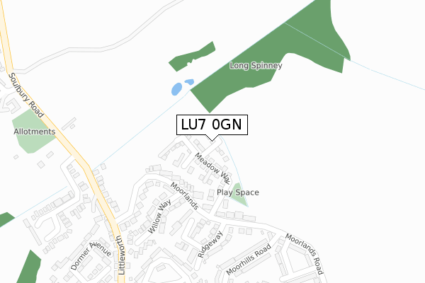
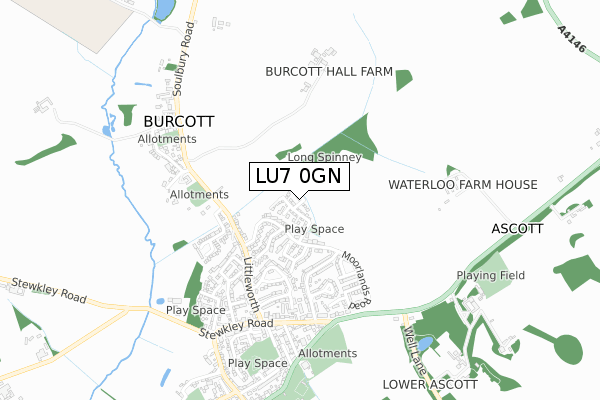
LU7 0GN is located in the Ivinghoe electoral ward, within the unitary authority of Buckinghamshire and the English Parliamentary constituency of Buckingham. The Sub Integrated Care Board (ICB) Location is NHS Buckinghamshire, Oxfordshire and Berkshire West ICB - 14Y and the police force is Thames Valley. This postcode has been in use since October 2019.


GetTheData
Source: OS Open Zoomstack (Ordnance Survey)
Licence: Open Government Licence (requires attribution)
Attribution: Contains OS data © Crown copyright and database right 2025
Source: Open Postcode Geo
Licence: Open Government Licence (requires attribution)
Attribution: Contains OS data © Crown copyright and database right 2025; Contains Royal Mail data © Royal Mail copyright and database right 2025; Source: Office for National Statistics licensed under the Open Government Licence v.3.0
| Easting | 491870 |
| Northing | 217583 |
| Latitude | 51.849301 |
| Longitude | -0.667638 |
GetTheData
Source: Open Postcode Geo
Licence: Open Government Licence
| Country | England |
| Postcode District | LU7 |
➜ See where LU7 is on a map ➜ Where is Cheddington? | |
GetTheData
Source: Land Registry Price Paid Data
Licence: Open Government Licence
| Ward | Ivinghoe |
| Constituency | Buckingham |
GetTheData
Source: ONS Postcode Database
Licence: Open Government Licence
12, MERRY LEYS, CHEDDINGTON, LEIGHTON BUZZARD, LU7 0GN 2022 16 DEC £530,000 |
14, MERRY LEYS, CHEDDINGTON, LEIGHTON BUZZARD, LU7 0GN 2022 28 NOV £480,000 |
11, MERRY LEYS, CHEDDINGTON, LEIGHTON BUZZARD, LU7 0GN 2022 30 SEP £584,995 |
10, MERRY LEYS, CHEDDINGTON, LEIGHTON BUZZARD, LU7 0GN 2021 26 NOV £579,995 |
9, MERRY LEYS, CHEDDINGTON, LEIGHTON BUZZARD, LU7 0GN 2021 25 JUN £579,995 |
GetTheData
Source: HM Land Registry Price Paid Data
Licence: Contains HM Land Registry data © Crown copyright and database right 2025. This data is licensed under the Open Government Licence v3.0.
| The Green (New Street) | Cheddington | 304m |
| The Green (New Street) | Cheddington | 313m |
| Manor Road | Cheddington | 355m |
| Manor Road | Cheddington | 362m |
| Long Marston Road | Cheddington | 401m |
| Cheddington Station | 1km |
GetTheData
Source: NaPTAN
Licence: Open Government Licence
GetTheData
Source: ONS Postcode Database
Licence: Open Government Licence


➜ Get more ratings from the Food Standards Agency
GetTheData
Source: Food Standards Agency
Licence: FSA terms & conditions
| Last Collection | |||
|---|---|---|---|
| Location | Mon-Fri | Sat | Distance |
| Post Office High Street | 17:00 | 09:30 | 325m |
| New Street | 17:00 | 09:00 | 342m |
| Station Road | 17:00 | 10:30 | 552m |
GetTheData
Source: Dracos
Licence: Creative Commons Attribution-ShareAlike
The below table lists the International Territorial Level (ITL) codes (formerly Nomenclature of Territorial Units for Statistics (NUTS) codes) and Local Administrative Units (LAU) codes for LU7 0GN:
| ITL 1 Code | Name |
|---|---|
| TLJ | South East (England) |
| ITL 2 Code | Name |
| TLJ1 | Berkshire, Buckinghamshire and Oxfordshire |
| ITL 3 Code | Name |
| TLJ13 | Buckinghamshire |
| LAU 1 Code | Name |
| E06000060 | Buckinghamshire |
GetTheData
Source: ONS Postcode Directory
Licence: Open Government Licence
The below table lists the Census Output Area (OA), Lower Layer Super Output Area (LSOA), and Middle Layer Super Output Area (MSOA) for LU7 0GN:
| Code | Name | |
|---|---|---|
| OA | E00089099 | |
| LSOA | E01017652 | Aylesbury Vale 009B |
| MSOA | E02003660 | Aylesbury Vale 009 |
GetTheData
Source: ONS Postcode Directory
Licence: Open Government Licence
| LU7 0FP | Partridge Close | 144m |
| LU7 0SB | Horseshoe Close | 155m |
| LU7 0SD | Mentmore Road | 156m |
| LU7 0SN | Paines Orchard | 159m |
| LU7 0UR | Ashley Close | 189m |
| LU7 0SY | Church Hill | 219m |
| LU7 0SA | Chaseside Close | 236m |
| LU7 0RT | Barkham Close | 239m |
| LU7 0SE | Blenheim Close | 271m |
| LU7 0SX | Church Hill | 271m |
GetTheData
Source: Open Postcode Geo; Land Registry Price Paid Data
Licence: Open Government Licence