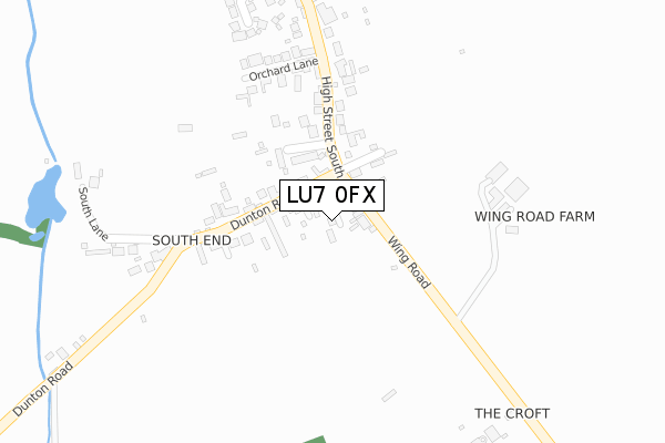
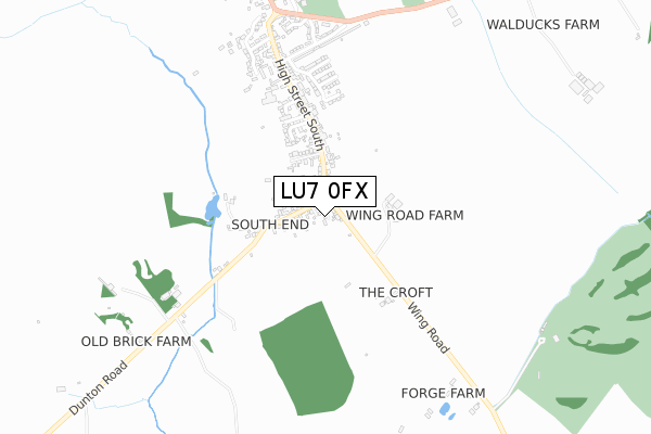
LU7 0FX is located in the Great Brickhill electoral ward, within the unitary authority of Buckinghamshire and the English Parliamentary constituency of Buckingham. The Sub Integrated Care Board (ICB) Location is NHS Buckinghamshire, Oxfordshire and Berkshire West ICB - 14Y and the police force is Thames Valley. This postcode has been in use since December 2019.


GetTheData
Source: OS Open Zoomstack (Ordnance Survey)
Licence: Open Government Licence (requires attribution)
Attribution: Contains OS data © Crown copyright and database right 2025
Source: Open Postcode Geo
Licence: Open Government Licence (requires attribution)
Attribution: Contains OS data © Crown copyright and database right 2025; Contains Royal Mail data © Royal Mail copyright and database right 2025; Source: Office for National Statistics licensed under the Open Government Licence v.3.0
| Easting | 485056 |
| Northing | 226604 |
| Latitude | 51.931468 |
| Longitude | -0.764317 |
GetTheData
Source: Open Postcode Geo
Licence: Open Government Licence
| Country | England |
| Postcode District | LU7 |
➜ See where LU7 is on a map ➜ Where is Stewkley? | |
GetTheData
Source: Land Registry Price Paid Data
Licence: Open Government Licence
| Ward | Great Brickhill |
| Constituency | Buckingham |
GetTheData
Source: ONS Postcode Database
Licence: Open Government Licence
3, CRICKETERS CLOSE, STEWKLEY, LEIGHTON BUZZARD, LU7 0FX 2024 1 AUG £450,000 |
2023 8 DEC £470,000 |
5, CRICKETERS CLOSE, STEWKLEY, LEIGHTON BUZZARD, LU7 0FX 2021 14 APR £450,000 |
1, CRICKETERS CLOSE, STEWKLEY, LEIGHTON BUZZARD, LU7 0FX 2021 5 FEB £370,000 |
6, CRICKETERS CLOSE, STEWKLEY, LEIGHTON BUZZARD, LU7 0FX 2021 29 JAN £375,000 |
3, CRICKETERS CLOSE, STEWKLEY, LEIGHTON BUZZARD, LU7 0FX 2020 18 DEC £375,000 |
2020 4 SEP £400,000 |
14, CRICKETERS CLOSE, STEWKLEY, LEIGHTON BUZZARD, LU7 0FX 2020 2 SEP £590,000 |
12, CRICKETERS CLOSE, STEWKLEY, LEIGHTON BUZZARD, LU7 0FX 2020 27 AUG £580,000 |
9, CRICKETERS CLOSE, STEWKLEY, LEIGHTON BUZZARD, LU7 0FX 2020 31 JUL £615,000 |
GetTheData
Source: HM Land Registry Price Paid Data
Licence: Contains HM Land Registry data © Crown copyright and database right 2025. This data is licensed under the Open Government Licence v3.0.
| Village Hall (High Street North) | Stewkley | 105m |
| Village Hall (High Street North) | Stewkley | 204m |
| Stockhall Crescent (High Street North) | Stewkley | 333m |
| Stockhall Crescent (High Street North) | Stewkley | 364m |
| Library (High Street North) | Stewkley | 487m |
GetTheData
Source: NaPTAN
Licence: Open Government Licence
GetTheData
Source: ONS Postcode Database
Licence: Open Government Licence


➜ Get more ratings from the Food Standards Agency
GetTheData
Source: Food Standards Agency
Licence: FSA terms & conditions
| Last Collection | |||
|---|---|---|---|
| Location | Mon-Fri | Sat | Distance |
| Village Hall Ivy Lane | 17:00 | 10:30 | 203m |
| Bowles Farm | 17:00 | 10:30 | 486m |
| Post Office High Street | 17:00 | 10:30 | 519m |
GetTheData
Source: Dracos
Licence: Creative Commons Attribution-ShareAlike
The below table lists the International Territorial Level (ITL) codes (formerly Nomenclature of Territorial Units for Statistics (NUTS) codes) and Local Administrative Units (LAU) codes for LU7 0FX:
| ITL 1 Code | Name |
|---|---|
| TLJ | South East (England) |
| ITL 2 Code | Name |
| TLJ1 | Berkshire, Buckinghamshire and Oxfordshire |
| ITL 3 Code | Name |
| TLJ13 | Buckinghamshire |
| LAU 1 Code | Name |
| E06000060 | Buckinghamshire |
GetTheData
Source: ONS Postcode Directory
Licence: Open Government Licence
The below table lists the Census Output Area (OA), Lower Layer Super Output Area (LSOA), and Middle Layer Super Output Area (MSOA) for LU7 0FX:
| Code | Name | |
|---|---|---|
| OA | E00089393 | |
| LSOA | E01017716 | Aylesbury Vale 006D |
| MSOA | E02003657 | Aylesbury Vale 006 |
GetTheData
Source: ONS Postcode Directory
Licence: Open Government Licence
| LU7 0EW | High Street North | 110m |
| LU7 0EZ | High Street North | 138m |
| LU7 0EY | Sycamore Close | 161m |
| LU7 0EN | Ivy Lane | 270m |
| LU7 0HA | Chapel Square | 295m |
| LU7 0HB | Fishweir | 337m |
| LU7 0HH | High Street North | 432m |
| LU7 0EP | High Street North | 444m |
| LU7 0HJ | High Street North | 472m |
| LU7 0HL | School Lane | 537m |
GetTheData
Source: Open Postcode Geo; Land Registry Price Paid Data
Licence: Open Government Licence