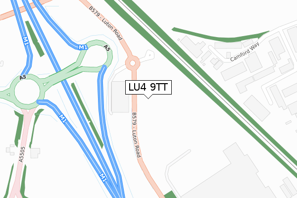
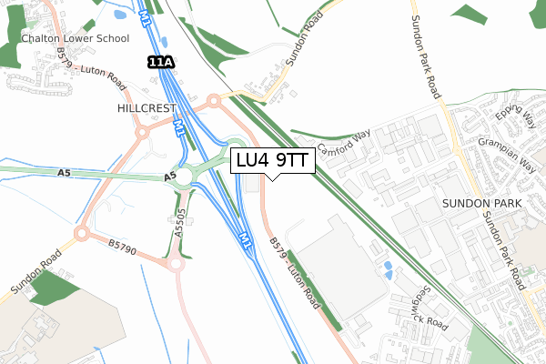
LU4 9TT is located in the Toddington electoral ward, within the unitary authority of Central Bedfordshire and the English Parliamentary constituency of Mid Bedfordshire. The Sub Integrated Care Board (ICB) Location is NHS Bedfordshire, Luton and Milton Keynes ICB - M1J4Y and the police force is Bedfordshire. This postcode has been in use since October 2017.


GetTheData
Source: OS Open Zoomstack (Ordnance Survey)
Licence: Open Government Licence (requires attribution)
Attribution: Contains OS data © Crown copyright and database right 2025
Source: Open Postcode Geo
Licence: Open Government Licence (requires attribution)
Attribution: Contains OS data © Crown copyright and database right 2025; Contains Royal Mail data © Royal Mail copyright and database right 2025; Source: Office for National Statistics licensed under the Open Government Licence v.3.0
| Easting | 504254 |
| Northing | 225746 |
| Latitude | 51.920496 |
| Longitude | -0.485450 |
GetTheData
Source: Open Postcode Geo
Licence: Open Government Licence
| Country | England |
| Postcode District | LU4 |
➜ See where LU4 is on a map | |
GetTheData
Source: Land Registry Price Paid Data
Licence: Open Government Licence
| Ward | Toddington |
| Constituency | Mid Bedfordshire |
GetTheData
Source: ONS Postcode Database
Licence: Open Government Licence
| Camford Way | Sundon Park | 329m |
| Camford Way | Sundon Park | 371m |
| Sundon Road (Luton Road) | Chalton | 433m |
| Sundon Road (Luton Road) | Chalton | 531m |
| Vauxhall Warehouse (Luton Road) | Chalton | 750m |
| Leagrave Station | 2.5km |
| Harlington (Beds) Station | 4.7km |
GetTheData
Source: NaPTAN
Licence: Open Government Licence
GetTheData
Source: ONS Postcode Database
Licence: Open Government Licence


➜ Get more ratings from the Food Standards Agency
GetTheData
Source: Food Standards Agency
Licence: FSA terms & conditions
| Last Collection | |||
|---|---|---|---|
| Location | Mon-Fri | Sat | Distance |
| Sundon Arches | 17:30 | 09:00 | 473m |
| Camford Way | 18:30 | 603m | |
| Sedgwick Road | 18:30 | 983m | |
GetTheData
Source: Dracos
Licence: Creative Commons Attribution-ShareAlike
The below table lists the International Territorial Level (ITL) codes (formerly Nomenclature of Territorial Units for Statistics (NUTS) codes) and Local Administrative Units (LAU) codes for LU4 9TT:
| ITL 1 Code | Name |
|---|---|
| TLH | East |
| ITL 2 Code | Name |
| TLH2 | Bedfordshire and Hertfordshire |
| ITL 3 Code | Name |
| TLH25 | Central Bedfordshire |
| LAU 1 Code | Name |
| E06000056 | Central Bedfordshire |
GetTheData
Source: ONS Postcode Directory
Licence: Open Government Licence
The below table lists the Census Output Area (OA), Lower Layer Super Output Area (LSOA), and Middle Layer Super Output Area (MSOA) for LU4 9TT:
| Code | Name | |
|---|---|---|
| OA | E00088953 | |
| LSOA | E01017620 | Central Bedfordshire 019C |
| MSOA | E02003637 | Central Bedfordshire 019 |
GetTheData
Source: ONS Postcode Directory
Licence: Open Government Licence
| LU3 3AN | Camford Way | 381m |
| LU4 9UA | Sundon Road | 455m |
| LU3 3HP | Dencora Way | 623m |
| LU4 9UB | Luton Road | 767m |
| LU3 3AS | Sundon Park Road | 782m |
| LU3 3AR | Sundon Park Road | 817m |
| LU3 3JB | Firbank Close | 850m |
| LU3 3HX | Grampian Way | 851m |
| LU3 3AT | Wellfield Avenue | 859m |
| LU4 9US | Eagle Centre Way | 867m |
GetTheData
Source: Open Postcode Geo; Land Registry Price Paid Data
Licence: Open Government Licence