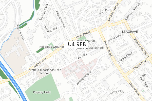
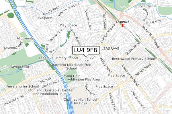
LU4 9FB is located in the Challney electoral ward, within the unitary authority of Luton and the English Parliamentary constituency of Luton North. The Sub Integrated Care Board (ICB) Location is NHS Bedfordshire, Luton and Milton Keynes ICB - M1J4Y and the police force is Bedfordshire. This postcode has been in use since September 2017.


GetTheData
Source: OS Open Zoomstack (Ordnance Survey)
Licence: Open Government Licence (requires attribution)
Attribution: Contains OS data © Crown copyright and database right 2025
Source: Open Postcode Geo
Licence: Open Government Licence (requires attribution)
Attribution: Contains OS data © Crown copyright and database right 2025; Contains Royal Mail data © Royal Mail copyright and database right 2025; Source: Office for National Statistics licensed under the Open Government Licence v.3.0
| Easting | 505607 |
| Northing | 223643 |
| Latitude | 51.901340 |
| Longitude | -0.466428 |
GetTheData
Source: Open Postcode Geo
Licence: Open Government Licence
| Country | England |
| Postcode District | LU4 |
➜ See where LU4 is on a map ➜ Where is Luton? | |
GetTheData
Source: Land Registry Price Paid Data
Licence: Open Government Licence
| Ward | Challney |
| Constituency | Luton North |
GetTheData
Source: ONS Postcode Database
Licence: Open Government Licence
2024 12 JUL £410,000 |
10, LAUREL CLOSE, LUTON, LU4 9FB 2017 31 OCT £350,000 |
11, LAUREL CLOSE, LUTON, LU4 9FB 2017 18 OCT £355,000 |
2017 13 SEP £350,000 |
GetTheData
Source: HM Land Registry Price Paid Data
Licence: Contains HM Land Registry data © Crown copyright and database right 2025. This data is licensed under the Open Government Licence v3.0.
| Torquay Drive (High Street) | Leagrave | 119m |
| Orchard Way (Mayne Avenue) | Hockwell Ring | 125m |
| Torquay Drive (High Street) | Leagrave | 142m |
| Westlea (High Street) | Leagrave | 160m |
| Orchard Way (Mayne Avenue) | Hockwell Ring | 176m |
| Leagrave Station | 0.7km |
| Luton Station | 4.2km |
| Luton Airport Parkway Station | 5.8km |
GetTheData
Source: NaPTAN
Licence: Open Government Licence
| Percentage of properties with Next Generation Access | 100.0% |
| Percentage of properties with Superfast Broadband | 18.2% |
| Percentage of properties with Ultrafast Broadband | 0.0% |
| Percentage of properties with Full Fibre Broadband | 0.0% |
Superfast Broadband is between 30Mbps and 300Mbps
Ultrafast Broadband is > 300Mbps
| Median download speed | 19.2Mbps |
| Average download speed | 20.4Mbps |
| Maximum download speed | 37.11Mbps |
| Median upload speed | 2.9Mbps |
| Average upload speed | 2.9Mbps |
| Maximum upload speed | 5.13Mbps |
| Percentage of properties unable to receive 2Mbps | 0.0% |
| Percentage of properties unable to receive 5Mbps | 0.0% |
| Percentage of properties unable to receive 10Mbps | 0.0% |
| Percentage of properties unable to receive 30Mbps | 81.8% |
GetTheData
Source: Ofcom
Licence: Ofcom Terms of Use (requires attribution)
GetTheData
Source: ONS Postcode Database
Licence: Open Government Licence


➜ Get more ratings from the Food Standards Agency
GetTheData
Source: Food Standards Agency
Licence: FSA terms & conditions
| Last Collection | |||
|---|---|---|---|
| Location | Mon-Fri | Sat | Distance |
| Mayne Avenue | 17:30 | 12:15 | 203m |
| Compton Avenue | 17:30 | 12:00 | 278m |
| Clifford Crescent | 17:30 | 12:15 | 527m |
GetTheData
Source: Dracos
Licence: Creative Commons Attribution-ShareAlike
The below table lists the International Territorial Level (ITL) codes (formerly Nomenclature of Territorial Units for Statistics (NUTS) codes) and Local Administrative Units (LAU) codes for LU4 9FB:
| ITL 1 Code | Name |
|---|---|
| TLH | East |
| ITL 2 Code | Name |
| TLH2 | Bedfordshire and Hertfordshire |
| ITL 3 Code | Name |
| TLH21 | Luton |
| LAU 1 Code | Name |
| E06000032 | Luton |
GetTheData
Source: ONS Postcode Directory
Licence: Open Government Licence
The below table lists the Census Output Area (OA), Lower Layer Super Output Area (LSOA), and Middle Layer Super Output Area (MSOA) for LU4 9FB:
| Code | Name | |
|---|---|---|
| OA | E00079634 | |
| LSOA | E01015751 | Luton 005B |
| MSOA | E02003262 | Luton 005 |
GetTheData
Source: ONS Postcode Directory
Licence: Open Government Licence
| LU4 9QP | Chatteris Close | 36m |
| LU4 9QN | Ely Way | 42m |
| LU4 9JZ | High Street | 52m |
| LU4 9JY | High Street | 117m |
| LU4 9LP | Mayne Avenue | 139m |
| LU4 9LF | High Street | 164m |
| LU4 9LQ | High Street | 187m |
| LU4 9GQ | Orchard Way | 214m |
| LU4 9GD | Ouseley Close | 223m |
| LU4 9LT | Orchard Way | 227m |
GetTheData
Source: Open Postcode Geo; Land Registry Price Paid Data
Licence: Open Government Licence