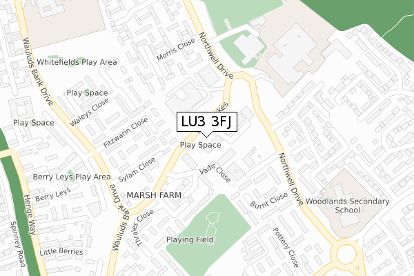
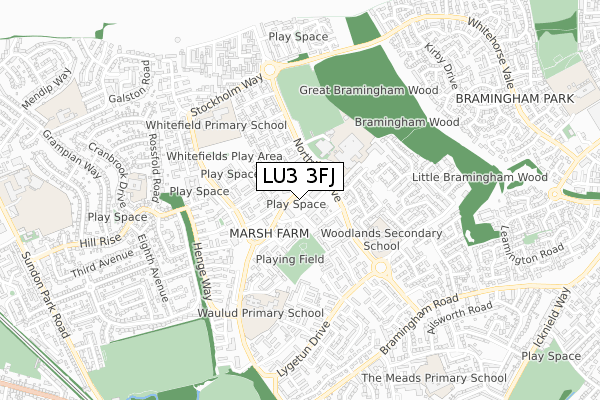
LU3 3FJ is located in the Northwell electoral ward, within the unitary authority of Luton and the English Parliamentary constituency of Luton North. The Sub Integrated Care Board (ICB) Location is NHS Bedfordshire, Luton and Milton Keynes ICB - M1J4Y and the police force is Bedfordshire. This postcode has been in use since November 2019.


GetTheData
Source: OS Open Zoomstack (Ordnance Survey)
Licence: Open Government Licence (requires attribution)
Attribution: Contains OS data © Crown copyright and database right 2025
Source: Open Postcode Geo
Licence: Open Government Licence (requires attribution)
Attribution: Contains OS data © Crown copyright and database right 2025; Contains Royal Mail data © Royal Mail copyright and database right 2025; Source: Office for National Statistics licensed under the Open Government Licence v.3.0
| Easting | 506452 |
| Northing | 225483 |
| Latitude | 51.917717 |
| Longitude | -0.453582 |
GetTheData
Source: Open Postcode Geo
Licence: Open Government Licence
| Country | England |
| Postcode District | LU3 |
➜ See where LU3 is on a map ➜ Where is Luton? | |
GetTheData
Source: Land Registry Price Paid Data
Licence: Open Government Licence
| Ward | Northwell |
| Constituency | Luton North |
GetTheData
Source: ONS Postcode Database
Licence: Open Government Licence
| Purway Close (The Moakes) | Marsh Farm | 45m |
| Purway Close (The Moakes) | Marsh Farm | 61m |
| Lea Manor High School (Northwell Drive) | Marsh Farm | 129m |
| Thrales Close (The Moakes) | Marsh Farm | 229m |
| Woodlands Secondary School (Northwell Drive) | Marsh Farm | 275m |
| Leagrave Station | 1.4km |
| Luton Station | 4.8km |
| Harlington (Beds) Station | 5.7km |
GetTheData
Source: NaPTAN
Licence: Open Government Licence
GetTheData
Source: ONS Postcode Database
Licence: Open Government Licence


➜ Get more ratings from the Food Standards Agency
GetTheData
Source: Food Standards Agency
Licence: FSA terms & conditions
| Last Collection | |||
|---|---|---|---|
| Location | Mon-Fri | Sat | Distance |
| Purley Centre | 18:30 | 12:30 | 33m |
| Verulam Gardens | 17:30 | 12:30 | 450m |
| Benson Close | 17:30 | 12:30 | 450m |
GetTheData
Source: Dracos
Licence: Creative Commons Attribution-ShareAlike
The below table lists the International Territorial Level (ITL) codes (formerly Nomenclature of Territorial Units for Statistics (NUTS) codes) and Local Administrative Units (LAU) codes for LU3 3FJ:
| ITL 1 Code | Name |
|---|---|
| TLH | East |
| ITL 2 Code | Name |
| TLH2 | Bedfordshire and Hertfordshire |
| ITL 3 Code | Name |
| TLH21 | Luton |
| LAU 1 Code | Name |
| E06000032 | Luton |
GetTheData
Source: ONS Postcode Directory
Licence: Open Government Licence
The below table lists the Census Output Area (OA), Lower Layer Super Output Area (LSOA), and Middle Layer Super Output Area (MSOA) for LU3 3FJ:
| Code | Name | |
|---|---|---|
| OA | E00079721 | |
| LSOA | E01015771 | Luton 003B |
| MSOA | E02003260 | Luton 003 |
GetTheData
Source: ONS Postcode Directory
Licence: Open Government Licence
| LU3 3SZ | Buckle Close | 126m |
| LU3 3RX | Sylam Close | 177m |
| LU3 3SU | Burnt Close | 177m |
| LU3 3RY | Fitzwarin Close | 179m |
| LU3 3RU | Sylam Close | 197m |
| LU3 3RR | Thrales Close | 208m |
| LU3 3QL | Redgrave Gardens | 210m |
| LU3 3TP | Morris Close | 212m |
| LU3 3QN | Redgrave Gardens | 241m |
| LU3 3SA | Waleys Close | 246m |
GetTheData
Source: Open Postcode Geo; Land Registry Price Paid Data
Licence: Open Government Licence