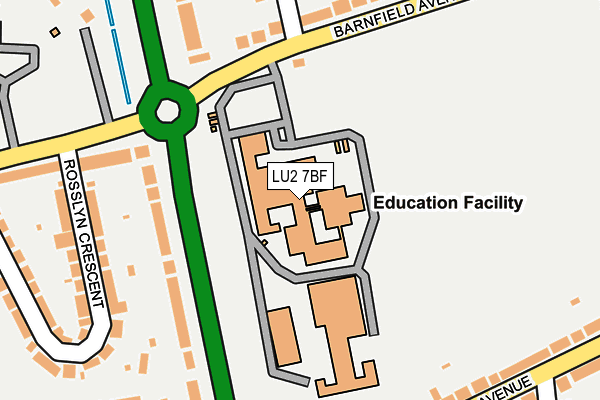
LU2 7BF is located in the Barnfield electoral ward, within the unitary authority of Luton and the English Parliamentary constituency of Luton North. The Sub Integrated Care Board (ICB) Location is NHS Bedfordshire, Luton and Milton Keynes ICB - M1J4Y and the police force is Bedfordshire. This postcode has been in use since January 1993.


GetTheData
Source: OS OpenMap – Local (Ordnance Survey)
Source: OS VectorMap District (Ordnance Survey)
Licence: Open Government Licence (requires attribution)
| Easting | 508662 |
| Northing | 224231 |
| Latitude | 51.906030 |
| Longitude | -0.421883 |
GetTheData
Source: Open Postcode Geo
Licence: Open Government Licence
| Country | England |
| Postcode District | LU2 |
➜ See where LU2 is on a map ➜ Where is Luton? | |
GetTheData
Source: Land Registry Price Paid Data
Licence: Open Government Licence
Elevation or altitude of LU2 7BF as distance above sea level:
| Metres | Feet | |
|---|---|---|
| Elevation | 110m | 361ft |
Elevation is measured from the approximate centre of the postcode, to the nearest point on an OS contour line from OS Terrain 50, which has contour spacing of ten vertical metres.
➜ How high above sea level am I? Find the elevation of your current position using your device's GPS.
GetTheData
Source: Open Postcode Elevation
Licence: Open Government Licence
| Ward | Barnfield |
| Constituency | Luton North |
GetTheData
Source: ONS Postcode Database
Licence: Open Government Licence
| Barnfield Avenue (New Bedford Road) | Barnfield | 103m |
| Barnfield College Nbr (Barnfield Avenue) | Barnfield | 156m |
| Barnfield College Nbr (Barnfield Avenue) | Barnfield | 168m |
| Icknield High School (Riddy Lane) | Barnfield | 210m |
| Austin Road (New Bedford Road) | Barnfield | 239m |
| Leagrave Station | 2.5km |
| Luton Station | 2.7km |
| Luton Airport Parkway Station | 4.1km |
GetTheData
Source: NaPTAN
Licence: Open Government Licence
GetTheData
Source: ONS Postcode Database
Licence: Open Government Licence


➜ Get more ratings from the Food Standards Agency
GetTheData
Source: Food Standards Agency
Licence: FSA terms & conditions
| Last Collection | |||
|---|---|---|---|
| Location | Mon-Fri | Sat | Distance |
| Barnfield Avenue | 17:30 | 12:00 | 157m |
| Kingsdown Avenue | 18:30 | 12:15 | 347m |
| Graham Gardens | 17:30 | 12:00 | 567m |
GetTheData
Source: Dracos
Licence: Creative Commons Attribution-ShareAlike
The below table lists the International Territorial Level (ITL) codes (formerly Nomenclature of Territorial Units for Statistics (NUTS) codes) and Local Administrative Units (LAU) codes for LU2 7BF:
| ITL 1 Code | Name |
|---|---|
| TLH | East |
| ITL 2 Code | Name |
| TLH2 | Bedfordshire and Hertfordshire |
| ITL 3 Code | Name |
| TLH21 | Luton |
| LAU 1 Code | Name |
| E06000032 | Luton |
GetTheData
Source: ONS Postcode Directory
Licence: Open Government Licence
The below table lists the Census Output Area (OA), Lower Layer Super Output Area (LSOA), and Middle Layer Super Output Area (MSOA) for LU2 7BF:
| Code | Name | |
|---|---|---|
| OA | E00079385 | |
| LSOA | E01015694 | Luton 007B |
| MSOA | E02003264 | Luton 007 |
GetTheData
Source: ONS Postcode Directory
Licence: Open Government Licence
| LU3 2AB | New Bedford Road | 159m |
| LU2 7AS | Barnfield Avenue | 220m |
| LU3 2AU | Rosslyn Crescent | 233m |
| LU3 2AD | Riddy Lane | 245m |
| LU2 7BU | Kingsdown Avenue | 251m |
| LU3 2AA | New Bedford Road | 258m |
| LU2 7BB | Sherborne Avenue | 287m |
| LU2 7BA | Hemingford Drive | 292m |
| LU3 1UG | Midhurst Gardens | 294m |
| LU3 2AT | Rosslyn Crescent | 307m |
GetTheData
Source: Open Postcode Geo; Land Registry Price Paid Data
Licence: Open Government Licence