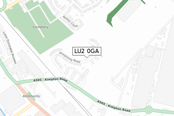
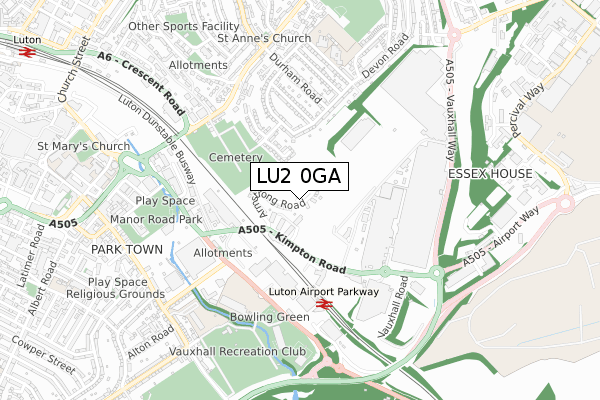
LU2 0GA is located in the Vauxhall electoral ward, within the unitary authority of Luton and the English Parliamentary constituency of Luton South. The Sub Integrated Care Board (ICB) Location is NHS Bedfordshire, Luton and Milton Keynes ICB - M1J4Y and the police force is Bedfordshire. This postcode has been in use since February 2020.


GetTheData
Source: OS Open Zoomstack (Ordnance Survey)
Licence: Open Government Licence (requires attribution)
Attribution: Contains OS data © Crown copyright and database right 2025
Source: Open Postcode Geo
Licence: Open Government Licence (requires attribution)
Attribution: Contains OS data © Crown copyright and database right 2025; Contains Royal Mail data © Royal Mail copyright and database right 2025; Source: Office for National Statistics licensed under the Open Government Licence v.3.0
| Easting | 510374 |
| Northing | 221005 |
| Latitude | 51.876709 |
| Longitude | -0.398014 |
GetTheData
Source: Open Postcode Geo
Licence: Open Government Licence
| Country | England |
| Postcode District | LU2 |
➜ See where LU2 is on a map ➜ Where is Luton? | |
GetTheData
Source: Land Registry Price Paid Data
Licence: Open Government Licence
| Ward | Vauxhall |
| Constituency | Luton South |
GetTheData
Source: ONS Postcode Database
Licence: Open Government Licence
23, HUNTING DRIVE, LUTON, LU2 0GA 2021 17 DEC £461,995 |
20, HUNTING DRIVE, LUTON, LU2 0GA 2021 15 NOV £460,000 |
18, HUNTING DRIVE, LUTON, LU2 0GA 2021 24 SEP £472,995 |
22, HUNTING DRIVE, LUTON, LU2 0GA 2021 23 SEP £569,995 |
16, HUNTING DRIVE, LUTON, LU2 0GA 2021 8 SEP £472,995 |
17, HUNTING DRIVE, LUTON, LU2 0GA 2021 20 AUG £546,995 |
19, HUNTING DRIVE, LUTON, LU2 0GA 2021 30 JUN £546,995 |
21, HUNTING DRIVE, LUTON, LU2 0GA 2021 30 JUN £549,995 |
10, HUNTING DRIVE, LUTON, LU2 0GA 2021 11 JUN £469,995 |
14, HUNTING DRIVE, LUTON, LU2 0GA 2021 21 MAY £544,995 |
GetTheData
Source: HM Land Registry Price Paid Data
Licence: Contains HM Land Registry data © Crown copyright and database right 2025. This data is licensed under the Open Government Licence v3.0.
| The Shops (Kimpton Road) | Vauxhall | 169m |
| Central Car Park Entrance (Kimpton Road) | Vauxhall | 223m |
| War Memorial (Kimpton Road) | Vauxhall | 274m |
| Ibc Vehicles Gate 1 (Kimpton Road) | Vauxhall | 363m |
| The Windmill Inn (Windmill Road) | Vauxhall | 402m |
| Luton Airport Parkway Station | 0.5km |
| Luton Station | 1.3km |
| Leagrave Station | 5.2km |
GetTheData
Source: NaPTAN
Licence: Open Government Licence
GetTheData
Source: ONS Postcode Database
Licence: Open Government Licence


➜ Get more ratings from the Food Standards Agency
GetTheData
Source: Food Standards Agency
Licence: FSA terms & conditions
| Last Collection | |||
|---|---|---|---|
| Location | Mon-Fri | Sat | Distance |
| Kimpton Road | 17:30 | 12:00 | 260m |
| Crawley Green Road | 17:30 | 12:30 | 439m |
| Blaydon Avenue | 17:30 | 12:00 | 562m |
GetTheData
Source: Dracos
Licence: Creative Commons Attribution-ShareAlike
The below table lists the International Territorial Level (ITL) codes (formerly Nomenclature of Territorial Units for Statistics (NUTS) codes) and Local Administrative Units (LAU) codes for LU2 0GA:
| ITL 1 Code | Name |
|---|---|
| TLH | East |
| ITL 2 Code | Name |
| TLH2 | Bedfordshire and Hertfordshire |
| ITL 3 Code | Name |
| TLH21 | Luton |
| LAU 1 Code | Name |
| E06000032 | Luton |
GetTheData
Source: ONS Postcode Directory
Licence: Open Government Licence
The below table lists the Census Output Area (OA), Lower Layer Super Output Area (LSOA), and Middle Layer Super Output Area (MSOA) for LU2 0GA:
| Code | Name | |
|---|---|---|
| OA | E00079492 | |
| LSOA | E01015719 | Luton 016A |
| MSOA | E02003273 | Luton 016 |
GetTheData
Source: ONS Postcode Directory
Licence: Open Government Licence
| LU2 0RQ | Ketton Close | 237m |
| LU2 0RG | Rutland Crescent | 339m |
| LU2 0RH | Devon Road | 361m |
| LU2 0RE | Norfolk Road | 382m |
| LU1 3XL | Windmill Road | 405m |
| LU2 0QZ | Ketton Close | 405m |
| LU2 0QX | Crawley Green Road | 430m |
| LU2 0QY | Crawley Green Road | 434m |
| LU2 0RD | Durham Road | 442m |
| LU2 0QW | Crawley Green Road | 460m |
GetTheData
Source: Open Postcode Geo; Land Registry Price Paid Data
Licence: Open Government Licence