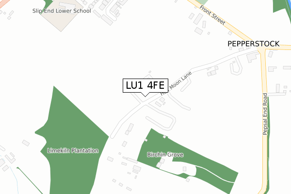
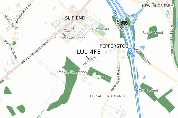
LU1 4FE is located in the Caddington electoral ward, within the unitary authority of Central Bedfordshire and the English Parliamentary constituency of Luton South. The Sub Integrated Care Board (ICB) Location is NHS Bedfordshire, Luton and Milton Keynes ICB - M1J4Y and the police force is Bedfordshire. This postcode has been in use since June 2019.


GetTheData
Source: OS Open Zoomstack (Ordnance Survey)
Licence: Open Government Licence (requires attribution)
Attribution: Contains OS data © Crown copyright and database right 2025
Source: Open Postcode Geo
Licence: Open Government Licence (requires attribution)
Attribution: Contains OS data © Crown copyright and database right 2025; Contains Royal Mail data © Royal Mail copyright and database right 2025; Source: Office for National Statistics licensed under the Open Government Licence v.3.0
| Easting | 508179 |
| Northing | 217920 |
| Latitude | 51.849411 |
| Longitude | -0.430853 |
GetTheData
Source: Open Postcode Geo
Licence: Open Government Licence
| Country | England |
| Postcode District | LU1 |
➜ See where LU1 is on a map ➜ Where is Pepperstock? | |
GetTheData
Source: Land Registry Price Paid Data
Licence: Open Government Licence
| Ward | Caddington |
| Constituency | Luton South |
GetTheData
Source: ONS Postcode Database
Licence: Open Government Licence
| Caravan Park (Half Moon Lane) | Pepperstock | 41m |
| Pepsal End Lane (Front Street) | Pepperstock | 384m |
| Pepsal End Lane (Front Street) | Pepperstock | 396m |
| Old School Walk (Front Street) | Slip End | 417m |
| Old School Walk (Front Street) | Slip End | 429m |
| Luton Airport Parkway Station | 3.5km |
| Luton Station | 3.8km |
GetTheData
Source: NaPTAN
Licence: Open Government Licence
GetTheData
Source: ONS Postcode Database
Licence: Open Government Licence


➜ Get more ratings from the Food Standards Agency
GetTheData
Source: Food Standards Agency
Licence: FSA terms & conditions
| Last Collection | |||
|---|---|---|---|
| Location | Mon-Fri | Sat | Distance |
| Brickhill Farm | 17:15 | 08:15 | 58m |
| Post Office Markyate Road | 17:15 | 11:45 | 602m |
| Lower Woodside | 17:00 | 08:30 | 1,132m |
GetTheData
Source: Dracos
Licence: Creative Commons Attribution-ShareAlike
The below table lists the International Territorial Level (ITL) codes (formerly Nomenclature of Territorial Units for Statistics (NUTS) codes) and Local Administrative Units (LAU) codes for LU1 4FE:
| ITL 1 Code | Name |
|---|---|
| TLH | East |
| ITL 2 Code | Name |
| TLH2 | Bedfordshire and Hertfordshire |
| ITL 3 Code | Name |
| TLH25 | Central Bedfordshire |
| LAU 1 Code | Name |
| E06000056 | Central Bedfordshire |
GetTheData
Source: ONS Postcode Directory
Licence: Open Government Licence
The below table lists the Census Output Area (OA), Lower Layer Super Output Area (LSOA), and Middle Layer Super Output Area (MSOA) for LU1 4FE:
| Code | Name | |
|---|---|---|
| OA | E00088661 | |
| LSOA | E01017564 | Central Bedfordshire 033D |
| MSOA | E02003651 | Central Bedfordshire 033 |
GetTheData
Source: ONS Postcode Directory
Licence: Open Government Licence
| LU1 4LL | Halfmoon Lane | 114m |
| LU1 4BT | Crawley Close | 332m |
| LU1 4BE | St Andrews Walk | 422m |
| LU1 4DE | St Andrews Close | 428m |
| LU1 4BS | Front Street | 438m |
| LU1 4LJ | 447m | |
| LU1 4BW | New Street | 454m |
| LU1 4DY | Old School Walk | 478m |
| LU1 4DD | Ross Way | 502m |
| LU1 4DA | Hammond Court | 510m |
GetTheData
Source: Open Postcode Geo; Land Registry Price Paid Data
Licence: Open Government Licence