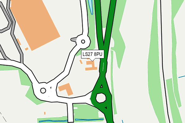
LS27 8PU is located in the Morley North electoral ward, within the metropolitan district of Leeds and the English Parliamentary constituency of Morley and Outwood. The Sub Integrated Care Board (ICB) Location is NHS West Yorkshire ICB - 15F and the police force is West Yorkshire. This postcode has been in use since January 1980.


GetTheData
Source: OS OpenMap – Local (Ordnance Survey)
Source: OS VectorMap District (Ordnance Survey)
Licence: Open Government Licence (requires attribution)
| Easting | 428381 |
| Northing | 428848 |
| Latitude | 53.755243 |
| Longitude | -1.571046 |
GetTheData
Source: Open Postcode Geo
Licence: Open Government Licence
| Country | England |
| Postcode District | LS27 |
➜ See where LS27 is on a map ➜ Where is Leeds? | |
GetTheData
Source: Land Registry Price Paid Data
Licence: Open Government Licence
Elevation or altitude of LS27 8PU as distance above sea level:
| Metres | Feet | |
|---|---|---|
| Elevation | 60m | 197ft |
Elevation is measured from the approximate centre of the postcode, to the nearest point on an OS contour line from OS Terrain 50, which has contour spacing of ten vertical metres.
➜ How high above sea level am I? Find the elevation of your current position using your device's GPS.
GetTheData
Source: Open Postcode Elevation
Licence: Open Government Licence
| Ward | Morley North |
| Constituency | Morley And Outwood |
GetTheData
Source: ONS Postcode Database
Licence: Open Government Licence
| Dewsbury Road Woodman Inn (Dewsbury Road) | White Rose Centre | 22m |
| Dewsbury Road Woodman Inn (Dewsbury Road) | White Rose Centre | 61m |
| Woodman Ph (Dewsbury Road) | Morley | 252m |
| Woodman Ph (Dewsbury Road) | Morley | 413m |
| Parkwood Estate (Park Wood Crescent) | Beeston | 416m |
| Morley Station | 1.4km |
| Cottingley Station | 1.8km |
| Leeds Station | 4.7km |
GetTheData
Source: NaPTAN
Licence: Open Government Licence
GetTheData
Source: ONS Postcode Database
Licence: Open Government Licence


➜ Get more ratings from the Food Standards Agency
GetTheData
Source: Food Standards Agency
Licence: FSA terms & conditions
| Last Collection | |||
|---|---|---|---|
| Location | Mon-Fri | Sat | Distance |
| White Rose Centre | 18:00 | 11:30 | 270m |
| White Rose Centre | 18:00 | 11:30 | 524m |
| Middleton Road | 17:30 | 12:15 | 608m |
GetTheData
Source: Dracos
Licence: Creative Commons Attribution-ShareAlike
The below table lists the International Territorial Level (ITL) codes (formerly Nomenclature of Territorial Units for Statistics (NUTS) codes) and Local Administrative Units (LAU) codes for LS27 8PU:
| ITL 1 Code | Name |
|---|---|
| TLE | Yorkshire and The Humber |
| ITL 2 Code | Name |
| TLE4 | West Yorkshire |
| ITL 3 Code | Name |
| TLE42 | Leeds |
| LAU 1 Code | Name |
| E08000035 | Leeds |
GetTheData
Source: ONS Postcode Directory
Licence: Open Government Licence
The below table lists the Census Output Area (OA), Lower Layer Super Output Area (LSOA), and Middle Layer Super Output Area (MSOA) for LS27 8PU:
| Code | Name | |
|---|---|---|
| OA | E00058115 | |
| LSOA | E01011531 | Leeds 093D |
| MSOA | E02002422 | Leeds 093 |
GetTheData
Source: ONS Postcode Directory
Licence: Open Government Licence
| LS11 5RD | Parkwood Crescent | 478m |
| LS11 8ER | Dewsbury Road | 505m |
| LS11 5RA | Parkwood Road | 604m |
| LS10 4PN | Helston Street | 611m |
| LS10 4PW | Helston Square | 640m |
| LS10 4PL | Bodmin Road | 659m |
| LS11 5RQ | Parkwood Road | 684m |
| LS11 8EP | Millshaw Mount | 694m |
| LS10 4PP | Bodmin Road | 716m |
| LS10 4PH | Helston Way | 722m |
GetTheData
Source: Open Postcode Geo; Land Registry Price Paid Data
Licence: Open Government Licence