Property/Postcode Data Search:
LS27 7FN maps, stats, and open data
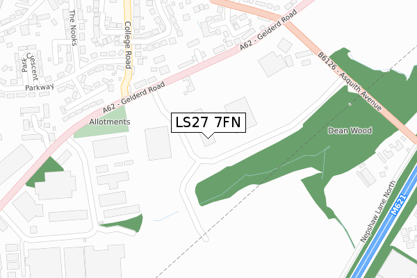
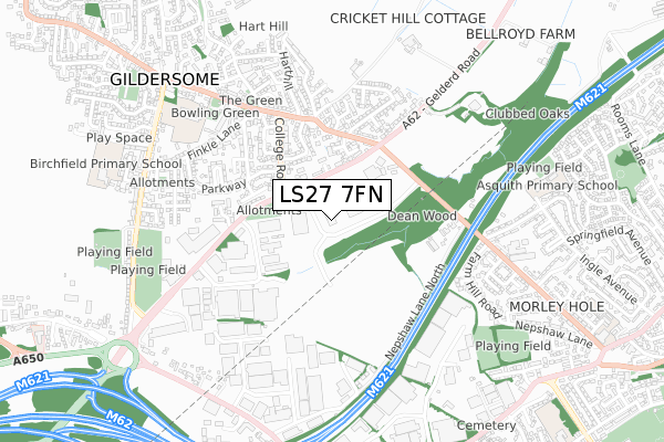
LS27 7FN is located in the Morley North electoral ward, within the metropolitan district of Leeds and the English Parliamentary constituency of Morley and Outwood. The Sub Integrated Care Board (ICB) Location is NHS West Yorkshire ICB - 15F and the police force is West Yorkshire. This postcode has been in use since July 2019.
LS27 7FN maps


Source: OS Open Zoomstack (Ordnance Survey)
Licence: Open Government Licence (requires attribution)
Attribution: Contains OS data © Crown copyright and database right 2025
Source: Open Postcode Geo
Licence: Open Government Licence (requires attribution)
Attribution: Contains OS data © Crown copyright and database right 2025; Contains Royal Mail data © Royal Mail copyright and database right 2025; Source: Office for National Statistics licensed under the Open Government Licence v.3.0
Licence: Open Government Licence (requires attribution)
Attribution: Contains OS data © Crown copyright and database right 2025
Source: Open Postcode Geo
Licence: Open Government Licence (requires attribution)
Attribution: Contains OS data © Crown copyright and database right 2025; Contains Royal Mail data © Royal Mail copyright and database right 2025; Source: Office for National Statistics licensed under the Open Government Licence v.3.0
LS27 7FN geodata
| Easting | 425060 |
| Northing | 428766 |
| Latitude | 53.754675 |
| Longitude | -1.621418 |
Where is LS27 7FN?
| Country | England |
| Postcode District | LS27 |
Politics
| Ward | Morley North |
|---|---|
| Constituency | Morley And Outwood |
Transport
Nearest bus stops to LS27 7FN
| Asquith Ave Gelderd Road (Asquith Avenue) | Gildersome | 235m |
| Branch End Highfield Close (Branch End) | Gildersome | 258m |
| Gelderd Road Asquith Ave (Gelderd Road) | Gildersome | 327m |
| Old Griffin Ph (Town Street) | Gildersome | 370m |
| Old Griffin Ph (Town Street) | Gildersome | 386m |
Nearest railway stations to LS27 7FN
| Morley Station | 2.1km |
| Cottingley Station | 2.7km |
| Batley Station | 5km |
Deprivation
18.6% of English postcodes are less deprived than LS27 7FN:Food Standards Agency
Three nearest food hygiene ratings to LS27 7FN (metres)
Gildersome Arms

Gelderd Road
141m
Shop And Drive

Esso
172m
Food From Scratch

4 Asquith Avenue Business Park
200m
➜ Get more ratings from the Food Standards Agency
Nearest post box to LS27 7FN
| Last Collection | |||
|---|---|---|---|
| Location | Mon-Fri | Sat | Distance |
| Branch End | 17:30 | 11:15 | 377m |
| Town Street/The Green | 17:30 | 11:15 | 600m |
| Deanfield Avenue | 17:30 | 11:00 | 809m |
LS27 7FN ITL and LS27 7FN LAU
The below table lists the International Territorial Level (ITL) codes (formerly Nomenclature of Territorial Units for Statistics (NUTS) codes) and Local Administrative Units (LAU) codes for LS27 7FN:
| ITL 1 Code | Name |
|---|---|
| TLE | Yorkshire and The Humber |
| ITL 2 Code | Name |
| TLE4 | West Yorkshire |
| ITL 3 Code | Name |
| TLE42 | Leeds |
| LAU 1 Code | Name |
| E08000035 | Leeds |
LS27 7FN census areas
The below table lists the Census Output Area (OA), Lower Layer Super Output Area (LSOA), and Middle Layer Super Output Area (MSOA) for LS27 7FN:
| Code | Name | |
|---|---|---|
| OA | E00058063 | |
| LSOA | E01011522 | Leeds 095B |
| MSOA | E02002424 | Leeds 095 |
Nearest postcodes to LS27 7FN
| LS27 7LH | Gelderd Road | 146m |
| LS27 7LZ | Gelderd Road | 177m |
| LS27 7LP | Deanhurst Gardens | 205m |
| LS27 7LW | Branch Road | 241m |
| LS27 7LU | Branch Road | 274m |
| LS27 7LA | Yarra Court | 281m |
| LS27 7EH | Kenilworth Avenue | 285m |
| LS27 7LR | Branch Road | 303m |
| LS27 7EQ | College Road | 335m |
| LS27 7EW | Kenilworth Gardens | 339m |