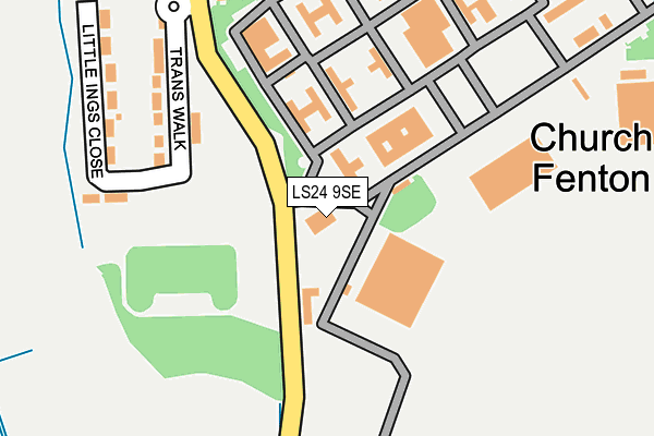
LS24 9SE is located in the Appleton Roebuck & Church Fenton electoral ward, within the unitary authority of North Yorkshire and the English Parliamentary constituency of Selby and Ainsty. The Sub Integrated Care Board (ICB) Location is NHS Humber and North Yorkshire ICB - 03Q and the police force is North Yorkshire. This postcode has been in use since June 1997.


GetTheData
Source: OS OpenMap – Local (Ordnance Survey)
Source: OS VectorMap District (Ordnance Survey)
Licence: Open Government Licence (requires attribution)
| Easting | 452460 |
| Northing | 437858 |
| Latitude | 53.834357 |
| Longitude | -1.204354 |
GetTheData
Source: Open Postcode Geo
Licence: Open Government Licence
| Country | England |
| Postcode District | LS24 |
➜ See where LS24 is on a map ➜ Where is Church Fenton? | |
GetTheData
Source: Land Registry Price Paid Data
Licence: Open Government Licence
Elevation or altitude of LS24 9SE as distance above sea level:
| Metres | Feet | |
|---|---|---|
| Elevation | 10m | 33ft |
Elevation is measured from the approximate centre of the postcode, to the nearest point on an OS contour line from OS Terrain 50, which has contour spacing of ten vertical metres.
➜ How high above sea level am I? Find the elevation of your current position using your device's GPS.
GetTheData
Source: Open Postcode Elevation
Licence: Open Government Licence
| Ward | Appleton Roebuck & Church Fenton |
| Constituency | Selby And Ainsty |
GetTheData
Source: ONS Postcode Database
Licence: Open Government Licence
| Main Gate (Busk Lane) | Church Fenton | 208m |
| Main Gate (Busk Lane) | Church Fenton | 221m |
| Ulla Green (Main Street) | Church Fenton | 390m |
| Dorts Crescent (Main Street) | Church Fenton | 399m |
| Fenton Flyer (Busk Lane) | Church Fenton | 962m |
| Church Fenton Station | 1.8km |
| Ulleskelf Station | 2.2km |
| Sherburn-in-Elmet Station | 4.5km |
GetTheData
Source: NaPTAN
Licence: Open Government Licence
GetTheData
Source: ONS Postcode Database
Licence: Open Government Licence


➜ Get more ratings from the Food Standards Agency
GetTheData
Source: Food Standards Agency
Licence: FSA terms & conditions
| Last Collection | |||
|---|---|---|---|
| Location | Mon-Fri | Sat | Distance |
| R.a.f. Church Fenton | 16:30 | 09:45 | 226m |
| Ryther | 17:15 | 09:30 | 2,896m |
| Biggin | 16:45 | 09:15 | 3,629m |
GetTheData
Source: Dracos
Licence: Creative Commons Attribution-ShareAlike
The below table lists the International Territorial Level (ITL) codes (formerly Nomenclature of Territorial Units for Statistics (NUTS) codes) and Local Administrative Units (LAU) codes for LS24 9SE:
| ITL 1 Code | Name |
|---|---|
| TLE | Yorkshire and The Humber |
| ITL 2 Code | Name |
| TLE2 | North Yorkshire |
| ITL 3 Code | Name |
| TLE22 | North Yorkshire CC |
| LAU 1 Code | Name |
| E07000169 | Selby |
GetTheData
Source: ONS Postcode Directory
Licence: Open Government Licence
The below table lists the Census Output Area (OA), Lower Layer Super Output Area (LSOA), and Middle Layer Super Output Area (MSOA) for LS24 9SE:
| Code | Name | |
|---|---|---|
| OA | E00142171 | |
| LSOA | E01027904 | Selby 002E |
| MSOA | E02005810 | Selby 002 |
GetTheData
Source: ONS Postcode Directory
Licence: Open Government Licence
| LS24 9RR | Trans Walk | 336m |
| LS24 9RU | Dorts Crescent | 355m |
| LS24 9RZ | Little Ings Close | 377m |
| LS24 9RX | Skelf Street | 389m |
| LS24 9RS | Ulla Green | 392m |
| LS24 9RY | Cawood Crescent | 426m |
| LS24 9RP | Brackenhill Lane | 719m |
| LS24 9RJ | Busk Lane | 887m |
| LS24 9RH | Northfield Lane | 1051m |
| LS24 9ER | 1095m |
GetTheData
Source: Open Postcode Geo; Land Registry Price Paid Data
Licence: Open Government Licence