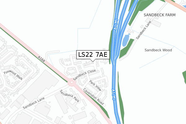
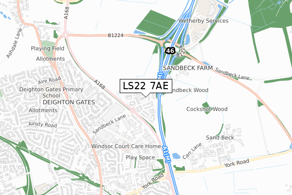
LS22 7AE is located in the Wetherby electoral ward, within the metropolitan district of Leeds and the English Parliamentary constituency of Elmet and Rothwell. The Sub Integrated Care Board (ICB) Location is NHS West Yorkshire ICB - 15F and the police force is West Yorkshire. This postcode has been in use since September 2019.


GetTheData
Source: OS Open Zoomstack (Ordnance Survey)
Licence: Open Government Licence (requires attribution)
Attribution: Contains OS data © Crown copyright and database right 2025
Source: Open Postcode Geo
Licence: Open Government Licence (requires attribution)
Attribution: Contains OS data © Crown copyright and database right 2025; Contains Royal Mail data © Royal Mail copyright and database right 2025; Source: Office for National Statistics licensed under the Open Government Licence v.3.0
| Easting | 440972 |
| Northing | 449513 |
| Latitude | 53.940132 |
| Longitude | -1.377349 |
GetTheData
Source: Open Postcode Geo
Licence: Open Government Licence
| Country | England |
| Postcode District | LS22 |
➜ See where LS22 is on a map ➜ Where is Wetherby? | |
GetTheData
Source: Land Registry Price Paid Data
Licence: Open Government Licence
| Ward | Wetherby |
| Constituency | Elmet And Rothwell |
GetTheData
Source: ONS Postcode Database
Licence: Open Government Licence
11, DEIGHTON DRIVE, WETHERBY, LS22 7AE 2025 9 JAN £440,000 |
2021 27 SEP £497,500 |
5, DEIGHTON DRIVE, WETHERBY, LS22 7AE 2020 12 JUN £439,995 |
1, DEIGHTON DRIVE, WETHERBY, LS22 7AE 2020 26 MAR £389,995 |
2020 28 FEB £466,995 |
9, DEIGHTON DRIVE, WETHERBY, LS22 7AE 2019 28 NOV £394,995 |
2019 1 NOV £464,995 |
11, DEIGHTON DRIVE, WETHERBY, LS22 7AE 2019 6 SEP £399,995 |
GetTheData
Source: HM Land Registry Price Paid Data
Licence: Contains HM Land Registry data © Crown copyright and database right 2025. This data is licensed under the Open Government Licence v3.0.
| Sandbeck Way | Wetherby | 413m |
| Sandbeck Way (Audby Lane) | Wetherby | 479m |
| Sandbeck Way (Audby Lane) | Wetherby | 503m |
| Deighton Rd Sandbeck Lane (Deighton Road) | Wetherby | 609m |
| Deighton Rd Sandbeck Lane (Deighton Road) | Wetherby | 614m |
GetTheData
Source: NaPTAN
Licence: Open Government Licence
GetTheData
Source: ONS Postcode Database
Licence: Open Government Licence

➜ Get more ratings from the Food Standards Agency
GetTheData
Source: Food Standards Agency
Licence: FSA terms & conditions
| Last Collection | |||
|---|---|---|---|
| Location | Mon-Fri | Sat | Distance |
| Sandbeck Way | 17:30 | 12:00 | 414m |
| Deighton Gates | 17:30 | 12:00 | 672m |
| 47 Ainsty Road Wetherby | 17:30 | 12:30 | 720m |
GetTheData
Source: Dracos
Licence: Creative Commons Attribution-ShareAlike
The below table lists the International Territorial Level (ITL) codes (formerly Nomenclature of Territorial Units for Statistics (NUTS) codes) and Local Administrative Units (LAU) codes for LS22 7AE:
| ITL 1 Code | Name |
|---|---|
| TLE | Yorkshire and The Humber |
| ITL 2 Code | Name |
| TLE4 | West Yorkshire |
| ITL 3 Code | Name |
| TLE42 | Leeds |
| LAU 1 Code | Name |
| E08000035 | Leeds |
GetTheData
Source: ONS Postcode Directory
Licence: Open Government Licence
The below table lists the Census Output Area (OA), Lower Layer Super Output Area (LSOA), and Middle Layer Super Output Area (MSOA) for LS22 7AE:
| Code | Name | |
|---|---|---|
| OA | E00170579 | |
| LSOA | E01011704 | Leeds 002C |
| MSOA | E02002331 | Leeds 002 |
GetTheData
Source: ONS Postcode Directory
Licence: Open Government Licence
| LS22 7TW | Sandbeck Lane | 242m |
| LS22 5HF | Sandbeck Lane | 378m |
| LS22 7XT | Otterwood Bank | 383m |
| LS22 7DN | Sandbeck Way | 395m |
| LS22 7XP | Beech Spinney | 437m |
| LS22 7XS | Foxwood Walk | 450m |
| LS22 7XW | Cedar Covert | 507m |
| LS22 7XR | Badgerwood Glade | 522m |
| LS22 7TJ | Knights Croft | 539m |
| LS22 7XU | Pine Close | 544m |
GetTheData
Source: Open Postcode Geo; Land Registry Price Paid Data
Licence: Open Government Licence