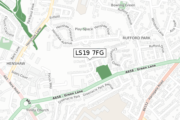
LS19 7FG is located in the Guiseley & Rawdon electoral ward, within the metropolitan district of Leeds and the English Parliamentary constituency of Pudsey. The Sub Integrated Care Board (ICB) Location is NHS West Yorkshire ICB - 15F and the police force is West Yorkshire. This postcode has been in use since October 2018.


GetTheData
Source: OS Open Zoomstack (Ordnance Survey)
Licence: Open Government Licence (requires attribution)
Attribution: Contains OS data © Crown copyright and database right 2024
Source: Open Postcode Geo
Licence: Open Government Licence (requires attribution)
Attribution: Contains OS data © Crown copyright and database right 2024; Contains Royal Mail data © Royal Mail copyright and database right 2024; Source: Office for National Statistics licensed under the Open Government Licence v.3.0
| Easting | 420815 |
| Northing | 440471 |
| Latitude | 53.860063 |
| Longitude | -1.685012 |
GetTheData
Source: Open Postcode Geo
Licence: Open Government Licence
| Country | England |
| Postcode District | LS19 |
➜ See where LS19 is on a map ➜ Where is Yeadon? | |
GetTheData
Source: Land Registry Price Paid Data
Licence: Open Government Licence
| Ward | Guiseley & Rawdon |
| Constituency | Pudsey |
GetTheData
Source: ONS Postcode Database
Licence: Open Government Licence
7, NAYLOR AVENUE, YEADON, LEEDS, LS19 7FG 2022 20 MAY £460,000 |
5, NAYLOR AVENUE, YEADON, LEEDS, LS19 7FG 2022 28 JAN £450,000 |
2021 22 NOV £500,000 |
9, NAYLOR AVENUE, YEADON, LEEDS, LS19 7FG 2021 16 JUL £450,000 |
11, NAYLOR AVENUE, YEADON, LEEDS, LS19 7FG 2021 16 JUL £450,000 |
4, NAYLOR AVENUE, YEADON, LEEDS, LS19 7FG 2021 11 JAN £550,000 |
13, NAYLOR AVENUE, YEADON, LEEDS, LS19 7FG 2020 11 DEC £425,000 |
20, NAYLOR AVENUE, YEADON, LEEDS, LS19 7FG 2020 9 DEC £450,000 |
6, NAYLOR AVENUE, YEADON, LEEDS, LS19 7FG 2020 27 NOV £435,000 |
17, NAYLOR AVENUE, YEADON, LEEDS, LS19 7FG 2020 27 NOV £425,000 |
GetTheData
Source: HM Land Registry Price Paid Data
Licence: Contains HM Land Registry data © Crown copyright and database right 2024. This data is licensed under the Open Government Licence v3.0.
| Henshaw Lane Henshaw Ave (Henshaw Lane) | Yeadon | 280m |
| Henshaw Lane Henshaw Ave (Henshaw Lane) | Yeadon | 293m |
| Henshaw Lane | Yeadon | 311m |
| Henshaw Lane Sizers Court (Henshaw Lane) | Yeadon | 335m |
| New Rd Side Quakers Lane (New Road Side) | Rawdon | 378m |
| Apperley Bridge Station | 2.5km |
| Guiseley Station | 2.7km |
| Horsforth Station | 3.9km |
GetTheData
Source: NaPTAN
Licence: Open Government Licence
| Percentage of properties with Next Generation Access | 100.0% |
| Percentage of properties with Superfast Broadband | 100.0% |
| Percentage of properties with Ultrafast Broadband | 100.0% |
| Percentage of properties with Full Fibre Broadband | 93.3% |
Superfast Broadband is between 30Mbps and 300Mbps
Ultrafast Broadband is > 300Mbps
| Median download speed | 200.0Mbps |
| Average download speed | 190.0Mbps |
| Maximum download speed | 350.00Mbps |
Ofcom does not currently provide upload speed data for LS19 7FG. This is because there are less than four broadband connections in this postcode.
| Percentage of properties unable to receive 2Mbps | 0.0% |
| Percentage of properties unable to receive 5Mbps | 0.0% |
| Percentage of properties unable to receive 10Mbps | 0.0% |
| Percentage of properties unable to receive 30Mbps | 0.0% |
GetTheData
Source: Ofcom
Licence: Ofcom Terms of Use (requires attribution)
GetTheData
Source: ONS Postcode Database
Licence: Open Government Licence


➜ Get more ratings from the Food Standards Agency
GetTheData
Source: Food Standards Agency
Licence: FSA terms & conditions
| Last Collection | |||
|---|---|---|---|
| Location | Mon-Fri | Sat | Distance |
| Rufford Park | 17:30 | 11:00 | 361m |
| Canada Road/Harrogate Road | 17:30 | 11:00 | 481m |
| Ackworth Cresent/Green Lane | 16:30 | 11:00 | 524m |
GetTheData
Source: Dracos
Licence: Creative Commons Attribution-ShareAlike
The below table lists the International Territorial Level (ITL) codes (formerly Nomenclature of Territorial Units for Statistics (NUTS) codes) and Local Administrative Units (LAU) codes for LS19 7FG:
| ITL 1 Code | Name |
|---|---|
| TLE | Yorkshire and The Humber |
| ITL 2 Code | Name |
| TLE4 | West Yorkshire |
| ITL 3 Code | Name |
| TLE42 | Leeds |
| LAU 1 Code | Name |
| E08000035 | Leeds |
GetTheData
Source: ONS Postcode Directory
Licence: Open Government Licence
The below table lists the Census Output Area (OA), Lower Layer Super Output Area (LSOA), and Middle Layer Super Output Area (MSOA) for LS19 7FG:
| Code | Name | |
|---|---|---|
| OA | E00056757 | |
| LSOA | E01011276 | Leeds 011C |
| MSOA | E02002340 | Leeds 011 |
GetTheData
Source: ONS Postcode Directory
Licence: Open Government Licence
| LS19 7TP | Henshaw Avenue | 133m |
| LS19 7BX | Green Lane | 144m |
| LS19 7TR | Henshaw Crescent | 190m |
| LS19 6RS | Greenacre Park Avenue | 202m |
| LS19 7YS | Cricketers Green | 211m |
| LS19 7TS | Henshaw Oval | 231m |
| LS19 7TW | Henshaw Avenue | 249m |
| LS19 7TT | Henshaw Mews | 255m |
| LS19 6RU | Greenacre Park Rise | 260m |
| LS19 6AP | Greenacre Park | 270m |
GetTheData
Source: Open Postcode Geo; Land Registry Price Paid Data
Licence: Open Government Licence