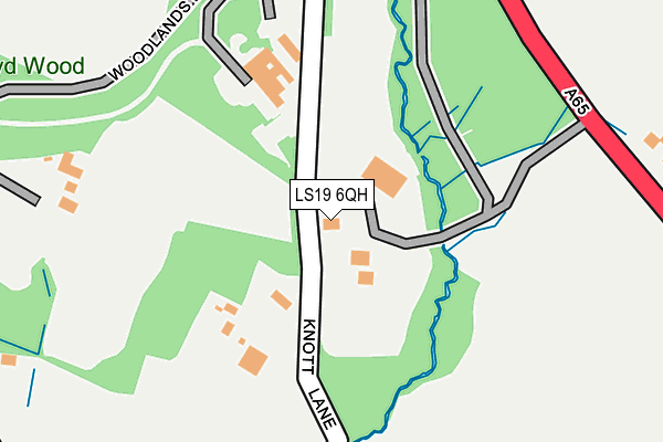
LS19 6QH is located in the Horsforth electoral ward, within the metropolitan district of Leeds and the English Parliamentary constituency of Pudsey. The Sub Integrated Care Board (ICB) Location is NHS West Yorkshire ICB - 15F and the police force is West Yorkshire. This postcode has been in use since January 1991.


GetTheData
Source: OS OpenMap – Local (Ordnance Survey)
Source: OS VectorMap District (Ordnance Survey)
Licence: Open Government Licence (requires attribution)
| Easting | 422067 |
| Northing | 438168 |
| Latitude | 53.839298 |
| Longitude | -1.666136 |
GetTheData
Source: Open Postcode Geo
Licence: Open Government Licence
| Country | England |
| Postcode District | LS19 |
➜ See where LS19 is on a map ➜ Where is Rawdon? | |
GetTheData
Source: Land Registry Price Paid Data
Licence: Open Government Licence
Elevation or altitude of LS19 6QH as distance above sea level:
| Metres | Feet | |
|---|---|---|
| Elevation | 100m | 328ft |
Elevation is measured from the approximate centre of the postcode, to the nearest point on an OS contour line from OS Terrain 50, which has contour spacing of ten vertical metres.
➜ How high above sea level am I? Find the elevation of your current position using your device's GPS.
GetTheData
Source: Open Postcode Elevation
Licence: Open Government Licence
| Ward | Horsforth |
| Constituency | Pudsey |
GetTheData
Source: ONS Postcode Database
Licence: Open Government Licence
| Rawdon Road | Horsforth | 238m |
| Rawdon Rd Water Lane (Rawdon Road) | Horsforth | 315m |
| Leeds Rd Knott Lane (Leeds Road) | Rawdon | 461m |
| Leeds Rd Layton Road (Leeds Road) | Rawdon | 499m |
| Rawdon Rd Hall Lane (Rawdon Road) | Horsforth | 677m |
| Horsforth Station | 2.5km |
| Apperley Bridge Station | 2.6km |
| Kirkstall Forge Station | 3.4km |
GetTheData
Source: NaPTAN
Licence: Open Government Licence
GetTheData
Source: ONS Postcode Database
Licence: Open Government Licence


➜ Get more ratings from the Food Standards Agency
GetTheData
Source: Food Standards Agency
Licence: FSA terms & conditions
| Last Collection | |||
|---|---|---|---|
| Location | Mon-Fri | Sat | Distance |
| 2 Layton Lane | 16:15 | 11:15 | 510m |
| Daisy Bank | 17:45 | 11:00 | 690m |
| Woodlands Drive | 16:30 | 11:15 | 728m |
GetTheData
Source: Dracos
Licence: Creative Commons Attribution-ShareAlike
The below table lists the International Territorial Level (ITL) codes (formerly Nomenclature of Territorial Units for Statistics (NUTS) codes) and Local Administrative Units (LAU) codes for LS19 6QH:
| ITL 1 Code | Name |
|---|---|
| TLE | Yorkshire and The Humber |
| ITL 2 Code | Name |
| TLE4 | West Yorkshire |
| ITL 3 Code | Name |
| TLE42 | Leeds |
| LAU 1 Code | Name |
| E08000035 | Leeds |
GetTheData
Source: ONS Postcode Directory
Licence: Open Government Licence
The below table lists the Census Output Area (OA), Lower Layer Super Output Area (LSOA), and Middle Layer Super Output Area (MSOA) for LS19 6QH:
| Code | Name | |
|---|---|---|
| OA | E00057712 | |
| LSOA | E01011458 | Leeds 027D |
| MSOA | E02002356 | Leeds 027 |
GetTheData
Source: ONS Postcode Directory
Licence: Open Government Licence
| LS19 6JW | Knott Lane | 31m |
| LS19 6HL | Woodleigh Hall View | 232m |
| LS18 4EQ | Red Beck Cottages | 314m |
| LS19 6JT | Knott Lane | 318m |
| LS19 6JN | Southlands Avenue | 339m |
| LS19 6JL | Knott Lane | 357m |
| LS19 6JS | Wood Bottom | 390m |
| LS19 6JJ | New York Lane | 403m |
| LS18 5EW | Rawdon Road | 472m |
| LS19 6RH | Layton Close | 524m |
GetTheData
Source: Open Postcode Geo; Land Registry Price Paid Data
Licence: Open Government Licence