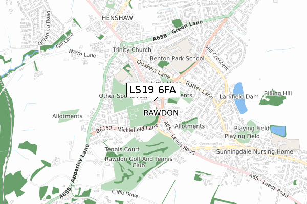
LS19 6FA is located in the Guiseley & Rawdon electoral ward, within the metropolitan district of Leeds and the English Parliamentary constituency of Pudsey. The Sub Integrated Care Board (ICB) Location is NHS West Yorkshire ICB - 15F and the police force is West Yorkshire. This postcode has been in use since January 2020.


GetTheData
Source: OS Open Zoomstack (Ordnance Survey)
Licence: Open Government Licence (requires attribution)
Attribution: Contains OS data © Crown copyright and database right 2025
Source: Open Postcode Geo
Licence: Open Government Licence (requires attribution)
Attribution: Contains OS data © Crown copyright and database right 2025; Contains Royal Mail data © Royal Mail copyright and database right 2025; Source: Office for National Statistics licensed under the Open Government Licence v.3.0
| Easting | 420768 |
| Northing | 439772 |
| Latitude | 53.853782 |
| Longitude | -1.685773 |
GetTheData
Source: Open Postcode Geo
Licence: Open Government Licence
| Country | England |
| Postcode District | LS19 |
➜ See where LS19 is on a map ➜ Where is Rawdon? | |
GetTheData
Source: Land Registry Price Paid Data
Licence: Open Government Licence
| Ward | Guiseley & Rawdon |
| Constituency | Pudsey |
GetTheData
Source: ONS Postcode Database
Licence: Open Government Licence
| Rawdon Cross Roads (New Road Side) | Rawdon | 56m |
| Rawdon Cross Roads (Harrogate Road) | Rawdon | 66m |
| Rawdon Cross Roads (Micklefield Lane) | Rawdon | 142m |
| Harrogate Rd Batter Lane (Harrogate Road) | Rawdon | 192m |
| Rawdon Cross Roads (Leeds Road) | Rawdon | 203m |
| Apperley Bridge Station | 1.9km |
| Guiseley Station | 3.1km |
| Horsforth Station | 3.7km |
GetTheData
Source: NaPTAN
Licence: Open Government Licence
GetTheData
Source: ONS Postcode Database
Licence: Open Government Licence


➜ Get more ratings from the Food Standards Agency
GetTheData
Source: Food Standards Agency
Licence: FSA terms & conditions
| Last Collection | |||
|---|---|---|---|
| Location | Mon-Fri | Sat | Distance |
| Crow Trees P.o. | 16:00 | 12:00 | 76m |
| Crow Trees Court/Leeds Road | 16:30 | 11:45 | 387m |
| Batter Lane/Canada Cresent | 17:00 | 11:00 | 412m |
GetTheData
Source: Dracos
Licence: Creative Commons Attribution-ShareAlike
The below table lists the International Territorial Level (ITL) codes (formerly Nomenclature of Territorial Units for Statistics (NUTS) codes) and Local Administrative Units (LAU) codes for LS19 6FA:
| ITL 1 Code | Name |
|---|---|
| TLE | Yorkshire and The Humber |
| ITL 2 Code | Name |
| TLE4 | West Yorkshire |
| ITL 3 Code | Name |
| TLE42 | Leeds |
| LAU 1 Code | Name |
| E08000035 | Leeds |
GetTheData
Source: ONS Postcode Directory
Licence: Open Government Licence
The below table lists the Census Output Area (OA), Lower Layer Super Output Area (LSOA), and Middle Layer Super Output Area (MSOA) for LS19 6FA:
| Code | Name | |
|---|---|---|
| OA | E00056761 | |
| LSOA | E01011278 | Leeds 014B |
| MSOA | E02002343 | Leeds 014 |
GetTheData
Source: ONS Postcode Directory
Licence: Open Government Licence
| LS19 6QW | Weavers Fold | 53m |
| LS19 6HW | Harrogate Road | 59m |
| LS19 6DE | Low Fold | 74m |
| LS19 6JF | South Street | 104m |
| LS19 6JE | North Street | 106m |
| LS19 6HJ | Harrogate Road | 120m |
| LS19 6JD | Derby Place | 130m |
| LS19 6HR | John Street | 136m |
| LS19 6HS | George Street | 146m |
| LS19 6HN | New Road Side | 150m |
GetTheData
Source: Open Postcode Geo; Land Registry Price Paid Data
Licence: Open Government Licence