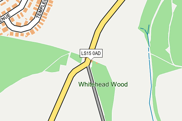
LS15 0AD is located in the Temple Newsam electoral ward, within the metropolitan district of Leeds and the English Parliamentary constituency of Leeds East. The Sub Integrated Care Board (ICB) Location is NHS West Yorkshire ICB - 15F and the police force is West Yorkshire. This postcode has been in use since January 1980.


GetTheData
Source: OS OpenMap – Local (Ordnance Survey)
Source: OS VectorMap District (Ordnance Survey)
Licence: Open Government Licence (requires attribution)
| Easting | 435999 |
| Northing | 432778 |
| Latitude | 53.790080 |
| Longitude | -1.455052 |
GetTheData
Source: Open Postcode Geo
Licence: Open Government Licence
| Country | England |
| Postcode District | LS15 |
➜ See where LS15 is on a map ➜ Where is Leeds? | |
GetTheData
Source: Land Registry Price Paid Data
Licence: Open Government Licence
Elevation or altitude of LS15 0AD as distance above sea level:
| Metres | Feet | |
|---|---|---|
| Elevation | 80m | 262ft |
Elevation is measured from the approximate centre of the postcode, to the nearest point on an OS contour line from OS Terrain 50, which has contour spacing of ten vertical metres.
➜ How high above sea level am I? Find the elevation of your current position using your device's GPS.
GetTheData
Source: Open Postcode Elevation
Licence: Open Government Licence
| Ward | Temple Newsam |
| Constituency | Leeds East |
GetTheData
Source: ONS Postcode Database
Licence: Open Government Licence
EAST LODGE, TEMPLENEWSAM PARK, LEEDS, LS15 0AD 2021 5 OCT £245,000 |
GetTheData
Source: HM Land Registry Price Paid Data
Licence: Contains HM Land Registry data © Crown copyright and database right 2025. This data is licensed under the Open Government Licence v3.0.
| Templegate Green | Halton | 511m |
| Temple Newsam Park (Temple Newsam Road) | Temple Newsam | 561m |
| New Temple Gate Templegate Ave (New Temple Gate) | Halton | 565m |
| Temple Gate Templegate Close (Templegate) | Halton | 573m |
| New Temple Gate Templegate Ave (New Temple Gate) | Halton | 576m |
| Cross Gates Station | 1.7km |
| Woodlesford Station | 3.8km |
| Garforth Station | 4.8km |
GetTheData
Source: NaPTAN
Licence: Open Government Licence
GetTheData
Source: ONS Postcode Database
Licence: Open Government Licence


➜ Get more ratings from the Food Standards Agency
GetTheData
Source: Food Standards Agency
Licence: FSA terms & conditions
| Last Collection | |||
|---|---|---|---|
| Location | Mon-Fri | Sat | Distance |
| New Templegate/Tenplegate Av | 17:45 | 11:00 | 545m |
| Temple Walk | 17:45 | 11:15 | 620m |
| Colton Village | 17:30 | 11:00 | 735m |
GetTheData
Source: Dracos
Licence: Creative Commons Attribution-ShareAlike
The below table lists the International Territorial Level (ITL) codes (formerly Nomenclature of Territorial Units for Statistics (NUTS) codes) and Local Administrative Units (LAU) codes for LS15 0AD:
| ITL 1 Code | Name |
|---|---|
| TLE | Yorkshire and The Humber |
| ITL 2 Code | Name |
| TLE4 | West Yorkshire |
| ITL 3 Code | Name |
| TLE42 | Leeds |
| LAU 1 Code | Name |
| E08000035 | Leeds |
GetTheData
Source: ONS Postcode Directory
Licence: Open Government Licence
The below table lists the Census Output Area (OA), Lower Layer Super Output Area (LSOA), and Middle Layer Super Output Area (MSOA) for LS15 0AD:
| Code | Name | |
|---|---|---|
| OA | E00057556 | |
| LSOA | E01011420 | Leeds 069E |
| MSOA | E02002398 | Leeds 069 |
GetTheData
Source: ONS Postcode Directory
Licence: Open Government Licence
| LS15 0EZ | Templegate Crescent | 206m |
| LS15 0HA | Templegate Crescent | 263m |
| LS15 0HB | Templegate Avenue | 332m |
| LS15 0HD | Templegate Avenue | 341m |
| LS15 0EY | Templegate Crescent | 351m |
| LS15 9HF | Cranewells Vale | 352m |
| LS15 0HF | Temple Gate Road | 378m |
| LS15 9EP | Hertford Chase | 387m |
| LS15 0HL | Templegate Avenue | 395m |
| LS15 0HE | Temple Gate Road | 412m |
GetTheData
Source: Open Postcode Geo; Land Registry Price Paid Data
Licence: Open Government Licence