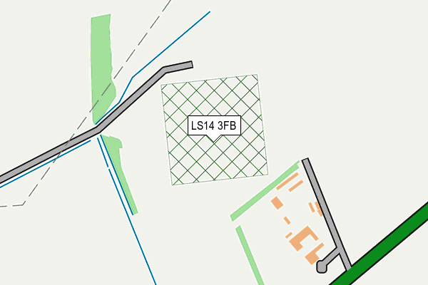
LS14 3FB is located in the Harewood electoral ward, within the metropolitan district of Leeds and the English Parliamentary constituency of Elmet and Rothwell. The Sub Integrated Care Board (ICB) Location is NHS West Yorkshire ICB - 15F and the police force is West Yorkshire. This postcode has been in use since June 2017.


GetTheData
Source: OS OpenMap – Local (Ordnance Survey)
Source: OS VectorMap District (Ordnance Survey)
Licence: Open Government Licence (requires attribution)
| Easting | 437429 |
| Northing | 438253 |
| Latitude | 53.839202 |
| Longitude | -1.432689 |
GetTheData
Source: Open Postcode Geo
Licence: Open Government Licence
| Country | England |
| Postcode District | LS14 |
➜ See where LS14 is on a map | |
GetTheData
Source: Land Registry Price Paid Data
Licence: Open Government Licence
| Ward | Harewood |
| Constituency | Elmet And Rothwell |
GetTheData
Source: ONS Postcode Database
Licence: Open Government Licence
| York Rd Stockheld Lane (York Road) | Scholes | 354m |
| York Rd Stockheld Lane (York Road) | Scholes | 380m |
| York Rd Scholes Lane (York Road) | Scholes | 421m |
| Skeltons Lane Thorner Ln (Skeltons Lane) | Whinmoor | 469m |
| Skeltons Lane Thorner Ln (Skeltons Lane) | Whinmoor | 469m |
| Cross Gates Station | 4km |
| Garforth Station | 5.8km |
GetTheData
Source: NaPTAN
Licence: Open Government Licence
GetTheData
Source: ONS Postcode Database
Licence: Open Government Licence


➜ Get more ratings from the Food Standards Agency
GetTheData
Source: Food Standards Agency
Licence: FSA terms & conditions
| Last Collection | |||
|---|---|---|---|
| Location | Mon-Fri | Sat | Distance |
| Bramley Grange Thorner Lane | 18:15 | 09:00 | 457m |
| Arthursdale | 17:00 | 09:00 | 776m |
| Scholes P.o. | 16:00 | 10:45 | 1,042m |
GetTheData
Source: Dracos
Licence: Creative Commons Attribution-ShareAlike
The below table lists the International Territorial Level (ITL) codes (formerly Nomenclature of Territorial Units for Statistics (NUTS) codes) and Local Administrative Units (LAU) codes for LS14 3FB:
| ITL 1 Code | Name |
|---|---|
| TLE | Yorkshire and The Humber |
| ITL 2 Code | Name |
| TLE4 | West Yorkshire |
| ITL 3 Code | Name |
| TLE42 | Leeds |
| LAU 1 Code | Name |
| E08000035 | Leeds |
GetTheData
Source: ONS Postcode Directory
Licence: Open Government Licence
The below table lists the Census Output Area (OA), Lower Layer Super Output Area (LSOA), and Middle Layer Super Output Area (MSOA) for LS14 3FB:
| Code | Name | |
|---|---|---|
| OA | E00059102 | |
| LSOA | E01011715 | Leeds 022C |
| MSOA | E02002351 | Leeds 022 |
GetTheData
Source: ONS Postcode Directory
Licence: Open Government Licence
| LS15 4NG | Stockheld Lane | 473m |
| LS15 4NF | York Road | 475m |
| LS14 3AA | Morwick Terrace | 485m |
| LS14 3DW | Skeltons Lane | 514m |
| LS15 4AX | Nook Road | 633m |
| LS15 4AU | Nook Road | 655m |
| LS14 3DP | Sandhills | 663m |
| LS15 4NE | Scholes Lane | 699m |
| LS14 3AD | York Road | 746m |
| LS14 3DN | Sandhills | 780m |
GetTheData
Source: Open Postcode Geo; Land Registry Price Paid Data
Licence: Open Government Licence