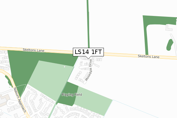
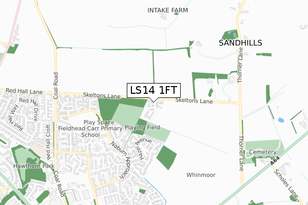
LS14 1FT is located in the Harewood electoral ward, within the metropolitan district of Leeds and the English Parliamentary constituency of Leeds East. The Sub Integrated Care Board (ICB) Location is NHS West Yorkshire ICB - 15F and the police force is West Yorkshire. This postcode has been in use since September 2019.


GetTheData
Source: OS Open Zoomstack (Ordnance Survey)
Licence: Open Government Licence (requires attribution)
Attribution: Contains OS data © Crown copyright and database right 2025
Source: Open Postcode Geo
Licence: Open Government Licence (requires attribution)
Attribution: Contains OS data © Crown copyright and database right 2025; Contains Royal Mail data © Royal Mail copyright and database right 2025; Source: Office for National Statistics licensed under the Open Government Licence v.3.0
| Easting | 436341 |
| Northing | 438211 |
| Latitude | 53.838902 |
| Longitude | -1.449227 |
GetTheData
Source: Open Postcode Geo
Licence: Open Government Licence
| Country | England |
| Postcode District | LS14 |
➜ See where LS14 is on a map ➜ Where is Leeds? | |
GetTheData
Source: Land Registry Price Paid Data
Licence: Open Government Licence
| Ward | Harewood |
| Constituency | Leeds East |
GetTheData
Source: ONS Postcode Database
Licence: Open Government Licence
24, MOSEDALE DRIVE, WHINMOOR, LEEDS, LS14 1FT 2021 6 AUG £380,000 |
23, MOSEDALE DRIVE, WHINMOOR, LEEDS, LS14 1FT 2021 29 MAR £420,000 |
7, MOSEDALE DRIVE, WHINMOOR, LEEDS, LS14 1FT 2021 19 FEB £580,000 |
6, MOSEDALE DRIVE, WHINMOOR, LEEDS, LS14 1FT 2021 5 FEB £499,950 |
19, MOSEDALE DRIVE, WHINMOOR, LEEDS, LS14 1FT 2021 4 FEB £460,000 |
5, MOSEDALE DRIVE, LEEDS, LS14 1FT 2020 18 DEC £520,000 |
28, MOSEDALE DRIVE, WHINMOOR, LEEDS, LS14 1FT 2020 18 DEC £510,000 |
21, MOSEDALE DRIVE, WHINMOOR, LEEDS, LS14 1FT 2020 18 DEC £460,000 |
17, MOSEDALE DRIVE, WHINMOOR, LEEDS, LS14 1FT 2020 18 DEC £460,000 |
26, MOSEDALE DRIVE, WHINMOOR, LEEDS, LS14 1FT 2020 29 NOV £510,000 |
GetTheData
Source: HM Land Registry Price Paid Data
Licence: Contains HM Land Registry data © Crown copyright and database right 2025. This data is licensed under the Open Government Licence v3.0.
| Skeltons Ln Bramley Gardens (Skeltons Lane) | Whinmoor | 115m |
| Skeltons Ln Bramley Gardens (Skeltons Lane) | Whinmoor | 125m |
| Naburn Approach White Laithe Green (Naburn Approach) | Whinmoor | 400m |
| Naburn Approach White Laithe Green (Naburn Approach) | Whinmoor | 413m |
| Terminus (White Approach) | Whinmoor | 444m |
| Cross Gates Station | 3.8km |
| Garforth Station | 6.4km |
GetTheData
Source: NaPTAN
Licence: Open Government Licence
GetTheData
Source: ONS Postcode Database
Licence: Open Government Licence


➜ Get more ratings from the Food Standards Agency
GetTheData
Source: Food Standards Agency
Licence: FSA terms & conditions
| Last Collection | |||
|---|---|---|---|
| Location | Mon-Fri | Sat | Distance |
| Skelton Wood P.o. | 17:30 | 12:00 | 480m |
| Sherburn Road North/Willow Garth | 18:15 | 11:45 | 728m |
| Bramley Grange Thorner Lane | 18:15 | 09:00 | 748m |
GetTheData
Source: Dracos
Licence: Creative Commons Attribution-ShareAlike
The below table lists the International Territorial Level (ITL) codes (formerly Nomenclature of Territorial Units for Statistics (NUTS) codes) and Local Administrative Units (LAU) codes for LS14 1FT:
| ITL 1 Code | Name |
|---|---|
| TLE | Yorkshire and The Humber |
| ITL 2 Code | Name |
| TLE4 | West Yorkshire |
| ITL 3 Code | Name |
| TLE42 | Leeds |
| LAU 1 Code | Name |
| E08000035 | Leeds |
GetTheData
Source: ONS Postcode Directory
Licence: Open Government Licence
The below table lists the Census Output Area (OA), Lower Layer Super Output Area (LSOA), and Middle Layer Super Output Area (MSOA) for LS14 1FT:
| Code | Name | |
|---|---|---|
| OA | E00059068 | |
| LSOA | E01011715 | Leeds 022C |
| MSOA | E02002351 | Leeds 022 |
GetTheData
Source: ONS Postcode Directory
Licence: Open Government Licence
| LS14 2HL | Maple Way | 282m |
| LS14 2HQ | Elm Croft | 289m |
| LS14 2HW | Hazel Avenue | 318m |
| LS14 2HX | Westwinn Garth | 320m |
| LS14 2HN | Hawthorne Rise | 341m |
| LS14 2HG | Walnut Close | 342m |
| LS14 2HY | Westwinn View | 358m |
| LS14 2HP | Hornbeam Way | 359m |
| LS14 2HH | Acorn Drive | 395m |
| LS14 2HJ | Cherry Rise | 440m |
GetTheData
Source: Open Postcode Geo; Land Registry Price Paid Data
Licence: Open Government Licence