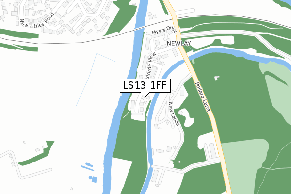
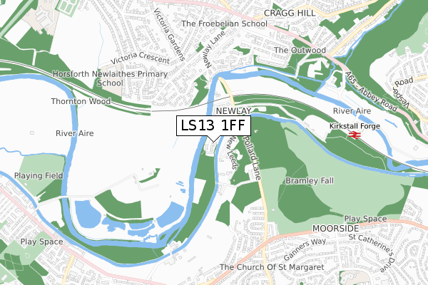
LS13 1FF is located in the Bramley & Stanningley electoral ward, within the metropolitan district of Leeds and the English Parliamentary constituency of Leeds West. The Sub Integrated Care Board (ICB) Location is NHS West Yorkshire ICB - 15F and the police force is West Yorkshire. This postcode has been in use since September 2019.


GetTheData
Source: OS Open Zoomstack (Ordnance Survey)
Licence: Open Government Licence (requires attribution)
Attribution: Contains OS data © Crown copyright and database right 2025
Source: Open Postcode Geo
Licence: Open Government Licence (requires attribution)
Attribution: Contains OS data © Crown copyright and database right 2025; Contains Royal Mail data © Royal Mail copyright and database right 2025; Source: Office for National Statistics licensed under the Open Government Licence v.3.0
| Easting | 423855 |
| Northing | 436553 |
| Latitude | 53.824720 |
| Longitude | -1.639094 |
GetTheData
Source: Open Postcode Geo
Licence: Open Government Licence
| Country | England |
| Postcode District | LS13 |
➜ See where LS13 is on a map ➜ Where is Leeds? | |
GetTheData
Source: Land Registry Price Paid Data
Licence: Open Government Licence
| Ward | Bramley & Stanningley |
| Constituency | Leeds West |
GetTheData
Source: ONS Postcode Database
Licence: Open Government Licence
2, HARDWICK COURT, BRAMLEY, LEEDS, LS13 1FF 2022 19 DEC £392,500 |
2, HARDWICK COURT, BRAMLEY, LEEDS, LS13 1FF 2019 27 SEP £289,950 |
1, HARDWICK COURT, BRAMLEY, LEEDS, LS13 1FF 2019 20 SEP £289,950 |
GetTheData
Source: HM Land Registry Price Paid Data
Licence: Contains HM Land Registry data © Crown copyright and database right 2025. This data is licensed under the Open Government Licence v3.0.
| Newlaithes Gardens | Horsforth | 615m |
| Victoria Crescent | Horsforth | 618m |
| Leeds & Bradford Rd Pollard Lane (Leeds And Bradford Road) | Bramley | 666m |
| Leeds & Bradford Rd Pollard Lane (Leeds And Bradford Road) | Bramley | 675m |
| Leeds Bradford Road Shirley Dr (Leeds And Bradford Road) | Bramley | 681m |
| Kirkstall Forge Station | 1.1km |
| Bramley (West Yorks) Station | 2.2km |
| Horsforth Station | 2.6km |
GetTheData
Source: NaPTAN
Licence: Open Government Licence
GetTheData
Source: ONS Postcode Database
Licence: Open Government Licence


➜ Get more ratings from the Food Standards Agency
GetTheData
Source: Food Standards Agency
Licence: FSA terms & conditions
| Last Collection | |||
|---|---|---|---|
| Location | Mon-Fri | Sat | Distance |
| In Bridge Wall Newlay Lane | 17:30 | 11:00 | 267m |
| Victoria Cresent/Gardens | 18:15 | 11:00 | 554m |
| Whitecote P.o. | 17:30 | 11:45 | 661m |
GetTheData
Source: Dracos
Licence: Creative Commons Attribution-ShareAlike
The below table lists the International Territorial Level (ITL) codes (formerly Nomenclature of Territorial Units for Statistics (NUTS) codes) and Local Administrative Units (LAU) codes for LS13 1FF:
| ITL 1 Code | Name |
|---|---|
| TLE | Yorkshire and The Humber |
| ITL 2 Code | Name |
| TLE4 | West Yorkshire |
| ITL 3 Code | Name |
| TLE42 | Leeds |
| LAU 1 Code | Name |
| E08000035 | Leeds |
GetTheData
Source: ONS Postcode Directory
Licence: Open Government Licence
The below table lists the Census Output Area (OA), Lower Layer Super Output Area (LSOA), and Middle Layer Super Output Area (MSOA) for LS13 1FF:
| Code | Name | |
|---|---|---|
| OA | E00057054 | |
| LSOA | E01011325 | Leeds 046B |
| MSOA | E02002375 | Leeds 046 |
GetTheData
Source: ONS Postcode Directory
Licence: Open Government Licence
| LS13 1GE | Horsforde View | 54m |
| LS13 1GA | Baxendale Drive | 182m |
| LS13 1GD | Billington Close | 184m |
| LS13 1GH | Myers Drive | 217m |
| LS13 1EF | Whitecote Lane | 280m |
| LS13 1EA | Airedale Cliff | 296m |
| LS18 4LQ | Newlay Grove | 328m |
| LS18 4UW | Thorntons Dale | 387m |
| LS18 4BZ | Newlay Mount | 391m |
| LS18 4LH | Newlay Grove | 403m |
GetTheData
Source: Open Postcode Geo; Land Registry Price Paid Data
Licence: Open Government Licence