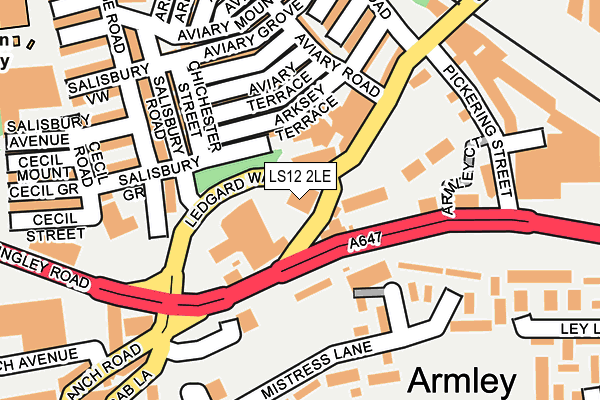
LS12 2LE is located in the Armley electoral ward, within the metropolitan district of Leeds and the English Parliamentary constituency of Leeds West. The Sub Integrated Care Board (ICB) Location is NHS West Yorkshire ICB - 15F and the police force is West Yorkshire. This postcode has been in use since June 2011.


GetTheData
Source: OS OpenMap – Local (Ordnance Survey)
Source: OS VectorMap District (Ordnance Survey)
Licence: Open Government Licence (requires attribution)
| Easting | 427432 |
| Northing | 433734 |
| Latitude | 53.799192 |
| Longitude | -1.585002 |
GetTheData
Source: Open Postcode Geo
Licence: Open Government Licence
| Country | England |
| Postcode District | LS12 |
➜ See where LS12 is on a map ➜ Where is Leeds? | |
GetTheData
Source: Land Registry Price Paid Data
Licence: Open Government Licence
Elevation or altitude of LS12 2LE as distance above sea level:
| Metres | Feet | |
|---|---|---|
| Elevation | 60m | 197ft |
Elevation is measured from the approximate centre of the postcode, to the nearest point on an OS contour line from OS Terrain 50, which has contour spacing of ten vertical metres.
➜ How high above sea level am I? Find the elevation of your current position using your device's GPS.
GetTheData
Source: Open Postcode Elevation
Licence: Open Government Licence
| Ward | Armley |
| Constituency | Leeds West |
GetTheData
Source: ONS Postcode Database
Licence: Open Government Licence
| Branch Road Canal Rd (Armley Road) | Armley | 81m |
| Canal Road Pickering St (Canal Road) | Armley | 117m |
| Ledgard Way Stanningley Rd (Ledgard Way) | Armley | 138m |
| Stanningley Rd Branch Road (Stanningley Road) | Armley | 207m |
| Canal Road Pickering St (Canal Road) | Armley | 208m |
| Burley Park Station | 1.5km |
| Headingley Station | 2.2km |
| Leeds Station | 2.5km |
GetTheData
Source: NaPTAN
Licence: Open Government Licence
GetTheData
Source: ONS Postcode Database
Licence: Open Government Licence


➜ Get more ratings from the Food Standards Agency
GetTheData
Source: Food Standards Agency
Licence: FSA terms & conditions
| Last Collection | |||
|---|---|---|---|
| Location | Mon-Fri | Sat | Distance |
| Armley Lodge Road | 17:30 | 12:15 | 114m |
| Pickering Street/Canal Road | 17:30 | 12:15 | 213m |
| Castleton | 17:30 | 12:00 | 428m |
GetTheData
Source: Dracos
Licence: Creative Commons Attribution-ShareAlike
The below table lists the International Territorial Level (ITL) codes (formerly Nomenclature of Territorial Units for Statistics (NUTS) codes) and Local Administrative Units (LAU) codes for LS12 2LE:
| ITL 1 Code | Name |
|---|---|
| TLE | Yorkshire and The Humber |
| ITL 2 Code | Name |
| TLE4 | West Yorkshire |
| ITL 3 Code | Name |
| TLE42 | Leeds |
| LAU 1 Code | Name |
| E08000035 | Leeds |
GetTheData
Source: ONS Postcode Directory
Licence: Open Government Licence
The below table lists the Census Output Area (OA), Lower Layer Super Output Area (LSOA), and Middle Layer Super Output Area (MSOA) for LS12 2LE:
| Code | Name | |
|---|---|---|
| OA | E00056886 | |
| LSOA | E01011293 | Leeds 071C |
| MSOA | E02002400 | Leeds 071 |
GetTheData
Source: ONS Postcode Directory
Licence: Open Government Licence
| LS12 2ND | Ledgard Way | 37m |
| LS12 2LY | Armley Road | 47m |
| LS12 2NH | Hereford Street | 96m |
| LS12 2NG | Arksey Place | 100m |
| LS12 2NQ | Arksey Terrace | 101m |
| LS12 2NJ | Ely Street | 113m |
| LS12 2JG | Fielding Gate | 114m |
| LS12 2NR | Aviary Terrace | 116m |
| LS12 2NW | Chester Street | 132m |
| LS12 2NP | Aviary Place | 136m |
GetTheData
Source: Open Postcode Geo; Land Registry Price Paid Data
Licence: Open Government Licence