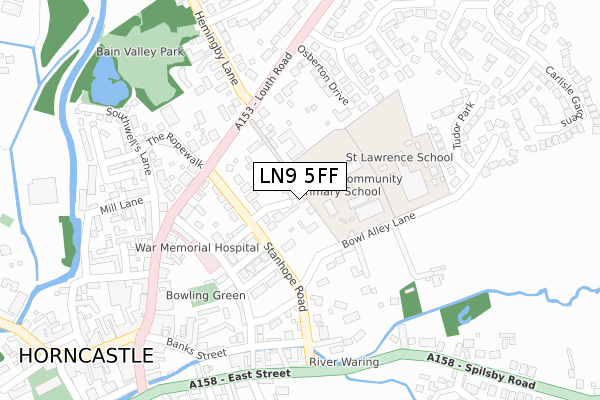
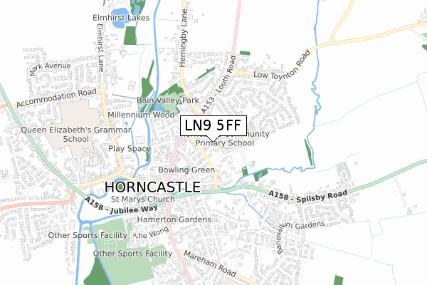
LN9 5FF is located in the Horncastle electoral ward, within the local authority district of East Lindsey and the English Parliamentary constituency of Louth and Horncastle. The Sub Integrated Care Board (ICB) Location is NHS Lincolnshire ICB - 71E and the police force is Lincolnshire. This postcode has been in use since September 2018.


GetTheData
Source: OS Open Zoomstack (Ordnance Survey)
Licence: Open Government Licence (requires attribution)
Attribution: Contains OS data © Crown copyright and database right 2024
Source: Open Postcode Geo
Licence: Open Government Licence (requires attribution)
Attribution: Contains OS data © Crown copyright and database right 2024; Contains Royal Mail data © Royal Mail copyright and database right 2024; Source: Office for National Statistics licensed under the Open Government Licence v.3.0
| Easting | 526262 |
| Northing | 369848 |
| Latitude | 53.210730 |
| Longitude | -0.110789 |
GetTheData
Source: Open Postcode Geo
Licence: Open Government Licence
| Country | England |
| Postcode District | LN9 |
➜ See where LN9 is on a map ➜ Where is Horncastle? | |
GetTheData
Source: Land Registry Price Paid Data
Licence: Open Government Licence
| Ward | Horncastle |
| Constituency | Louth And Horncastle |
GetTheData
Source: ONS Postcode Database
Licence: Open Government Licence
2023 6 DEC £455,000 |
2021 11 FEB £350,000 |
3, BLACKTHORN LANE, HORNCASTLE, LN9 5FF 2020 22 OCT £345,000 |
2020 11 SEP £359,999 |
2, BLACKTHORN LANE, HORNCASTLE, LN9 5FF 2020 14 FEB £367,999 |
1, BLACKTHORN LANE, HORNCASTLE, LN9 5FF 2018 30 JUL £100,000 |
GetTheData
Source: HM Land Registry Price Paid Data
Licence: Contains HM Land Registry data © Crown copyright and database right 2024. This data is licensed under the Open Government Licence v3.0.
| St Lawrence School (Bowl Alley Lane) | Horncastle | 159m |
| Interchange Shelter (High Street) | Horncastle | 446m |
| Ashwood Close (Prospect Street) | Horncastle | 576m |
| Bryant Close (South Street) | Horncastle | 602m |
| Bryant Close (South Street) | Horncastle | 617m |
GetTheData
Source: NaPTAN
Licence: Open Government Licence
| Percentage of properties with Next Generation Access | 100.0% |
| Percentage of properties with Superfast Broadband | 100.0% |
| Percentage of properties with Ultrafast Broadband | 0.0% |
| Percentage of properties with Full Fibre Broadband | 0.0% |
Superfast Broadband is between 30Mbps and 300Mbps
Ultrafast Broadband is > 300Mbps
| Percentage of properties unable to receive 2Mbps | 0.0% |
| Percentage of properties unable to receive 5Mbps | 0.0% |
| Percentage of properties unable to receive 10Mbps | 0.0% |
| Percentage of properties unable to receive 30Mbps | 0.0% |
GetTheData
Source: Ofcom
Licence: Ofcom Terms of Use (requires attribution)
GetTheData
Source: ONS Postcode Database
Licence: Open Government Licence


➜ Get more ratings from the Food Standards Agency
GetTheData
Source: Food Standards Agency
Licence: FSA terms & conditions
The below table lists the International Territorial Level (ITL) codes (formerly Nomenclature of Territorial Units for Statistics (NUTS) codes) and Local Administrative Units (LAU) codes for LN9 5FF:
| ITL 1 Code | Name |
|---|---|
| TLF | East Midlands (England) |
| ITL 2 Code | Name |
| TLF3 | Lincolnshire |
| ITL 3 Code | Name |
| TLF30 | Lincolnshire CC |
| LAU 1 Code | Name |
| E07000137 | East Lindsey |
GetTheData
Source: ONS Postcode Directory
Licence: Open Government Licence
The below table lists the Census Output Area (OA), Lower Layer Super Output Area (LSOA), and Middle Layer Super Output Area (MSOA) for LN9 5FF:
| Code | Name | |
|---|---|---|
| OA | E00132267 | |
| LSOA | E01026065 | East Lindsey 011B |
| MSOA | E02005434 | East Lindsey 011 |
GetTheData
Source: ONS Postcode Directory
Licence: Open Government Licence
| LN9 5EL | Stanhope Road | 59m |
| LN9 5EF | Park Road | 110m |
| LN9 5EQ | Bowl Alley Lane | 115m |
| LN9 5EG | Stanhope Terrace | 132m |
| LN9 5EE | Linden Road | 169m |
| LN9 5ED | Louth Road | 178m |
| LN9 5DF | The Becks | 191m |
| LN9 5DG | Stanhope Road | 214m |
| LN9 5DE | Hodson Green | 216m |
| LN9 5BF | The Ropewalk | 244m |
GetTheData
Source: Open Postcode Geo; Land Registry Price Paid Data
Licence: Open Government Licence