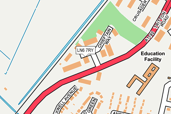
LN6 7RY is located in the Boultham electoral ward, within the local authority district of Lincoln and the English Parliamentary constituency of Lincoln. The Sub Integrated Care Board (ICB) Location is NHS Lincolnshire ICB - 71E and the police force is Lincolnshire. This postcode has been in use since April 1987.


GetTheData
Source: OS OpenMap – Local (Ordnance Survey)
Source: OS VectorMap District (Ordnance Survey)
Licence: Open Government Licence (requires attribution)
| Easting | 496107 |
| Northing | 369979 |
| Latitude | 53.218206 |
| Longitude | -0.562117 |
GetTheData
Source: Open Postcode Geo
Licence: Open Government Licence
| Country | England |
| Postcode District | LN6 |
➜ See where LN6 is on a map ➜ Where is Lincoln? | |
GetTheData
Source: Land Registry Price Paid Data
Licence: Open Government Licence
Elevation or altitude of LN6 7RY as distance above sea level:
| Metres | Feet | |
|---|---|---|
| Elevation | 10m | 33ft |
Elevation is measured from the approximate centre of the postcode, to the nearest point on an OS contour line from OS Terrain 50, which has contour spacing of ten vertical metres.
➜ How high above sea level am I? Find the elevation of your current position using your device's GPS.
GetTheData
Source: Open Postcode Elevation
Licence: Open Government Licence
| Ward | Boultham |
| Constituency | Lincoln |
GetTheData
Source: ONS Postcode Database
Licence: Open Government Licence
| Bristol Drive (Boultham Park Road) | Lincoln | 517m |
| Bristol Drive (Boultham Park Road) | Lincoln | 528m |
| Valentine Retail Park (Tritton Road) | Lincoln | 529m |
| St Andrew's Drive (Boultham Park Road) | Lincoln | 542m |
| Mayfair Avenue (Boultham Park Road) | Lincoln | 544m |
| Lincoln Central Station | 1.7km |
| Hykeham Station | 3.6km |
GetTheData
Source: NaPTAN
Licence: Open Government Licence
GetTheData
Source: ONS Postcode Database
Licence: Open Government Licence


➜ Get more ratings from the Food Standards Agency
GetTheData
Source: Food Standards Agency
Licence: FSA terms & conditions
| Last Collection | |||
|---|---|---|---|
| Location | Mon-Fri | Sat | Distance |
| Morrisons Tritton Road | 17:30 | 12:30 | 285m |
| Rookery Lane | 17:30 | 12:00 | 932m |
| Golden Cross | 17:30 | 12:15 | 1,107m |
GetTheData
Source: Dracos
Licence: Creative Commons Attribution-ShareAlike
| Risk of LN6 7RY flooding from rivers and sea | Medium |
| ➜ LN6 7RY flood map | |
GetTheData
Source: Open Flood Risk by Postcode
Licence: Open Government Licence
The below table lists the International Territorial Level (ITL) codes (formerly Nomenclature of Territorial Units for Statistics (NUTS) codes) and Local Administrative Units (LAU) codes for LN6 7RY:
| ITL 1 Code | Name |
|---|---|
| TLF | East Midlands (England) |
| ITL 2 Code | Name |
| TLF3 | Lincolnshire |
| ITL 3 Code | Name |
| TLF30 | Lincolnshire CC |
| LAU 1 Code | Name |
| E07000138 | Lincoln |
GetTheData
Source: ONS Postcode Directory
Licence: Open Government Licence
The below table lists the Census Output Area (OA), Lower Layer Super Output Area (LSOA), and Middle Layer Super Output Area (MSOA) for LN6 7RY:
| Code | Name | |
|---|---|---|
| OA | E00173647 | |
| LSOA | E01026133 | Lincoln 008A |
| MSOA | E02005449 | Lincoln 008 |
GetTheData
Source: ONS Postcode Directory
Licence: Open Government Licence
| LN6 7UX | Maxwell Avenue | 173m |
| LN6 7UU | Rufford Green | 173m |
| LN6 7UQ | St Andrews Gardens | 235m |
| LN6 7UY | Hunt Lea Avenue | 258m |
| LN6 7UR | Clive Avenue | 294m |
| LN6 7XA | Hunt Lea Avenue | 325m |
| LN6 7UT | Meynell Avenue | 368m |
| LN6 7UZ | Hunt Lea Avenue | 375m |
| LN6 7UW | Clive Avenue | 404m |
| LN6 7UH | Clive Avenue | 407m |
GetTheData
Source: Open Postcode Geo; Land Registry Price Paid Data
Licence: Open Government Licence