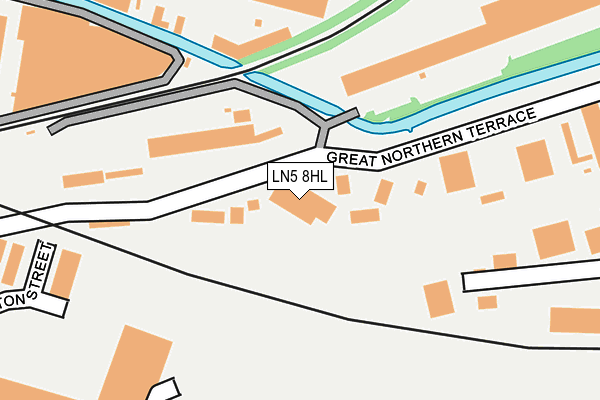
LN5 8HL is located in the Park electoral ward, within the local authority district of Lincoln and the English Parliamentary constituency of Lincoln. The Sub Integrated Care Board (ICB) Location is NHS Lincolnshire ICB - 71E and the police force is Lincolnshire. This postcode has been in use since January 1980.


GetTheData
Source: OS OpenMap – Local (Ordnance Survey)
Source: OS VectorMap District (Ordnance Survey)
Licence: Open Government Licence (requires attribution)
| Easting | 498272 |
| Northing | 370730 |
| Latitude | 53.224537 |
| Longitude | -0.529474 |
GetTheData
Source: Open Postcode Geo
Licence: Open Government Licence
| Country | England |
| Postcode District | LN5 |
➜ See where LN5 is on a map ➜ Where is Lincoln? | |
GetTheData
Source: Land Registry Price Paid Data
Licence: Open Government Licence
Elevation or altitude of LN5 8HL as distance above sea level:
| Metres | Feet | |
|---|---|---|
| Elevation | 10m | 33ft |
Elevation is measured from the approximate centre of the postcode, to the nearest point on an OS contour line from OS Terrain 50, which has contour spacing of ten vertical metres.
➜ How high above sea level am I? Find the elevation of your current position using your device's GPS.
GetTheData
Source: Open Postcode Elevation
Licence: Open Government Licence
| Ward | Park |
| Constituency | Lincoln |
GetTheData
Source: ONS Postcode Database
Licence: Open Government Licence
| Stagecoach Depot (Great Northern Terrace) | Lincoln | 57m |
| Tesco (Dunford Road) | Lincoln | 223m |
| Ripon Street (Canwick Road) | Lincoln | 440m |
| Ripon Street (Canwick Road) | Lincoln | 454m |
| Siemens (Pelham Street) | Lincoln | 488m |
| Lincoln Central Station | 0.7km |
| Hykeham Station | 5.8km |
GetTheData
Source: NaPTAN
Licence: Open Government Licence
GetTheData
Source: ONS Postcode Database
Licence: Open Government Licence


➜ Get more ratings from the Food Standards Agency
GetTheData
Source: Food Standards Agency
Licence: FSA terms & conditions
| Last Collection | |||
|---|---|---|---|
| Location | Mon-Fri | Sat | Distance |
| Central Railway Station | 18:45 | 12:30 | 584m |
| Grafton Street | 17:00 | 12:15 | 695m |
| Sincil Street Post Office | 19:00 | 12:30 | 723m |
GetTheData
Source: Dracos
Licence: Creative Commons Attribution-ShareAlike
| Risk of LN5 8HL flooding from rivers and sea | Low |
| ➜ LN5 8HL flood map | |
GetTheData
Source: Open Flood Risk by Postcode
Licence: Open Government Licence
The below table lists the International Territorial Level (ITL) codes (formerly Nomenclature of Territorial Units for Statistics (NUTS) codes) and Local Administrative Units (LAU) codes for LN5 8HL:
| ITL 1 Code | Name |
|---|---|
| TLF | East Midlands (England) |
| ITL 2 Code | Name |
| TLF3 | Lincolnshire |
| ITL 3 Code | Name |
| TLF30 | Lincolnshire CC |
| LAU 1 Code | Name |
| E07000138 | Lincoln |
GetTheData
Source: ONS Postcode Directory
Licence: Open Government Licence
The below table lists the Census Output Area (OA), Lower Layer Super Output Area (LSOA), and Middle Layer Super Output Area (MSOA) for LN5 8HL:
| Code | Name | |
|---|---|---|
| OA | E00132903 | |
| LSOA | E01026176 | Lincoln 006B |
| MSOA | E02005447 | Lincoln 006 |
GetTheData
Source: ONS Postcode Directory
Licence: Open Government Licence
| LN5 7JE | Witham Park | 182m |
| LN5 8LG | George Street | 295m |
| LN2 5DP | Stamp End | 395m |
| LN5 8HH | Canwick Road | 412m |
| LN5 8HE | Canwick Road | 430m |
| LN2 5EE | Cannon Street | 443m |
| LN2 5ED | Cannon Street | 455m |
| LN5 7ND | St Andrews Street | 473m |
| LN5 7LQ | Archer Street | 476m |
| LN5 8HN | Great Northern Terrace | 480m |
GetTheData
Source: Open Postcode Geo; Land Registry Price Paid Data
Licence: Open Government Licence