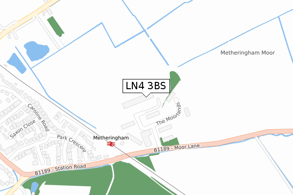
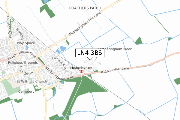
LN4 3BS is located in the Metheringham Rural electoral ward, within the local authority district of North Kesteven and the English Parliamentary constituency of Sleaford and North Hykeham. The Sub Integrated Care Board (ICB) Location is NHS Lincolnshire ICB - 71E and the police force is Lincolnshire. This postcode has been in use since May 2019.


GetTheData
Source: OS Open Zoomstack (Ordnance Survey)
Licence: Open Government Licence (requires attribution)
Attribution: Contains OS data © Crown copyright and database right 2024
Source: Open Postcode Geo
Licence: Open Government Licence (requires attribution)
Attribution: Contains OS data © Crown copyright and database right 2024; Contains Royal Mail data © Royal Mail copyright and database right 2024; Source: Office for National Statistics licensed under the Open Government Licence v.3.0
| Easting | 507790 |
| Northing | 361547 |
| Latitude | 53.140204 |
| Longitude | -0.390055 |
GetTheData
Source: Open Postcode Geo
Licence: Open Government Licence
| Country | England |
| Postcode District | LN4 |
➜ See where LN4 is on a map ➜ Where is Metheringham? | |
GetTheData
Source: Land Registry Price Paid Data
Licence: Open Government Licence
| Ward | Metheringham Rural |
| Constituency | Sleaford And North Hykeham |
GetTheData
Source: ONS Postcode Database
Licence: Open Government Licence
| Railway Station (Station Road) | Metheringham | 212m |
| Railway Station (Station Road) | Metheringham | 233m |
| The Lincolnshire Poacher Ph (High Street) | Metheringham | 710m |
| The Lincolnshire Poacher Ph (High Street) | Metheringham | 717m |
| Methodist Church (High Street) | Metheringham | 905m |
| Metheringham Station | 0.2km |
GetTheData
Source: NaPTAN
Licence: Open Government Licence
GetTheData
Source: ONS Postcode Database
Licence: Open Government Licence


➜ Get more ratings from the Food Standards Agency
GetTheData
Source: Food Standards Agency
Licence: FSA terms & conditions
| Last Collection | |||
|---|---|---|---|
| Location | Mon-Fri | Sat | Distance |
| Metheringham P.o. | 17:30 | 12:15 | 920m |
| The Firs Scopwick | 16:45 | 11:15 | 3,335m |
| Kirkby Green | 16:45 | 09:45 | 3,709m |
GetTheData
Source: Dracos
Licence: Creative Commons Attribution-ShareAlike
The below table lists the International Territorial Level (ITL) codes (formerly Nomenclature of Territorial Units for Statistics (NUTS) codes) and Local Administrative Units (LAU) codes for LN4 3BS:
| ITL 1 Code | Name |
|---|---|
| TLF | East Midlands (England) |
| ITL 2 Code | Name |
| TLF3 | Lincolnshire |
| ITL 3 Code | Name |
| TLF30 | Lincolnshire CC |
| LAU 1 Code | Name |
| E07000139 | North Kesteven |
GetTheData
Source: ONS Postcode Directory
Licence: Open Government Licence
The below table lists the Census Output Area (OA), Lower Layer Super Output Area (LSOA), and Middle Layer Super Output Area (MSOA) for LN4 3BS:
| Code | Name | |
|---|---|---|
| OA | E00133098 | |
| LSOA | E01026212 | North Kesteven 005D |
| MSOA | E02005457 | North Kesteven 005 |
GetTheData
Source: ONS Postcode Directory
Licence: Open Government Licence
| LN4 3HX | Moor Lane | 78m |
| LN4 3JH | Pullman Close | 212m |
| LN4 3HH | Park Crescent | 243m |
| LN4 3HJ | Alexander Close | 292m |
| LN4 3HG | Manor Close | 340m |
| LN4 3HQ | Saxon Close | 403m |
| LN4 3HF | Caroline Road | 415m |
| LN4 3HS | Roman Close | 428m |
| LN4 3AR | Westfield Close | 475m |
| LN4 3HR | Station Road | 494m |
GetTheData
Source: Open Postcode Geo; Land Registry Price Paid Data
Licence: Open Government Licence