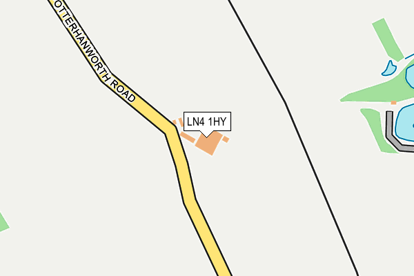
LN4 1HY is located in the Branston electoral ward, within the local authority district of North Kesteven and the English Parliamentary constituency of Sleaford and North Hykeham. The Sub Integrated Care Board (ICB) Location is NHS Lincolnshire ICB - 71E and the police force is Lincolnshire. This postcode has been in use since January 1980.


GetTheData
Source: OS OpenMap – Local (Ordnance Survey)
Source: OS VectorMap District (Ordnance Survey)
Licence: Open Government Licence (requires attribution)
| Easting | 504225 |
| Northing | 366638 |
| Latitude | 53.186657 |
| Longitude | -0.441673 |
GetTheData
Source: Open Postcode Geo
Licence: Open Government Licence
| Country | England |
| Postcode District | LN4 |
➜ See where LN4 is on a map | |
GetTheData
Source: Land Registry Price Paid Data
Licence: Open Government Licence
Elevation or altitude of LN4 1HY as distance above sea level:
| Metres | Feet | |
|---|---|---|
| Elevation | 30m | 98ft |
Elevation is measured from the approximate centre of the postcode, to the nearest point on an OS contour line from OS Terrain 50, which has contour spacing of ten vertical metres.
➜ How high above sea level am I? Find the elevation of your current position using your device's GPS.
GetTheData
Source: Open Postcode Elevation
Licence: Open Government Licence
| Ward | Branston |
| Constituency | Sleaford And North Hykeham |
GetTheData
Source: ONS Postcode Database
Licence: Open Government Licence
| Village Lane End (B1188) | Potterhanworth | 927m |
| Village Lane End (B1188) | Potterhanworth | 976m |
| War Memorial (Main Road) | Potterhanworth | 1,344m |
| Demand Responsive Area | Potterhanworth | 1,353m |
| War Memorial (Main Road) | Potterhanworth | 1,361m |
GetTheData
Source: NaPTAN
Licence: Open Government Licence
GetTheData
Source: ONS Postcode Database
Licence: Open Government Licence


➜ Get more ratings from the Food Standards Agency
GetTheData
Source: Food Standards Agency
Licence: FSA terms & conditions
| Last Collection | |||
|---|---|---|---|
| Location | Mon-Fri | Sat | Distance |
| Potterhanworth P.o. | 17:30 | 12:30 | 1,319m |
| Branston P.o. | 17:30 | 12:00 | 2,042m |
| Heighington Post Office | 17:15 | 11:45 | 3,090m |
GetTheData
Source: Dracos
Licence: Creative Commons Attribution-ShareAlike
The below table lists the International Territorial Level (ITL) codes (formerly Nomenclature of Territorial Units for Statistics (NUTS) codes) and Local Administrative Units (LAU) codes for LN4 1HY:
| ITL 1 Code | Name |
|---|---|
| TLF | East Midlands (England) |
| ITL 2 Code | Name |
| TLF3 | Lincolnshire |
| ITL 3 Code | Name |
| TLF30 | Lincolnshire CC |
| LAU 1 Code | Name |
| E07000139 | North Kesteven |
GetTheData
Source: ONS Postcode Directory
Licence: Open Government Licence
The below table lists the Census Output Area (OA), Lower Layer Super Output Area (LSOA), and Middle Layer Super Output Area (MSOA) for LN4 1HY:
| Code | Name | |
|---|---|---|
| OA | E00132979 | |
| LSOA | E01026191 | North Kesteven 005A |
| MSOA | E02005457 | North Kesteven 005 |
GetTheData
Source: ONS Postcode Directory
Licence: Open Government Licence
| LN4 1HX | Sleaford Road | 691m |
| LN4 1HR | Potterhanworth Road | 721m |
| LN4 2DX | Station Road | 967m |
| LN4 1HZ | The Moors | 1115m |
| LN4 2FD | The Paddocks | 1244m |
| LN4 2DS | Cross Street | 1250m |
| LN4 2DT | Main Road | 1278m |
| LN4 2DR | Middle Street | 1293m |
| LN4 2ED | Woodlands Close | 1318m |
| LN4 2DE | Fosters Gardens | 1338m |
GetTheData
Source: Open Postcode Geo; Land Registry Price Paid Data
Licence: Open Government Licence