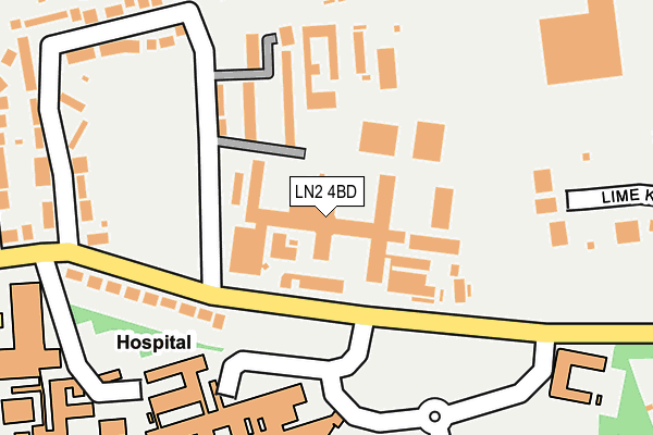
LN2 4BD is located in the Abbey electoral ward, within the local authority district of Lincoln and the English Parliamentary constituency of Lincoln. The Sub Integrated Care Board (ICB) Location is NHS Lincolnshire ICB - 71E and the police force is Lincolnshire. This postcode has been in use since January 1980.


GetTheData
Source: OS OpenMap – Local (Ordnance Survey)
Source: OS VectorMap District (Ordnance Survey)
Licence: Open Government Licence (requires attribution)
| Easting | 499013 |
| Northing | 371953 |
| Latitude | 53.235411 |
| Longitude | -0.517999 |
GetTheData
Source: Open Postcode Geo
Licence: Open Government Licence
| Country | England |
| Postcode District | LN2 |
➜ See where LN2 is on a map ➜ Where is Lincoln? | |
GetTheData
Source: Land Registry Price Paid Data
Licence: Open Government Licence
Elevation or altitude of LN2 4BD as distance above sea level:
| Metres | Feet | |
|---|---|---|
| Elevation | 50m | 164ft |
Elevation is measured from the approximate centre of the postcode, to the nearest point on an OS contour line from OS Terrain 50, which has contour spacing of ten vertical metres.
➜ How high above sea level am I? Find the elevation of your current position using your device's GPS.
GetTheData
Source: Open Postcode Elevation
Licence: Open Government Licence
| Ward | Abbey |
| Constituency | Lincoln |
GetTheData
Source: ONS Postcode Database
Licence: Open Government Licence
| Hm Prison (Greetwell Road) | Lincoln | 92m |
| Hm Prison (Greetwell Road) | Lincoln | 93m |
| County Hospital Main Entrance (Greetwell Road) | Lincoln | 159m |
| Lime Kiln Way (Greetwell Road) | Tower Estate | 291m |
| Ancaster Avenue (Greetwell Road) | Lincoln | 310m |
| Lincoln Central Station | 1.8km |
GetTheData
Source: NaPTAN
Licence: Open Government Licence
GetTheData
Source: ONS Postcode Database
Licence: Open Government Licence


➜ Get more ratings from the Food Standards Agency
GetTheData
Source: Food Standards Agency
Licence: FSA terms & conditions
| Last Collection | |||
|---|---|---|---|
| Location | Mon-Fri | Sat | Distance |
| Greetwell Road | 17:30 | 11:15 | 255m |
| Grafton Street | 17:00 | 12:15 | 742m |
| Lee Road | 17:30 | 11:30 | 903m |
GetTheData
Source: Dracos
Licence: Creative Commons Attribution-ShareAlike
The below table lists the International Territorial Level (ITL) codes (formerly Nomenclature of Territorial Units for Statistics (NUTS) codes) and Local Administrative Units (LAU) codes for LN2 4BD:
| ITL 1 Code | Name |
|---|---|
| TLF | East Midlands (England) |
| ITL 2 Code | Name |
| TLF3 | Lincolnshire |
| ITL 3 Code | Name |
| TLF30 | Lincolnshire CC |
| LAU 1 Code | Name |
| E07000138 | Lincoln |
GetTheData
Source: ONS Postcode Directory
Licence: Open Government Licence
The below table lists the Census Output Area (OA), Lower Layer Super Output Area (LSOA), and Middle Layer Super Output Area (MSOA) for LN2 4BD:
| Code | Name | |
|---|---|---|
| OA | E00173653 | |
| LSOA | E01026125 | Lincoln 003A |
| MSOA | E02005444 | Lincoln 003 |
GetTheData
Source: ONS Postcode Directory
Licence: Open Government Licence
| LN2 4BB | Greetwell Place | 125m |
| LN2 4FL | Fulford Court | 180m |
| LN2 4BA | Greetwell Close | 250m |
| LN2 4AZ | Greetwell Road | 257m |
| LN2 4RZ | Admiral Walk | 266m |
| LN2 4AY | Ancaster Avenue | 307m |
| LN2 4AX | Greetwell Road | 320m |
| LN2 5LY | Sewell Road | 390m |
| LN2 4AU | Monks Manor Court | 399m |
| LN2 4AT | Monks Manor Drive | 412m |
GetTheData
Source: Open Postcode Geo; Land Registry Price Paid Data
Licence: Open Government Licence