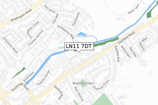
LN11 7DT is located in the Trinity electoral ward, within the local authority district of East Lindsey and the English Parliamentary constituency of Louth and Horncastle. The Sub Integrated Care Board (ICB) Location is NHS Lincolnshire ICB - 71E and the police force is Lincolnshire. This postcode has been in use since December 2019.


GetTheData
Source: OS Open Zoomstack (Ordnance Survey)
Licence: Open Government Licence (requires attribution)
Attribution: Contains OS data © Crown copyright and database right 2025
Source: Open Postcode Geo
Licence: Open Government Licence (requires attribution)
Attribution: Contains OS data © Crown copyright and database right 2025; Contains Royal Mail data © Royal Mail copyright and database right 2025; Source: Office for National Statistics licensed under the Open Government Licence v.3.0
| Easting | 534088 |
| Northing | 388151 |
| Latitude | 53.373235 |
| Longitude | 0.014039 |
GetTheData
Source: Open Postcode Geo
Licence: Open Government Licence
| Country | England |
| Postcode District | LN11 |
➜ See where LN11 is on a map ➜ Where is Louth? | |
GetTheData
Source: Land Registry Price Paid Data
Licence: Open Government Licence
| Ward | Trinity |
| Constituency | Louth And Horncastle |
GetTheData
Source: ONS Postcode Database
Licence: Open Government Licence
11, THE RIVERBANK, LOUTH, LN11 7DT 2023 6 APR £190,000 |
5, THE RIVERBANK, LOUTH, LN11 7DT 2023 6 APR £300,000 |
4, THE RIVERBANK, LOUTH, LN11 7DT 2023 5 JAN £295,000 |
10, THE RIVERBANK, LOUTH, LN11 7DT 2020 9 OCT £350,000 |
8, THE RIVERBANK, LOUTH, LN11 7DT 2019 20 DEC £395,000 |
7, THE RIVERBANK, LOUTH, LN11 7DT 2019 1 NOV £395,000 |
GetTheData
Source: HM Land Registry Price Paid Data
Licence: Contains HM Land Registry data © Crown copyright and database right 2025. This data is licensed under the Open Government Licence v3.0.
| Park Avenue (Eastfield Road) | Louth | 184m |
| 75 Chestnut Drive (Chestnut Drive) | Louth | 206m |
| 8 Chestnut Drive (Chestnut Drive) | Louth | 221m |
| 23 Park Avenue (Park Avenue) | Louth | 259m |
| 26 Park Avenue (Park Avenue) | Louth | 275m |
GetTheData
Source: NaPTAN
Licence: Open Government Licence
GetTheData
Source: ONS Postcode Database
Licence: Open Government Licence


➜ Get more ratings from the Food Standards Agency
GetTheData
Source: Food Standards Agency
Licence: FSA terms & conditions
| Last Collection | |||
|---|---|---|---|
| Location | Mon-Fri | Sat | Distance |
| Trinity Post Office | 17:15 | 11:30 | 711m |
| Brackenborough Road P.o. | 17:00 | 11:15 | 749m |
| Keddington | 17:00 | 07:00 | 827m |
GetTheData
Source: Dracos
Licence: Creative Commons Attribution-ShareAlike
The below table lists the International Territorial Level (ITL) codes (formerly Nomenclature of Territorial Units for Statistics (NUTS) codes) and Local Administrative Units (LAU) codes for LN11 7DT:
| ITL 1 Code | Name |
|---|---|
| TLF | East Midlands (England) |
| ITL 2 Code | Name |
| TLF3 | Lincolnshire |
| ITL 3 Code | Name |
| TLF30 | Lincolnshire CC |
| LAU 1 Code | Name |
| E07000137 | East Lindsey |
GetTheData
Source: ONS Postcode Directory
Licence: Open Government Licence
The below table lists the Census Output Area (OA), Lower Layer Super Output Area (LSOA), and Middle Layer Super Output Area (MSOA) for LN11 7DT:
| Code | Name | |
|---|---|---|
| OA | E00132555 | |
| LSOA | E01026108 | East Lindsey 003G |
| MSOA | E02005426 | East Lindsey 003 |
GetTheData
Source: ONS Postcode Directory
Licence: Open Government Licence
| LN11 0GG | Ticklepenny Walk | 75m |
| LN11 7AP | Eastfield Road | 85m |
| LN11 7UH | Kings Court | 100m |
| LN11 7AL | Eastfield Road | 130m |
| LN11 7AR | Eastfield Road | 148m |
| LN11 0FH | Canal Close | 161m |
| LN11 0GQ | Lock Keepers Way | 168m |
| LN11 7AS | Eastfield Road | 176m |
| LN11 7AY | Chestnut Drive | 177m |
| LN11 0DE | Staines Way | 199m |
GetTheData
Source: Open Postcode Geo; Land Registry Price Paid Data
Licence: Open Government Licence