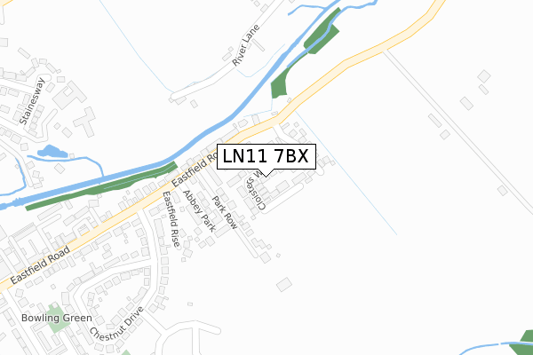
LN11 7BX is located in the Trinity electoral ward, within the local authority district of East Lindsey and the English Parliamentary constituency of Louth and Horncastle. The Sub Integrated Care Board (ICB) Location is NHS Lincolnshire ICB - 71E and the police force is Lincolnshire. This postcode has been in use since August 2018.


GetTheData
Source: OS Open Zoomstack (Ordnance Survey)
Licence: Open Government Licence (requires attribution)
Attribution: Contains OS data © Crown copyright and database right 2025
Source: Open Postcode Geo
Licence: Open Government Licence (requires attribution)
Attribution: Contains OS data © Crown copyright and database right 2025; Contains Royal Mail data © Royal Mail copyright and database right 2025; Source: Office for National Statistics licensed under the Open Government Licence v.3.0
| Easting | 534509 |
| Northing | 388220 |
| Latitude | 53.373748 |
| Longitude | 0.020392 |
GetTheData
Source: Open Postcode Geo
Licence: Open Government Licence
| Country | England |
| Postcode District | LN11 |
➜ See where LN11 is on a map ➜ Where is Louth? | |
GetTheData
Source: Land Registry Price Paid Data
Licence: Open Government Licence
| Ward | Trinity |
| Constituency | Louth And Horncastle |
GetTheData
Source: ONS Postcode Database
Licence: Open Government Licence
2023 1 SEP £305,000 |
2021 29 SEP £250,000 |
2021 30 JUN £325,000 |
2020 15 DEC £255,000 |
40, CLOISTERS WALK, LOUTH, LN11 7BX 2019 29 NOV £247,500 |
2019 15 NOV £305,000 |
38, CLOISTERS WALK, LOUTH, LN11 7BX 2019 25 OCT £252,950 |
2019 16 OCT £220,000 |
2019 2 OCT £269,950 |
32, CLOISTERS WALK, LOUTH, LN11 7BX 2019 20 SEP £254,950 |
GetTheData
Source: HM Land Registry Price Paid Data
Licence: Contains HM Land Registry data © Crown copyright and database right 2025. This data is licensed under the Open Government Licence v3.0.
| Park Row (Eastfield Road) | Louth | 143m |
| Park Row (Eastfield Road) | Louth | 144m |
| 75 Chestnut Drive (Chestnut Drive) | Louth | 251m |
| Demand Responsive Area | Keddington Corner | 407m |
| 8 Chestnut Drive (Chestnut Drive) | Louth | 437m |
GetTheData
Source: NaPTAN
Licence: Open Government Licence
| Percentage of properties with Next Generation Access | 100.0% |
| Percentage of properties with Superfast Broadband | 100.0% |
| Percentage of properties with Ultrafast Broadband | 100.0% |
| Percentage of properties with Full Fibre Broadband | 90.9% |
Superfast Broadband is between 30Mbps and 300Mbps
Ultrafast Broadband is > 300Mbps
| Percentage of properties unable to receive 2Mbps | 0.0% |
| Percentage of properties unable to receive 5Mbps | 0.0% |
| Percentage of properties unable to receive 10Mbps | 0.0% |
| Percentage of properties unable to receive 30Mbps | 0.0% |
GetTheData
Source: Ofcom
Licence: Ofcom Terms of Use (requires attribution)
GetTheData
Source: ONS Postcode Database
Licence: Open Government Licence


➜ Get more ratings from the Food Standards Agency
GetTheData
Source: Food Standards Agency
Licence: FSA terms & conditions
| Last Collection | |||
|---|---|---|---|
| Location | Mon-Fri | Sat | Distance |
| Keddington | 17:00 | 07:00 | 777m |
| Trinity Post Office | 17:15 | 11:30 | 1,090m |
| Brackenborough Road P.o. | 17:00 | 11:15 | 1,154m |
GetTheData
Source: Dracos
Licence: Creative Commons Attribution-ShareAlike
The below table lists the International Territorial Level (ITL) codes (formerly Nomenclature of Territorial Units for Statistics (NUTS) codes) and Local Administrative Units (LAU) codes for LN11 7BX:
| ITL 1 Code | Name |
|---|---|
| TLF | East Midlands (England) |
| ITL 2 Code | Name |
| TLF3 | Lincolnshire |
| ITL 3 Code | Name |
| TLF30 | Lincolnshire CC |
| LAU 1 Code | Name |
| E07000137 | East Lindsey |
GetTheData
Source: ONS Postcode Directory
Licence: Open Government Licence
The below table lists the Census Output Area (OA), Lower Layer Super Output Area (LSOA), and Middle Layer Super Output Area (MSOA) for LN11 7BX:
| Code | Name | |
|---|---|---|
| OA | E00132550 | |
| LSOA | E01026108 | East Lindsey 003G |
| MSOA | E02005426 | East Lindsey 003 |
GetTheData
Source: ONS Postcode Directory
Licence: Open Government Licence
| LN11 7AT | Park Row | 87m |
| LN11 7BB | Abbey Park | 154m |
| LN11 7XA | Eastfield Rise | 196m |
| LN11 7HQ | River Lane | 249m |
| LN11 7AS | Eastfield Road | 251m |
| LN11 7AR | Eastfield Road | 293m |
| LN11 7AX | Chestnut Drive | 313m |
| LN11 7UH | Kings Court | 333m |
| LN11 7AY | Chestnut Drive | 381m |
| LN11 7HH | Cowslip Lane | 422m |
GetTheData
Source: Open Postcode Geo; Land Registry Price Paid Data
Licence: Open Government Licence