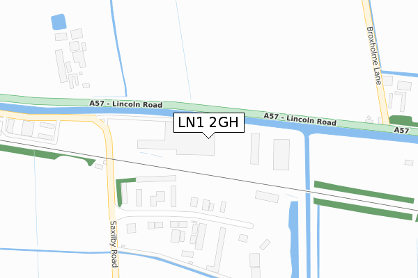
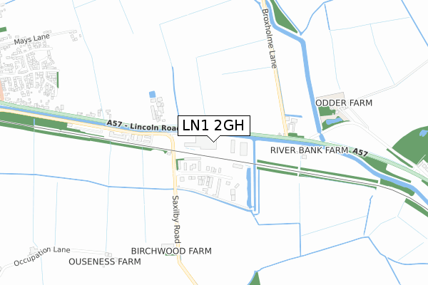
LN1 2GH is located in the Saxilby electoral ward, within the local authority district of West Lindsey and the English Parliamentary constituency of Gainsborough. The Sub Integrated Care Board (ICB) Location is NHS Lincolnshire ICB - 71E and the police force is Lincolnshire. This postcode has been in use since January 2018.


GetTheData
Source: OS Open Zoomstack (Ordnance Survey)
Licence: Open Government Licence (requires attribution)
Attribution: Contains OS data © Crown copyright and database right 2025
Source: Open Postcode Geo
Licence: Open Government Licence (requires attribution)
Attribution: Contains OS data © Crown copyright and database right 2025; Contains Royal Mail data © Royal Mail copyright and database right 2025; Source: Office for National Statistics licensed under the Open Government Licence v.3.0
| Easting | 491117 |
| Northing | 374882 |
| Latitude | 53.263142 |
| Longitude | -0.635425 |
GetTheData
Source: Open Postcode Geo
Licence: Open Government Licence
| Country | England |
| Postcode District | LN1 |
➜ See where LN1 is on a map ➜ Where is Saxilby? | |
GetTheData
Source: Land Registry Price Paid Data
Licence: Open Government Licence
| Ward | Saxilby |
| Constituency | Gainsborough |
GetTheData
Source: ONS Postcode Database
Licence: Open Government Licence
| Hodson's Depot (Skellingthorpe Road) | Saxilby | 207m |
| Odda Farm Broxholme Lane (Lincoln Road) | Odder | 404m |
| Odda Farm Broxholme Lane (Lincoln Road) | Odder | 453m |
| 1 Queensway (Queensway) | Saxilby | 1,311m |
| 1 Queensway (Queensway) | Saxilby | 1,312m |
| Saxilby Station | 2km |
GetTheData
Source: NaPTAN
Licence: Open Government Licence
GetTheData
Source: ONS Postcode Database
Licence: Open Government Licence


➜ Get more ratings from the Food Standards Agency
GetTheData
Source: Food Standards Agency
Licence: FSA terms & conditions
| Last Collection | |||
|---|---|---|---|
| Location | Mon-Fri | Sat | Distance |
| Odder | 17:15 | 12:45 | 1,236m |
| South Carlton | 17:15 | 12:15 | 4,374m |
| Bransby | 16:00 | 08:30 | 4,505m |
GetTheData
Source: Dracos
Licence: Creative Commons Attribution-ShareAlike
| Risk of LN1 2GH flooding from rivers and sea | Low |
| ➜ LN1 2GH flood map | |
GetTheData
Source: Open Flood Risk by Postcode
Licence: Open Government Licence
The below table lists the International Territorial Level (ITL) codes (formerly Nomenclature of Territorial Units for Statistics (NUTS) codes) and Local Administrative Units (LAU) codes for LN1 2GH:
| ITL 1 Code | Name |
|---|---|
| TLF | East Midlands (England) |
| ITL 2 Code | Name |
| TLF3 | Lincolnshire |
| ITL 3 Code | Name |
| TLF30 | Lincolnshire CC |
| LAU 1 Code | Name |
| E07000142 | West Lindsey |
GetTheData
Source: ONS Postcode Directory
Licence: Open Government Licence
The below table lists the Census Output Area (OA), Lower Layer Super Output Area (LSOA), and Middle Layer Super Output Area (MSOA) for LN1 2GH:
| Code | Name | |
|---|---|---|
| OA | E00134124 | |
| LSOA | E01026398 | West Lindsey 009C |
| MSOA | E02005500 | West Lindsey 009 |
GetTheData
Source: ONS Postcode Directory
Licence: Open Government Licence
| LN1 2LR | Skellingthorpe Road | 180m |
| LN1 2NF | Lincoln Road | 916m |
| LN1 2WX | Ingamells Drive | 1028m |
| LN1 2WY | Spencer Close | 1059m |
| LN1 2WL | Macphail Crescent | 1094m |
| LN1 2QY | Ballerini Way | 1120m |
| LN1 2WA | Daubeney Avenue | 1130m |
| LN1 2WG | Vasey Close | 1163m |
| LN1 2WJ | Forrington Place | 1164m |
| LN1 2GW | Horton Place | 1175m |
GetTheData
Source: Open Postcode Geo; Land Registry Price Paid Data
Licence: Open Government Licence