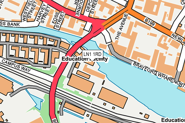
LN1 1RD is located in the Boultham electoral ward, within the local authority district of Lincoln and the English Parliamentary constituency of Lincoln. The Sub Integrated Care Board (ICB) Location is NHS Lincolnshire ICB - 71E and the police force is Lincolnshire. This postcode has been in use since January 1980.


GetTheData
Source: OS OpenMap – Local (Ordnance Survey)
Source: OS VectorMap District (Ordnance Survey)
Licence: Open Government Licence (requires attribution)
| Easting | 496949 |
| Northing | 371239 |
| Latitude | 53.229375 |
| Longitude | -0.549129 |
GetTheData
Source: Open Postcode Geo
Licence: Open Government Licence
| Country | England |
| Postcode District | LN1 |
➜ See where LN1 is on a map ➜ Where is Lincoln? | |
GetTheData
Source: Land Registry Price Paid Data
Licence: Open Government Licence
Elevation or altitude of LN1 1RD as distance above sea level:
| Metres | Feet | |
|---|---|---|
| Elevation | 10m | 33ft |
Elevation is measured from the approximate centre of the postcode, to the nearest point on an OS contour line from OS Terrain 50, which has contour spacing of ten vertical metres.
➜ How high above sea level am I? Find the elevation of your current position using your device's GPS.
GetTheData
Source: Open Postcode Elevation
Licence: Open Government Licence
| Ward | Boultham |
| Constituency | Lincoln |
GetTheData
Source: ONS Postcode Database
Licence: Open Government Licence
| University Of Lincoln (Brayford Way) | Lincoln | 76m |
| Holiday Inn (Brayford Wharf North) | Lincoln | 151m |
| Holmes Road (Carholme Road) | Carholme | 160m |
| Holmes Road (Carholme Road) | Carholme | 174m |
| County Offices (Newland) | Lincoln | 250m |
| Lincoln Central Station | 0.7km |
| Hykeham Station | 5.1km |
GetTheData
Source: NaPTAN
Licence: Open Government Licence
GetTheData
Source: ONS Postcode Database
Licence: Open Government Licence


➜ Get more ratings from the Food Standards Agency
GetTheData
Source: Food Standards Agency
Licence: FSA terms & conditions
| Last Collection | |||
|---|---|---|---|
| Location | Mon-Fri | Sat | Distance |
| Boulthan Park Road P.o. | 17:30 | 12:00 | 399m |
| West Parade Post Office | 17:30 | 11:45 | 448m |
| Outer Circle Drive | 17:45 | 12:15 | 519m |
GetTheData
Source: Dracos
Licence: Creative Commons Attribution-ShareAlike
| Risk of LN1 1RD flooding from rivers and sea | Medium |
| ➜ LN1 1RD flood map | |
GetTheData
Source: Open Flood Risk by Postcode
Licence: Open Government Licence
The below table lists the International Territorial Level (ITL) codes (formerly Nomenclature of Territorial Units for Statistics (NUTS) codes) and Local Administrative Units (LAU) codes for LN1 1RD:
| ITL 1 Code | Name |
|---|---|
| TLF | East Midlands (England) |
| ITL 2 Code | Name |
| TLF3 | Lincolnshire |
| ITL 3 Code | Name |
| TLF30 | Lincolnshire CC |
| LAU 1 Code | Name |
| E07000138 | Lincoln |
GetTheData
Source: ONS Postcode Directory
Licence: Open Government Licence
The below table lists the Census Output Area (OA), Lower Layer Super Output Area (LSOA), and Middle Layer Super Output Area (MSOA) for LN1 1RD:
| Code | Name | |
|---|---|---|
| OA | E00173632 | |
| LSOA | E01026132 | Lincoln 005A |
| MSOA | E02005446 | Lincoln 005 |
GetTheData
Source: ONS Postcode Directory
Licence: Open Government Licence
| LN1 1RF | Holmes Road | 136m |
| LN1 1TJ | Far Wharf | 145m |
| LN1 1TG | Far Wharf | 173m |
| LN1 1RN | Carholme Road | 173m |
| LN1 1TQ | Foss Street | 183m |
| LN1 1YW | Brayford Wharf North | 184m |
| LN1 1RR | Carholme Road | 198m |
| LN1 1RS | Carholme Road | 227m |
| LN1 1TD | Foss Bank | 230m |
| LN1 1RP | Westbourne Grove | 231m |
GetTheData
Source: Open Postcode Geo; Land Registry Price Paid Data
Licence: Open Government Licence