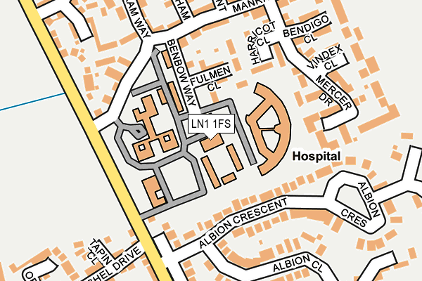
LN1 1FS is located in the Carholme electoral ward, within the local authority district of Lincoln and the English Parliamentary constituency of Lincoln. The Sub Integrated Care Board (ICB) Location is NHS Lincolnshire ICB - 71E and the police force is Lincolnshire. This postcode has been in use since June 1996.


GetTheData
Source: OS OpenMap – Local (Ordnance Survey)
Source: OS VectorMap District (Ordnance Survey)
Licence: Open Government Licence (requires attribution)
| Easting | 496397 |
| Northing | 372861 |
| Latitude | 53.244029 |
| Longitude | -0.556905 |
GetTheData
Source: Open Postcode Geo
Licence: Open Government Licence
| Country | England |
| Postcode District | LN1 |
➜ See where LN1 is on a map ➜ Where is Lincoln? | |
GetTheData
Source: Land Registry Price Paid Data
Licence: Open Government Licence
Elevation or altitude of LN1 1FS as distance above sea level:
| Metres | Feet | |
|---|---|---|
| Elevation | 20m | 66ft |
Elevation is measured from the approximate centre of the postcode, to the nearest point on an OS contour line from OS Terrain 50, which has contour spacing of ten vertical metres.
➜ How high above sea level am I? Find the elevation of your current position using your device's GPS.
GetTheData
Source: Open Postcode Elevation
Licence: Open Government Licence
| Ward | Carholme |
| Constituency | Lincoln |
GetTheData
Source: ONS Postcode Database
Licence: Open Government Licence
| Carram Way (Long Leys Road) | St Georges Hospital | 139m |
| Berilldon Drive (Carram Way) | St Georges Hospital | 248m |
| Curtis Factory (Long Leys Road) | St Georges Hospital | 307m |
| Curtis Factory (Long Leys Road) | St Georges Hospital | 342m |
| Higson Road (Burton Road) | Ermine West | 520m |
| Lincoln Central Station | 2.3km |
GetTheData
Source: NaPTAN
Licence: Open Government Licence
GetTheData
Source: ONS Postcode Database
Licence: Open Government Licence


➜ Get more ratings from the Food Standards Agency
GetTheData
Source: Food Standards Agency
Licence: FSA terms & conditions
| Last Collection | |||
|---|---|---|---|
| Location | Mon-Fri | Sat | Distance |
| Carholme Road | 18:30 | 11:30 | 609m |
| Hillcroft | 16:30 | 11:30 | 691m |
| Yarbrough Crescent | 17:30 | 11:45 | 716m |
GetTheData
Source: Dracos
Licence: Creative Commons Attribution-ShareAlike
The below table lists the International Territorial Level (ITL) codes (formerly Nomenclature of Territorial Units for Statistics (NUTS) codes) and Local Administrative Units (LAU) codes for LN1 1FS:
| ITL 1 Code | Name |
|---|---|
| TLF | East Midlands (England) |
| ITL 2 Code | Name |
| TLF3 | Lincolnshire |
| ITL 3 Code | Name |
| TLF30 | Lincolnshire CC |
| LAU 1 Code | Name |
| E07000138 | Lincoln |
GetTheData
Source: ONS Postcode Directory
Licence: Open Government Licence
The below table lists the Census Output Area (OA), Lower Layer Super Output Area (LSOA), and Middle Layer Super Output Area (MSOA) for LN1 1FS:
| Code | Name | |
|---|---|---|
| OA | E00132759 | |
| LSOA | E01026147 | Lincoln 003C |
| MSOA | E02005444 | Lincoln 003 |
GetTheData
Source: ONS Postcode Directory
Licence: Open Government Licence
| LN1 1AW | Fulmen Close | 105m |
| LN1 1AE | Harricot Close | 136m |
| LN1 1AS | Benbow Way | 147m |
| LN1 1AU | Madden Close | 182m |
| LN1 1AG | Mercer Drive | 186m |
| LN1 1EA | Long Leys Road | 191m |
| LN1 1EW | Long Leys Road | 192m |
| LN1 1AD | Manrico Drive | 203m |
| LN1 1EB | Albion Crescent | 204m |
| LN1 1AB | Carram Way | 217m |
GetTheData
Source: Open Postcode Geo; Land Registry Price Paid Data
Licence: Open Government Licence