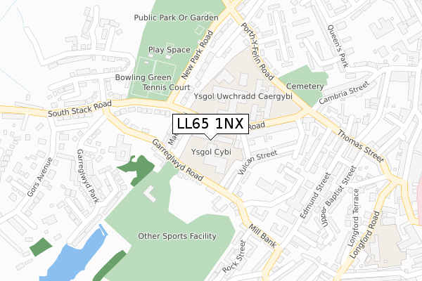
LL65 1NX is located in the Ynys Gybi electoral ward, within the unitary authority of Isle of Anglesey and the Welsh Parliamentary constituency of Ynys Môn. The Local Health Board is Betsi Cadwaladr University and the police force is North Wales. This postcode has been in use since October 2019.


GetTheData
Source: OS Open Zoomstack (Ordnance Survey)
Licence: Open Government Licence (requires attribution)
Attribution: Contains OS data © Crown copyright and database right 2025
Source: Open Postcode Geo
Licence: Open Government Licence (requires attribution)
Attribution: Contains OS data © Crown copyright and database right 2025; Contains Royal Mail data © Royal Mail copyright and database right 2025; Source: Office for National Statistics licensed under the Open Government Licence v.3.0
| Easting | 224190 |
| Northing | 382481 |
| Latitude | 53.310020 |
| Longitude | -4.640308 |
GetTheData
Source: Open Postcode Geo
Licence: Open Government Licence
| Country | Wales |
| Postcode District | LL65 |
➜ See where LL65 is on a map ➜ Where is Holyhead? | |
GetTheData
Source: Land Registry Price Paid Data
Licence: Open Government Licence
| Ward | Ynys Gybi |
| Constituency | Ynys Môn |
GetTheData
Source: ONS Postcode Database
Licence: Open Government Licence
| Chester Inn (Mill Bank) | Holyhead | 178m |
| Bowling Greens (South Stack Road) | Llaingoch | 208m |
| Bowling Greens (South Stack Road) | Llaingoch | 212m |
| British Terrace (Alderley Terrace) | Holyhead | 213m |
| Ysgol Ganradd Caergybi (Porth-y-felin Road) | Porth-y-felin | 239m |
| Holyhead Station | 0.7km |
GetTheData
Source: NaPTAN
Licence: Open Government Licence
GetTheData
Source: ONS Postcode Database
Licence: Open Government Licence


➜ Get more ratings from the Food Standards Agency
GetTheData
Source: Food Standards Agency
Licence: FSA terms & conditions
| Last Collection | |||
|---|---|---|---|
| Location | Mon-Fri | Sat | Distance |
| Gors | 16:00 | 11:45 | 350m |
| Morrison's | 17:30 | 12:30 | 3,105m |
| Market Street | 17:00 | 11:45 | 4,254m |
GetTheData
Source: Dracos
Licence: Creative Commons Attribution-ShareAlike
The below table lists the International Territorial Level (ITL) codes (formerly Nomenclature of Territorial Units for Statistics (NUTS) codes) and Local Administrative Units (LAU) codes for LL65 1NX:
| ITL 1 Code | Name |
|---|---|
| TLL | Wales |
| ITL 2 Code | Name |
| TLL1 | West Wales and The Valleys |
| ITL 3 Code | Name |
| TLL11 | Isle of Anglesey |
| LAU 1 Code | Name |
| W06000001 | Isle of Anglesey |
GetTheData
Source: ONS Postcode Directory
Licence: Open Government Licence
The below table lists the Census Output Area (OA), Lower Layer Super Output Area (LSOA), and Middle Layer Super Output Area (MSOA) for LL65 1NX:
| Code | Name | |
|---|---|---|
| OA | W00000155 | |
| LSOA | W01000030 | Isle of Anglesey 003D |
| MSOA | W02000003 | Isle of Anglesey 003 |
GetTheData
Source: ONS Postcode Directory
Licence: Open Government Licence
| LL65 1NY | Southstack Road | 70m |
| LL65 1TH | Garreglwyd Road | 71m |
| LL65 1TN | Vulcan Street | 94m |
| LL65 1NN | Seiriol Street | 94m |
| LL65 1TG | Maes Y Felin | 127m |
| LL65 1NL | Alderley Terrace | 153m |
| LL65 1TL | Vulcan Street | 156m |
| LL65 1NS | Garreglwyd Road | 175m |
| LL65 1TE | Mill Bank | 220m |
| LL65 1PH | New Park Road | 230m |
GetTheData
Source: Open Postcode Geo; Land Registry Price Paid Data
Licence: Open Government Licence