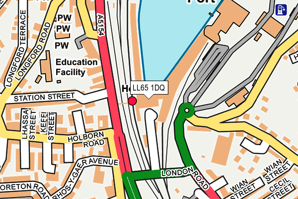
LL65 1DQ is located in the Tref Cybi electoral ward, within the unitary authority of Isle of Anglesey and the Welsh Parliamentary constituency of Ynys Môn. The Local Health Board is Betsi Cadwaladr University and the police force is North Wales. This postcode has been in use since September 1991.


GetTheData
Source: OS OpenMap – Local (Ordnance Survey)
Source: OS VectorMap District (Ordnance Survey)
Licence: Open Government Licence (requires attribution)
| Easting | 224784 |
| Northing | 382195 |
| Latitude | 53.307632 |
| Longitude | -4.631239 |
GetTheData
Source: Open Postcode Geo
Licence: Open Government Licence
| Country | Wales |
| Postcode District | LL65 |
➜ See where LL65 is on a map ➜ Where is Holyhead? | |
GetTheData
Source: Land Registry Price Paid Data
Licence: Open Government Licence
Elevation or altitude of LL65 1DQ as distance above sea level:
| Metres | Feet | |
|---|---|---|
| Elevation | 10m | 33ft |
Elevation is measured from the approximate centre of the postcode, to the nearest point on an OS contour line from OS Terrain 50, which has contour spacing of ten vertical metres.
➜ How high above sea level am I? Find the elevation of your current position using your device's GPS.
GetTheData
Source: Open Postcode Elevation
Licence: Open Government Licence
| Ward | Tref Cybi |
| Constituency | Ynys Môn |
GetTheData
Source: ONS Postcode Database
Licence: Open Government Licence
| Railway Station (Victoria Road) | Holyhead | 81m |
| Railway Station (Victoria Street) | Holyhead | 90m |
| Port (Grounds) | Holyhead | 152m |
| Clock (Victoria Terrace) | Holyhead | 208m |
| King's Road | Holyhead | 320m |
| Holyhead Station | 0km |
| Valley Station | 5.4km |
GetTheData
Source: NaPTAN
Licence: Open Government Licence
GetTheData
Source: ONS Postcode Database
Licence: Open Government Licence


➜ Get more ratings from the Food Standards Agency
GetTheData
Source: Food Standards Agency
Licence: FSA terms & conditions
| Last Collection | |||
|---|---|---|---|
| Location | Mon-Fri | Sat | Distance |
| Gors | 16:00 | 11:45 | 1,006m |
| Morrison's | 17:30 | 12:30 | 2,632m |
| Market Street | 17:00 | 11:45 | 3,832m |
GetTheData
Source: Dracos
Licence: Creative Commons Attribution-ShareAlike
The below table lists the International Territorial Level (ITL) codes (formerly Nomenclature of Territorial Units for Statistics (NUTS) codes) and Local Administrative Units (LAU) codes for LL65 1DQ:
| ITL 1 Code | Name |
|---|---|
| TLL | Wales |
| ITL 2 Code | Name |
| TLL1 | West Wales and The Valleys |
| ITL 3 Code | Name |
| TLL11 | Isle of Anglesey |
| LAU 1 Code | Name |
| W06000001 | Isle of Anglesey |
GetTheData
Source: ONS Postcode Directory
Licence: Open Government Licence
The below table lists the Census Output Area (OA), Lower Layer Super Output Area (LSOA), and Middle Layer Super Output Area (MSOA) for LL65 1DQ:
| Code | Name | |
|---|---|---|
| OA | W00000165 | |
| LSOA | W01000033 | Isle of Anglesey 003E |
| MSOA | W02000003 | Isle of Anglesey 003 |
GetTheData
Source: ONS Postcode Directory
Licence: Open Government Licence
| LL65 2HW | Rhos Y Gaer Terrace | 103m |
| LL65 2HP | Church Terrace | 130m |
| LL65 2BU | Black Bridge | 134m |
| LL65 2HU | Holborn Close | 135m |
| LL65 2DF | Turkey Shore Road | 171m |
| LL65 1UT | Victoria Terrace | 177m |
| LL65 2AS | Holborn Road | 179m |
| LL65 2HS | Bodlondeb Terrace | 185m |
| LL65 2BY | Tan Alltran Close | 201m |
| LL65 2BD | Herbert Street | 207m |
GetTheData
Source: Open Postcode Geo; Land Registry Price Paid Data
Licence: Open Government Licence