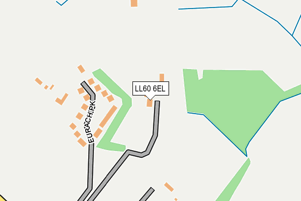
LL60 6EL is located in the Bodowyr electoral ward, within the unitary authority of Isle of Anglesey and the Welsh Parliamentary constituency of Ynys Môn. The Local Health Board is Betsi Cadwaladr University and the police force is North Wales. This postcode has been in use since January 1980.


GetTheData
Source: OS OpenMap – Local (Ordnance Survey)
Source: OS VectorMap District (Ordnance Survey)
Licence: Open Government Licence (requires attribution)
| Easting | 250089 |
| Northing | 370531 |
| Latitude | 53.210639 |
| Longitude | -4.246291 |
GetTheData
Source: Open Postcode Geo
Licence: Open Government Licence
| Country | Wales |
| Postcode District | LL60 |
➜ See where LL60 is on a map ➜ Where is Llanddaniel Fab? | |
GetTheData
Source: Land Registry Price Paid Data
Licence: Open Government Licence
Elevation or altitude of LL60 6EL as distance above sea level:
| Metres | Feet | |
|---|---|---|
| Elevation | 50m | 164ft |
Elevation is measured from the approximate centre of the postcode, to the nearest point on an OS contour line from OS Terrain 50, which has contour spacing of ten vertical metres.
➜ How high above sea level am I? Find the elevation of your current position using your device's GPS.
GetTheData
Source: Open Postcode Elevation
Licence: Open Government Licence
| Ward | Bodowyr |
| Constituency | Ynys Môn |
GetTheData
Source: ONS Postcode Database
Licence: Open Government Licence
| Post Office (Main Road) | Llanddaniel Fab | 513m |
| Post Office (Main Road) | Llanddaniel Fab | 541m |
| Tan-y-capel (Main Road) | Llanddaniel Fab | 657m |
| Tan-y-capel (Main Road) | Llanddaniel Fab | 661m |
| Meddygfa Star (Holyhead Road) | Gaerwen | 1,465m |
| Llanfairpwll Station | 2.7km |
GetTheData
Source: NaPTAN
Licence: Open Government Licence
| Percentage of properties with Next Generation Access | 100.0% |
| Percentage of properties with Superfast Broadband | 100.0% |
| Percentage of properties with Ultrafast Broadband | 0.0% |
| Percentage of properties with Full Fibre Broadband | 0.0% |
Superfast Broadband is between 30Mbps and 300Mbps
Ultrafast Broadband is > 300Mbps
| Percentage of properties unable to receive 2Mbps | 0.0% |
| Percentage of properties unable to receive 5Mbps | 0.0% |
| Percentage of properties unable to receive 10Mbps | 0.0% |
| Percentage of properties unable to receive 30Mbps | 0.0% |
GetTheData
Source: Ofcom
Licence: Ofcom Terms of Use (requires attribution)
GetTheData
Source: ONS Postcode Database
Licence: Open Government Licence


➜ Get more ratings from the Food Standards Agency
GetTheData
Source: Food Standards Agency
Licence: FSA terms & conditions
| Last Collection | |||
|---|---|---|---|
| Location | Mon-Fri | Sat | Distance |
| Star | 12:15 | 10:30 | 1,682m |
| Llanedwen | 10:00 | 09:45 | 1,692m |
| Pringle | 16:30 | 10:00 | 2,664m |
GetTheData
Source: Dracos
Licence: Creative Commons Attribution-ShareAlike
The below table lists the International Territorial Level (ITL) codes (formerly Nomenclature of Territorial Units for Statistics (NUTS) codes) and Local Administrative Units (LAU) codes for LL60 6EL:
| ITL 1 Code | Name |
|---|---|
| TLL | Wales |
| ITL 2 Code | Name |
| TLL1 | West Wales and The Valleys |
| ITL 3 Code | Name |
| TLL11 | Isle of Anglesey |
| LAU 1 Code | Name |
| W06000001 | Isle of Anglesey |
GetTheData
Source: ONS Postcode Directory
Licence: Open Government Licence
The below table lists the Census Output Area (OA), Lower Layer Super Output Area (LSOA), and Middle Layer Super Output Area (MSOA) for LL60 6EL:
| Code | Name | |
|---|---|---|
| OA | W00000133 | |
| LSOA | W01000027 | Isle of Anglesey 009C |
| MSOA | W02000009 | Isle of Anglesey 009 |
GetTheData
Source: ONS Postcode Directory
Licence: Open Government Licence
| LL60 6EQ | Eurach Park | 132m |
| LL60 6EH | 175m | |
| LL60 6EP | 276m | |
| LL60 6EW | Cae Mawr | 399m |
| LL60 6HW | Stad Plas Hen | 431m |
| LL60 6EU | Tre Gof | 456m |
| LL60 6HB | 477m | |
| LL60 6EG | 484m | |
| LL60 6HA | Glan Waun | 500m |
| LL60 6EY | Maes Gwyn | 512m |
GetTheData
Source: Open Postcode Geo; Land Registry Price Paid Data
Licence: Open Government Licence