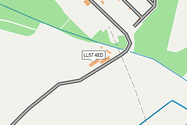
LL57 4ED is located in the Penisa'r-waun electoral ward, within the unitary authority of Gwynedd and the Welsh Parliamentary constituency of Arfon. The Local Health Board is Betsi Cadwaladr University and the police force is North Wales. This postcode has been in use since January 1980.


GetTheData
Source: OS OpenMap – Local (Ordnance Survey)
Source: OS VectorMap District (Ordnance Survey)
Licence: Open Government Licence (requires attribution)
| Easting | 255856 |
| Northing | 367535 |
| Latitude | 53.185324 |
| Longitude | -4.158649 |
GetTheData
Source: Open Postcode Geo
Licence: Open Government Licence
| Country | Wales |
| Postcode District | LL57 |
➜ See where LL57 is on a map | |
GetTheData
Source: Land Registry Price Paid Data
Licence: Open Government Licence
Elevation or altitude of LL57 4ED as distance above sea level:
| Metres | Feet | |
|---|---|---|
| Elevation | 110m | 361ft |
Elevation is measured from the approximate centre of the postcode, to the nearest point on an OS contour line from OS Terrain 50, which has contour spacing of ten vertical metres.
➜ How high above sea level am I? Find the elevation of your current position using your device's GPS.
GetTheData
Source: Open Postcode Elevation
Licence: Open Government Licence
| Ward | Penisa'r-waun |
| Constituency | Arfon |
GetTheData
Source: ONS Postcode Database
Licence: Open Government Licence
| Ty Mawr (B4547) | Llanddeiniolen | 553m |
| Ty Mawr (B4366) | Llanddeiniolen | 613m |
| Groeslon Ty Mawr (B4366) | Llanddeiniolen | 669m |
| Groeslon Ty Mawr (B4366) | Llanddeiniolen | 674m |
| Rhosywylfa (B4547) | Seion | 775m |
| Bangor (Gwynedd) Station | 4.4km |
| Llanfairpwll Station | 5.2km |
GetTheData
Source: NaPTAN
Licence: Open Government Licence
GetTheData
Source: ONS Postcode Database
Licence: Open Government Licence


➜ Get more ratings from the Food Standards Agency
GetTheData
Source: Food Standards Agency
Licence: FSA terms & conditions
| Last Collection | |||
|---|---|---|---|
| Location | Mon-Fri | Sat | Distance |
| Ynys Iago Pentir | 09:00 | 07:30 | 1,481m |
| Capel Craig | 16:48 | 07:15 | 2,295m |
| Tesco Stores | 17:30 | 12:00 | 2,378m |
GetTheData
Source: Dracos
Licence: Creative Commons Attribution-ShareAlike
The below table lists the International Territorial Level (ITL) codes (formerly Nomenclature of Territorial Units for Statistics (NUTS) codes) and Local Administrative Units (LAU) codes for LL57 4ED:
| ITL 1 Code | Name |
|---|---|
| TLL | Wales |
| ITL 2 Code | Name |
| TLL1 | West Wales and The Valleys |
| ITL 3 Code | Name |
| TLL12 | Gwynedd |
| LAU 1 Code | Name |
| W06000002 | Gwynedd |
GetTheData
Source: ONS Postcode Directory
Licence: Open Government Licence
The below table lists the Census Output Area (OA), Lower Layer Super Output Area (LSOA), and Middle Layer Super Output Area (MSOA) for LL57 4ED:
| Code | Name | |
|---|---|---|
| OA | W00000508 | |
| LSOA | W01000099 | Gwynedd 005C |
| MSOA | W02000014 | Gwynedd 005 |
GetTheData
Source: ONS Postcode Directory
Licence: Open Government Licence
| LL56 4QE | 705m | |
| LL56 4QU | 811m | |
| LL57 4EB | 824m | |
| LL55 3AG | Cae Rhos Terrace | 1064m |
| LL56 4QD | 1235m | |
| LL55 3AF | Seion Terrace | 1257m |
| LL55 3AE | 1337m | |
| LL57 4EF | 1477m | |
| LL57 4DY | 1497m | |
| LL57 4EA | 1590m |
GetTheData
Source: Open Postcode Geo; Land Registry Price Paid Data
Licence: Open Government Licence