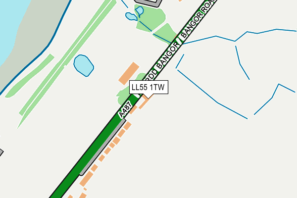
LL55 1TW lies on Bangor Road in Caernarfon. LL55 1TW is located in the Menai electoral ward, within the unitary authority of Gwynedd and the Welsh Parliamentary constituency of Arfon. The Local Health Board is Betsi Cadwaladr University and the police force is North Wales. This postcode has been in use since March 2023.


GetTheData
Source: OS OpenMap – Local (Ordnance Survey)
Source: OS VectorMap District (Ordnance Survey)
Licence: Open Government Licence (requires attribution)
| Easting | 249128 |
| Northing | 364617 |
| Latitude | 53.157265 |
| Longitude | -4.257883 |
GetTheData
Source: Open Postcode Geo
Licence: Open Government Licence
| Street | Bangor Road |
| Town/City | Caernarfon |
| Country | Wales |
| Postcode District | LL55 |
➜ See where LL55 is on a map ➜ Where is Caernarfon? | |
GetTheData
Source: Land Registry Price Paid Data
Licence: Open Government Licence
Elevation or altitude of LL55 1TW as distance above sea level:
| Metres | Feet | |
|---|---|---|
| Elevation | 20m | 66ft |
Elevation is measured from the approximate centre of the postcode, to the nearest point on an OS contour line from OS Terrain 50, which has contour spacing of ten vertical metres.
➜ How high above sea level am I? Find the elevation of your current position using your device's GPS.
GetTheData
Source: Open Postcode Elevation
Licence: Open Government Licence
| Ward | Menai |
| Constituency | Arfon |
GetTheData
Source: ONS Postcode Database
Licence: Open Government Licence
PLAS BRERETON, BANGOR ROAD, CAERNARFON, LL55 1TW 2015 15 APR £591,146 |
GetTheData
Source: HM Land Registry Price Paid Data
Licence: Contains HM Land Registry data © Crown copyright and database right 2025. This data is licensed under the Open Government Licence v3.0.
| Tal Menai (Caernarfon Road) | Waterloo Port | 331m |
| Tal Menai (Caernarfon Road) | Waterloo Port | 360m |
| Ffordd Bangor (Bangor Road) | Waterloo Port | 543m |
| Ffordd Bangor Road (Bangor Road) | Waterloo Port | 648m |
| Waterloo Port (North Road) | Waterloo Port | 777m |
GetTheData
Source: NaPTAN
Licence: Open Government Licence
GetTheData
Source: ONS Postcode Database
Licence: Open Government Licence


➜ Get more ratings from the Food Standards Agency
GetTheData
Source: Food Standards Agency
Licence: FSA terms & conditions
| Last Collection | |||
|---|---|---|---|
| Location | Mon-Fri | Sat | Distance |
| Anglesey Sea Zoo | 16:45 | 10:00 | 1,578m |
| Ty Coch | 10:30 | 08:15 | 2,037m |
| Caernarfon Delivery Office | 17:30 | 13:00 | 2,201m |
GetTheData
Source: Dracos
Licence: Creative Commons Attribution-ShareAlike
The below table lists the International Territorial Level (ITL) codes (formerly Nomenclature of Territorial Units for Statistics (NUTS) codes) and Local Administrative Units (LAU) codes for LL55 1TW:
| ITL 1 Code | Name |
|---|---|
| TLL | Wales |
| ITL 2 Code | Name |
| TLL1 | West Wales and The Valleys |
| ITL 3 Code | Name |
| TLL12 | Gwynedd |
| LAU 1 Code | Name |
| W06000002 | Gwynedd |
GetTheData
Source: ONS Postcode Directory
Licence: Open Government Licence
The below table lists the Census Output Area (OA), Lower Layer Super Output Area (LSOA), and Middle Layer Super Output Area (MSOA) for LL55 1TW:
| Code | Name | |
|---|---|---|
| OA | W00000474 | |
| LSOA | W01000093 | Gwynedd 006B |
| MSOA | W02000015 | Gwynedd 006 |
GetTheData
Source: ONS Postcode Directory
Licence: Open Government Licence
| LL55 1TP | Bangor Road | 344m |
| LL55 1LS | Bangor Road | 347m |
| LL55 1LR | Bangor Road | 555m |
| LL55 1LP | Marine Terrace | 620m |
| LL55 1LF | Ffordd Menai | 827m |
| LL55 1LL | Cae Gwyn | 905m |
| LL55 1LN | Bangor Road | 969m |
| LL55 1DY | Bethel Road | 991m |
| LL55 1EN | Llys Gwyn | 1059m |
| LL55 1LE | Llys Meirion | 1064m |
GetTheData
Source: Open Postcode Geo; Land Registry Price Paid Data
Licence: Open Government Licence