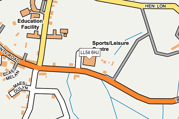
LL54 6HJ is located in the Pen-y-groes electoral ward, within the unitary authority of Gwynedd and the Welsh Parliamentary constituency of Arfon. The Local Health Board is Betsi Cadwaladr University and the police force is North Wales. This postcode has been in use since January 1995.


GetTheData
Source: OS OpenMap – Local (Ordnance Survey)
Source: OS VectorMap District (Ordnance Survey)
Licence: Open Government Licence (requires attribution)
| Easting | 247549 |
| Northing | 353064 |
| Latitude | 53.053030 |
| Longitude | -4.275983 |
GetTheData
Source: Open Postcode Geo
Licence: Open Government Licence
| Country | Wales |
| Postcode District | LL54 |
➜ See where LL54 is on a map ➜ Where is Penygroes? | |
GetTheData
Source: Land Registry Price Paid Data
Licence: Open Government Licence
Elevation or altitude of LL54 6HJ as distance above sea level:
| Metres | Feet | |
|---|---|---|
| Elevation | 110m | 361ft |
Elevation is measured from the approximate centre of the postcode, to the nearest point on an OS contour line from OS Terrain 50, which has contour spacing of ten vertical metres.
➜ How high above sea level am I? Find the elevation of your current position using your device's GPS.
GetTheData
Source: Open Postcode Elevation
Licence: Open Government Licence
| Ward | Pen-y-groes |
| Constituency | Arfon |
GetTheData
Source: ONS Postcode Database
Licence: Open Government Licence
| Leisure Centre (County Road) | Penygroes | 146m |
| Leisure Centre (County Road) | Penygroes | 149m |
| Ysgol Dyffryn Nantlle (King`s Road) | Penygroes | 157m |
| Ysgol Dyffryn Nantlle (King`s Road) | Penygroes | 184m |
| Rhwng Llwyni (King`s Road) | Penygroes | 303m |
GetTheData
Source: NaPTAN
Licence: Open Government Licence
GetTheData
Source: ONS Postcode Database
Licence: Open Government Licence


➜ Get more ratings from the Food Standards Agency
GetTheData
Source: Food Standards Agency
Licence: FSA terms & conditions
| Last Collection | |||
|---|---|---|---|
| Location | Mon-Fri | Sat | Distance |
| Groeslon Post Office | 16:45 | 11:30 | 2,900m |
| Swan Pontllyfni | 09:30 | 08:15 | 3,757m |
| Tailon | 11:00 | 09:45 | 4,384m |
GetTheData
Source: Dracos
Licence: Creative Commons Attribution-ShareAlike
The below table lists the International Territorial Level (ITL) codes (formerly Nomenclature of Territorial Units for Statistics (NUTS) codes) and Local Administrative Units (LAU) codes for LL54 6HJ:
| ITL 1 Code | Name |
|---|---|
| TLL | Wales |
| ITL 2 Code | Name |
| TLL1 | West Wales and The Valleys |
| ITL 3 Code | Name |
| TLL12 | Gwynedd |
| LAU 1 Code | Name |
| W06000002 | Gwynedd |
GetTheData
Source: ONS Postcode Directory
Licence: Open Government Licence
The below table lists the Census Output Area (OA), Lower Layer Super Output Area (LSOA), and Middle Layer Super Output Area (MSOA) for LL54 6HJ:
| Code | Name | |
|---|---|---|
| OA | W00000526 | |
| LSOA | W01000104 | Gwynedd 008C |
| MSOA | W02000017 | Gwynedd 008 |
GetTheData
Source: ONS Postcode Directory
Licence: Open Government Licence
| LL54 6HE | County Road | 50m |
| LL54 6RL | Kings Road | 194m |
| LL54 6EY | County Road | 245m |
| LL54 6RG | Henlon | 256m |
| LL54 6RW | Maes Dulyn | 263m |
| LL54 6RN | Tyn Y Weirglodd | 292m |
| LL54 6RH | Rhwng Llwyni Terrace | 301m |
| LL54 6HD | Victoria Road | 351m |
| LL54 6RF | Carmel Road | 357m |
| LL54 6ET | Llwyn Fuches | 360m |
GetTheData
Source: Open Postcode Geo; Land Registry Price Paid Data
Licence: Open Government Licence