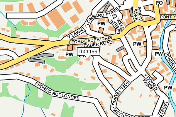
LL40 1RR is located in the De Dolgellau electoral ward, within the unitary authority of Gwynedd and the Welsh Parliamentary constituency of Dwyfor Meirionnydd. The Local Health Board is Betsi Cadwaladr University and the police force is North Wales. This postcode has been in use since January 1980.


GetTheData
Source: OS OpenMap – Local (Ordnance Survey)
Source: OS VectorMap District (Ordnance Survey)
Licence: Open Government Licence (requires attribution)
| Easting | 272643 |
| Northing | 317628 |
| Latitude | 52.741231 |
| Longitude | -3.887939 |
GetTheData
Source: Open Postcode Geo
Licence: Open Government Licence
| Country | Wales |
| Postcode District | LL40 |
➜ See where LL40 is on a map ➜ Where is Dolgellau? | |
GetTheData
Source: Land Registry Price Paid Data
Licence: Open Government Licence
Elevation or altitude of LL40 1RR as distance above sea level:
| Metres | Feet | |
|---|---|---|
| Elevation | 30m | 98ft |
Elevation is measured from the approximate centre of the postcode, to the nearest point on an OS contour line from OS Terrain 50, which has contour spacing of ten vertical metres.
➜ How high above sea level am I? Find the elevation of your current position using your device's GPS.
GetTheData
Source: Open Postcode Elevation
Licence: Open Government Licence
| Ward | De Dolgellau |
| Constituency | Dwyfor Meirionnydd |
GetTheData
Source: ONS Postcode Database
Licence: Open Government Licence
| Penbryn Garage (Cader Idris Road) | Dolgellau | 186m |
| Sgwƒr Eldon Square (High Street) | Dolgellau | 198m |
| Sgwƒr Eldon Square (High Street) | Dolgellau | 204m |
| Primary School (Bala Road) | Dolgellau | 437m |
| Primary School (Bala Road) | Dolgellau | 446m |
GetTheData
Source: NaPTAN
Licence: Open Government Licence
GetTheData
Source: ONS Postcode Database
Licence: Open Government Licence


➜ Get more ratings from the Food Standards Agency
GetTheData
Source: Food Standards Agency
Licence: FSA terms & conditions
| Last Collection | |||
|---|---|---|---|
| Location | Mon-Fri | Sat | Distance |
| Ysgol Brithdir | 17:00 | 10:45 | 3,604m |
| Brithdir | 16:45 | 10:45 | 4,559m |
| Dolserau Terrace | 16:45 | 09:45 | 4,960m |
GetTheData
Source: Dracos
Licence: Creative Commons Attribution-ShareAlike
The below table lists the International Territorial Level (ITL) codes (formerly Nomenclature of Territorial Units for Statistics (NUTS) codes) and Local Administrative Units (LAU) codes for LL40 1RR:
| ITL 1 Code | Name |
|---|---|
| TLL | Wales |
| ITL 2 Code | Name |
| TLL1 | West Wales and The Valleys |
| ITL 3 Code | Name |
| TLL12 | Gwynedd |
| LAU 1 Code | Name |
| W06000002 | Gwynedd |
GetTheData
Source: ONS Postcode Directory
Licence: Open Government Licence
The below table lists the Census Output Area (OA), Lower Layer Super Output Area (LSOA), and Middle Layer Super Output Area (MSOA) for LL40 1RR:
| Code | Name | |
|---|---|---|
| OA | W00000350 | |
| LSOA | W01000068 | Gwynedd 016E |
| MSOA | W02000025 | Gwynedd 016 |
GetTheData
Source: ONS Postcode Directory
Licence: Open Government Licence
| LL40 1RW | Love Lane | 49m |
| LL40 1RS | Cader Road | 53m |
| LL40 1RT | Idris Terrace | 58m |
| LL40 1RP | Mount Pleasant Road | 62m |
| LL40 1SR | 68m | |
| LL40 1RJ | Cader Road | 77m |
| LL40 1SA | Park Lane | 82m |
| LL40 1RN | Cader Road | 84m |
| LL40 1RH | Cader Road | 88m |
| LL40 1RU | Cader Road | 89m |
GetTheData
Source: Open Postcode Geo; Land Registry Price Paid Data
Licence: Open Government Licence