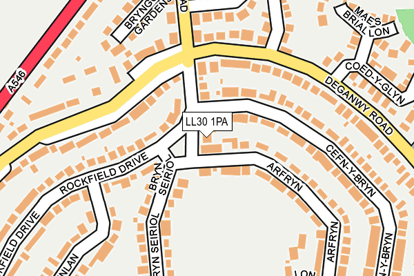
LL30 1PA lies on Rockfield Drive in Llandudno. LL30 1PA is located in the Deganwy electoral ward, within the unitary authority of Conwy and the Welsh Parliamentary constituency of Aberconwy. The Local Health Board is Betsi Cadwaladr University and the police force is North Wales. This postcode has been in use since January 1980.


GetTheData
Source: OS OpenMap – Local (Ordnance Survey)
Source: OS VectorMap District (Ordnance Survey)
Licence: Open Government Licence (requires attribution)
| Easting | 278159 |
| Northing | 380090 |
| Latitude | 53.303700 |
| Longitude | -3.829883 |
GetTheData
Source: Open Postcode Geo
Licence: Open Government Licence
| Street | Rockfield Drive |
| Town/City | Llandudno |
| Country | Wales |
| Postcode District | LL30 |
➜ See where LL30 is on a map ➜ Where is Conwy? | |
GetTheData
Source: Land Registry Price Paid Data
Licence: Open Government Licence
Elevation or altitude of LL30 1PA as distance above sea level:
| Metres | Feet | |
|---|---|---|
| Elevation | 50m | 164ft |
Elevation is measured from the approximate centre of the postcode, to the nearest point on an OS contour line from OS Terrain 50, which has contour spacing of ten vertical metres.
➜ How high above sea level am I? Find the elevation of your current position using your device's GPS.
GetTheData
Source: Open Postcode Elevation
Licence: Open Government Licence
| Ward | Deganwy |
| Constituency | Aberconwy |
GetTheData
Source: ONS Postcode Database
Licence: Open Government Licence
48, ROCKFIELD DRIVE, LLANDUDNO, LL30 1PA 2020 21 DEC £325,000 |
46, ROCKFIELD DRIVE, LLANDUDNO, LL30 1PA 2018 5 NOV £366,250 |
42, ROCKFIELD DRIVE, LLANDUDNO, LL30 1PA 2009 24 JUL £350,000 |
44, ROCKFIELD DRIVE, LLANDUDNO, LL30 1PA 2007 4 MAY £410,000 |
44, ROCKFIELD DRIVE, LLANDUDNO, LL30 1PA 2004 17 AUG £275,000 |
GetTheData
Source: HM Land Registry Price Paid Data
Licence: Contains HM Land Registry data © Crown copyright and database right 2025. This data is licensed under the Open Government Licence v3.0.
| Bryn Seiriol | Deganwy | 77m |
| Bryn-y-fedwen (Deganwy Road) | Deganwy | 130m |
| Bryn-y-fedwen (Deganwy Road) | Deganwy | 171m |
| Bryn Seiriol | Deganwy | 233m |
| Penlan | Deganwy | 276m |
| Deganwy Station | 1km |
| Llandudno Station | 1.9km |
| Llandudno Junction Station | 2.6km |
GetTheData
Source: NaPTAN
Licence: Open Government Licence
| Percentage of properties with Next Generation Access | 100.0% |
| Percentage of properties with Superfast Broadband | 100.0% |
| Percentage of properties with Ultrafast Broadband | 0.0% |
| Percentage of properties with Full Fibre Broadband | 0.0% |
Superfast Broadband is between 30Mbps and 300Mbps
Ultrafast Broadband is > 300Mbps
| Percentage of properties unable to receive 2Mbps | 0.0% |
| Percentage of properties unable to receive 5Mbps | 0.0% |
| Percentage of properties unable to receive 10Mbps | 0.0% |
| Percentage of properties unable to receive 30Mbps | 0.0% |
GetTheData
Source: Ofcom
Licence: Ofcom Terms of Use (requires attribution)
GetTheData
Source: ONS Postcode Database
Licence: Open Government Licence


➜ Get more ratings from the Food Standards Agency
GetTheData
Source: Food Standards Agency
Licence: FSA terms & conditions
| Last Collection | |||
|---|---|---|---|
| Location | Mon-Fri | Sat | Distance |
| Tre Cwm | 17:05 | 11:30 | 1,099m |
| Llandudno Delivery Office | 17:30 | 12:30 | 1,212m |
| Victoria Drive | 17:10 | 11:15 | 1,733m |
GetTheData
Source: Dracos
Licence: Creative Commons Attribution-ShareAlike
The below table lists the International Territorial Level (ITL) codes (formerly Nomenclature of Territorial Units for Statistics (NUTS) codes) and Local Administrative Units (LAU) codes for LL30 1PA:
| ITL 1 Code | Name |
|---|---|
| TLL | Wales |
| ITL 2 Code | Name |
| TLL1 | West Wales and The Valleys |
| ITL 3 Code | Name |
| TLL13 | Conwy and Denbighshire |
| LAU 1 Code | Name |
| W06000003 | Conwy |
GetTheData
Source: ONS Postcode Directory
Licence: Open Government Licence
The below table lists the Census Output Area (OA), Lower Layer Super Output Area (LSOA), and Middle Layer Super Output Area (MSOA) for LL30 1PA:
| Code | Name | |
|---|---|---|
| OA | W00000721 | |
| LSOA | W01000135 | Conwy 006A |
| MSOA | W02000032 | Conwy 006 |
GetTheData
Source: ONS Postcode Directory
Licence: Open Government Licence
| LL30 1NY | Rockfield Drive | 76m |
| LL30 1NH | Cefn Y Bryn | 150m |
| LL30 1NA | Deganwy Road | 178m |
| LL30 1NE | Deganwy Road | 178m |
| LL30 1PB | Arfryn | 193m |
| LL30 1PD | Bryn Seiriol | 198m |
| LL30 1NU | Bryngosol Gardens | 223m |
| LL30 1PL | Bryn Y Fedwen | 229m |
| LL30 1NS | Conway Crescent | 242m |
| LL30 1NR | Maesdu Avenue | 250m |
GetTheData
Source: Open Postcode Geo; Land Registry Price Paid Data
Licence: Open Government Licence