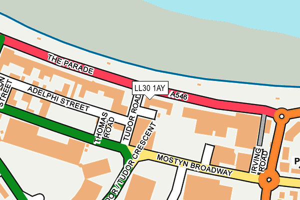
LL30 1AY is located in the Tudno electoral ward, within the unitary authority of Conwy and the Welsh Parliamentary constituency of Aberconwy. The Local Health Board is Betsi Cadwaladr University and the police force is North Wales. This postcode has been in use since January 1980.


GetTheData
Source: OS OpenMap – Local (Ordnance Survey)
Source: OS VectorMap District (Ordnance Survey)
Licence: Open Government Licence (requires attribution)
| Easting | 278934 |
| Northing | 382135 |
| Latitude | 53.322250 |
| Longitude | -3.819040 |
GetTheData
Source: Open Postcode Geo
Licence: Open Government Licence
| Country | Wales |
| Postcode District | LL30 |
➜ See where LL30 is on a map ➜ Where is Llandudno? | |
GetTheData
Source: Land Registry Price Paid Data
Licence: Open Government Licence
Elevation or altitude of LL30 1AY as distance above sea level:
| Metres | Feet | |
|---|---|---|
| Elevation | 10m | 33ft |
Elevation is measured from the approximate centre of the postcode, to the nearest point on an OS contour line from OS Terrain 50, which has contour spacing of ten vertical metres.
➜ How high above sea level am I? Find the elevation of your current position using your device's GPS.
GetTheData
Source: Open Postcode Elevation
Licence: Open Government Licence
| Ward | Tudno |
| Constituency | Aberconwy |
GetTheData
Source: ONS Postcode Database
Licence: Open Government Licence
| Venue Cymru (Mostyn Broadway) | Llandudno | 125m |
| Coach Park (Mostyn Broadway) | Llandudno | 162m |
| B&q (Mostyn Broadway) | Llandudno | 222m |
| Grand Theatre (Mostyn Broadway) | Llandudno | 235m |
| Law Courts (Conway Road) | Llandudno | 335m |
| Victoria Station (Great Orme Tramway) | Llandudno | 1,234m |
| Llandudno Station | 0.6km |
| Deganwy Station | 3.2km |
| Llandudno Junction Station | 4.3km |
GetTheData
Source: NaPTAN
Licence: Open Government Licence
GetTheData
Source: ONS Postcode Database
Licence: Open Government Licence


➜ Get more ratings from the Food Standards Agency
GetTheData
Source: Food Standards Agency
Licence: FSA terms & conditions
| Last Collection | |||
|---|---|---|---|
| Location | Mon-Fri | Sat | Distance |
| East Parade | 17:20 | 11:30 | 406m |
| St Georges Crescent | 17:15 | 11:30 | 559m |
| Mostyn Street Post Office | 17:10 | 11:30 | 711m |
GetTheData
Source: Dracos
Licence: Creative Commons Attribution-ShareAlike
The below table lists the International Territorial Level (ITL) codes (formerly Nomenclature of Territorial Units for Statistics (NUTS) codes) and Local Administrative Units (LAU) codes for LL30 1AY:
| ITL 1 Code | Name |
|---|---|
| TLL | Wales |
| ITL 2 Code | Name |
| TLL1 | West Wales and The Valleys |
| ITL 3 Code | Name |
| TLL13 | Conwy and Denbighshire |
| LAU 1 Code | Name |
| W06000003 | Conwy |
GetTheData
Source: ONS Postcode Directory
Licence: Open Government Licence
The below table lists the Census Output Area (OA), Lower Layer Super Output Area (LSOA), and Middle Layer Super Output Area (MSOA) for LL30 1AY:
| Code | Name | |
|---|---|---|
| OA | W00001004 | |
| LSOA | W01000186 | Conwy 001E |
| MSOA | W02000027 | Conwy 001 |
GetTheData
Source: ONS Postcode Directory
Licence: Open Government Licence
| LL30 1BU | Tudor Road | 105m |
| LL30 1AT | Nevill Crescent | 178m |
| LL30 1AR | Mostyn Crescent | 223m |
| LL30 1AL | Adelphi Street | 259m |
| LL30 1YG | Mostyn Broadway | 290m |
| LL30 1YN | Mostyn Broadway | 299m |
| LL30 1BZ | Clarence Road | 307m |
| LL30 1AW | Vaughan Street | 310m |
| LL30 1AH | Vaughan Street | 314m |
| LL30 1YT | Mostyn Broadway | 336m |
GetTheData
Source: Open Postcode Geo; Land Registry Price Paid Data
Licence: Open Government Licence