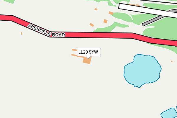
LL29 9YW is located in the Llysfaen electoral ward, within the unitary authority of Conwy and the Welsh Parliamentary constituency of Clwyd West. The Local Health Board is Betsi Cadwaladr University and the police force is North Wales. This postcode has been in use since January 1980.


GetTheData
Source: OS OpenMap – Local (Ordnance Survey)
Source: OS VectorMap District (Ordnance Survey)
Licence: Open Government Licence (requires attribution)
| Easting | 288846 |
| Northing | 378234 |
| Latitude | 53.289376 |
| Longitude | -3.668935 |
GetTheData
Source: Open Postcode Geo
Licence: Open Government Licence
| Country | Wales |
| Postcode District | LL29 |
➜ See where LL29 is on a map | |
GetTheData
Source: Land Registry Price Paid Data
Licence: Open Government Licence
Elevation or altitude of LL29 9YW as distance above sea level:
| Metres | Feet | |
|---|---|---|
| Elevation | 90m | 295ft |
Elevation is measured from the approximate centre of the postcode, to the nearest point on an OS contour line from OS Terrain 50, which has contour spacing of ten vertical metres.
➜ How high above sea level am I? Find the elevation of your current position using your device's GPS.
GetTheData
Source: Open Postcode Elevation
Licence: Open Government Licence
| Ward | Llysfaen |
| Constituency | Clwyd West |
GetTheData
Source: ONS Postcode Database
Licence: Open Government Licence
| Raynes Quarry (Abergele Road) | Penmaen-rhos | 82m |
| Raynes Quarry (Abergele Road) | Penmaen-rhos | 167m |
| Clobryn Road (Abergele Road) | Llanddulas | 386m |
| Clobryn Road (Abergele Road) | Llanddulas | 398m |
| Bryn Gorwel (Clobryn Road) | Llanddulas | 466m |
| Colwyn Bay Station | 3.8km |
GetTheData
Source: NaPTAN
Licence: Open Government Licence
GetTheData
Source: ONS Postcode Database
Licence: Open Government Licence


➜ Get more ratings from the Food Standards Agency
GetTheData
Source: Food Standards Agency
Licence: FSA terms & conditions
| Last Collection | |||
|---|---|---|---|
| Location | Mon-Fri | Sat | Distance |
| Glyn Estate | 17:10 | 11:15 | 2,678m |
| Abergele Road Post Office | 17:15 | 12:00 | 3,539m |
| Greenfield Road | 17:15 | 11:30 | 3,563m |
GetTheData
Source: Dracos
Licence: Creative Commons Attribution-ShareAlike
The below table lists the International Territorial Level (ITL) codes (formerly Nomenclature of Territorial Units for Statistics (NUTS) codes) and Local Administrative Units (LAU) codes for LL29 9YW:
| ITL 1 Code | Name |
|---|---|
| TLL | Wales |
| ITL 2 Code | Name |
| TLL1 | West Wales and The Valleys |
| ITL 3 Code | Name |
| TLL13 | Conwy and Denbighshire |
| LAU 1 Code | Name |
| W06000003 | Conwy |
GetTheData
Source: ONS Postcode Directory
Licence: Open Government Licence
The below table lists the Census Output Area (OA), Lower Layer Super Output Area (LSOA), and Middle Layer Super Output Area (MSOA) for LL29 9YW:
| Code | Name | |
|---|---|---|
| OA | W00000871 | |
| LSOA | W01000163 | Conwy 009E |
| MSOA | W02000035 | Conwy 009 |
GetTheData
Source: ONS Postcode Directory
Licence: Open Government Licence
| LL22 8HY | Llysfaen | 239m |
| LL29 9HT | Berth Y Glyd Road | 480m |
| LL29 9HU | Highlands Road | 556m |
| LL29 9BA | Maenan | 572m |
| LL29 8UF | Bodryfedd Terrace | 589m |
| LL29 9DL | Cae Glas | 594m |
| LL29 9DD | Peulwys Lane | 600m |
| LL29 9LG | Mor Awel | 604m |
| LL29 9HY | Highlands Road | 614m |
| LL29 8SB | Ffordd Y Llan | 624m |
GetTheData
Source: Open Postcode Geo; Land Registry Price Paid Data
Licence: Open Government Licence